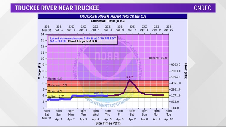
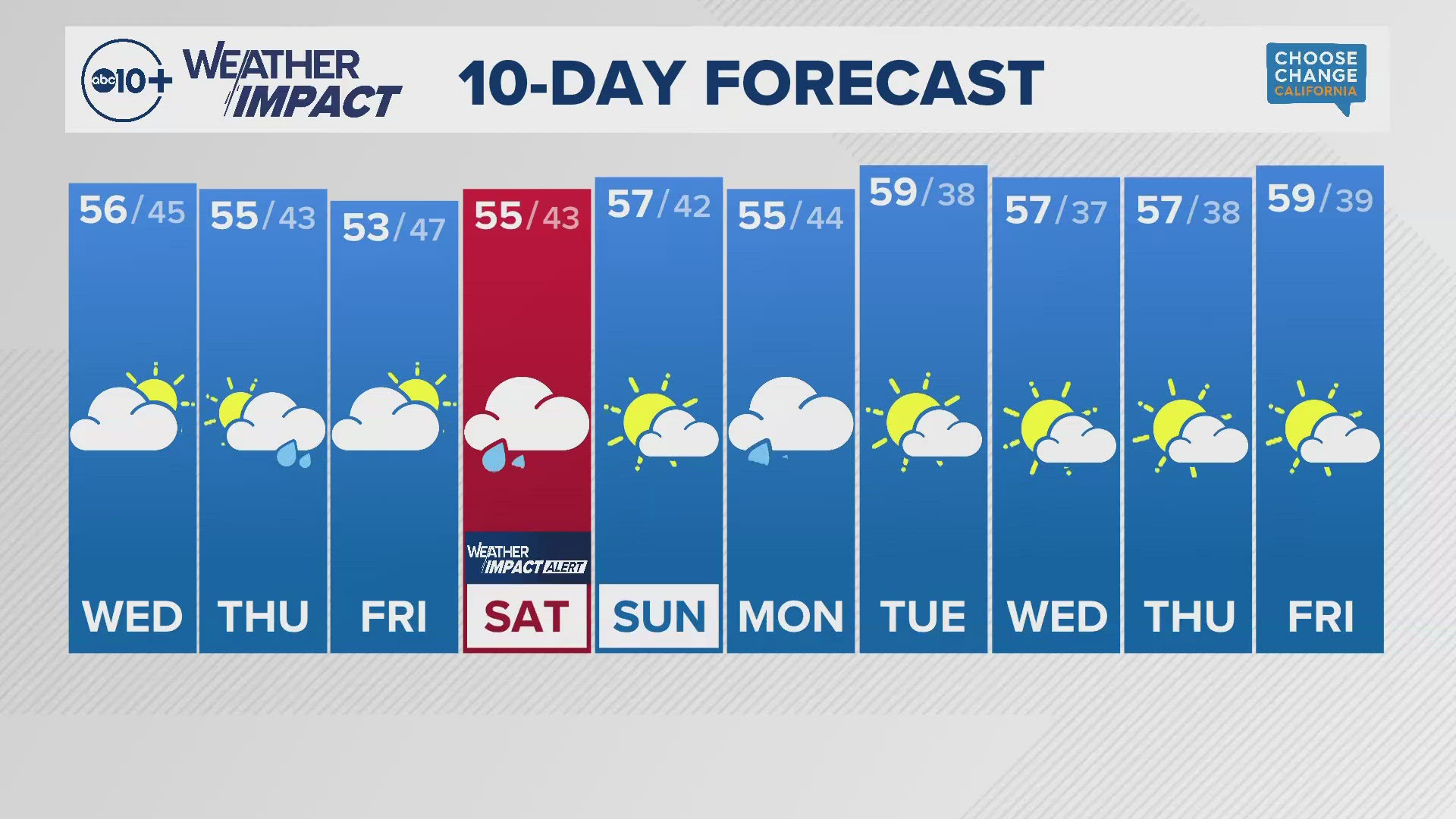
Update from Monica Thursday -- 5:30 p.m.
Key Storm Points:
- Heaviest rain late Friday.
- Not all snow will melt.
- Streams in the valley continue to rise 12-24 hours after rain ends.
Rain is already starting in the Valley as a major storm rolls into California.
The morning commute will have light to moderate rain with the heaviest rain arriving later in the day.
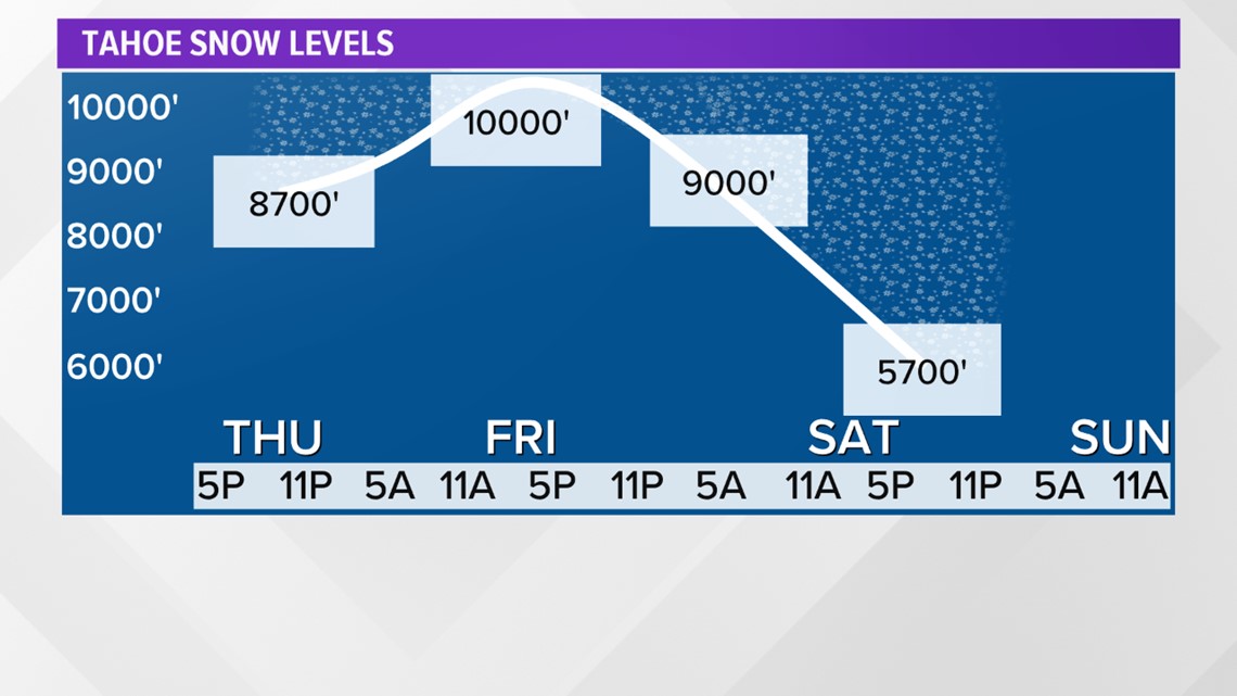
Snow level is still expected to be high in the Sierra, rising to near 11,000 feet during Friday afternoon. It will fall to near 5,500 feet by Saturday afternoon.
Those higher snow levels are still a concern for the mountain rivers with the Truckee River still expected to reach major flood stage Saturday.

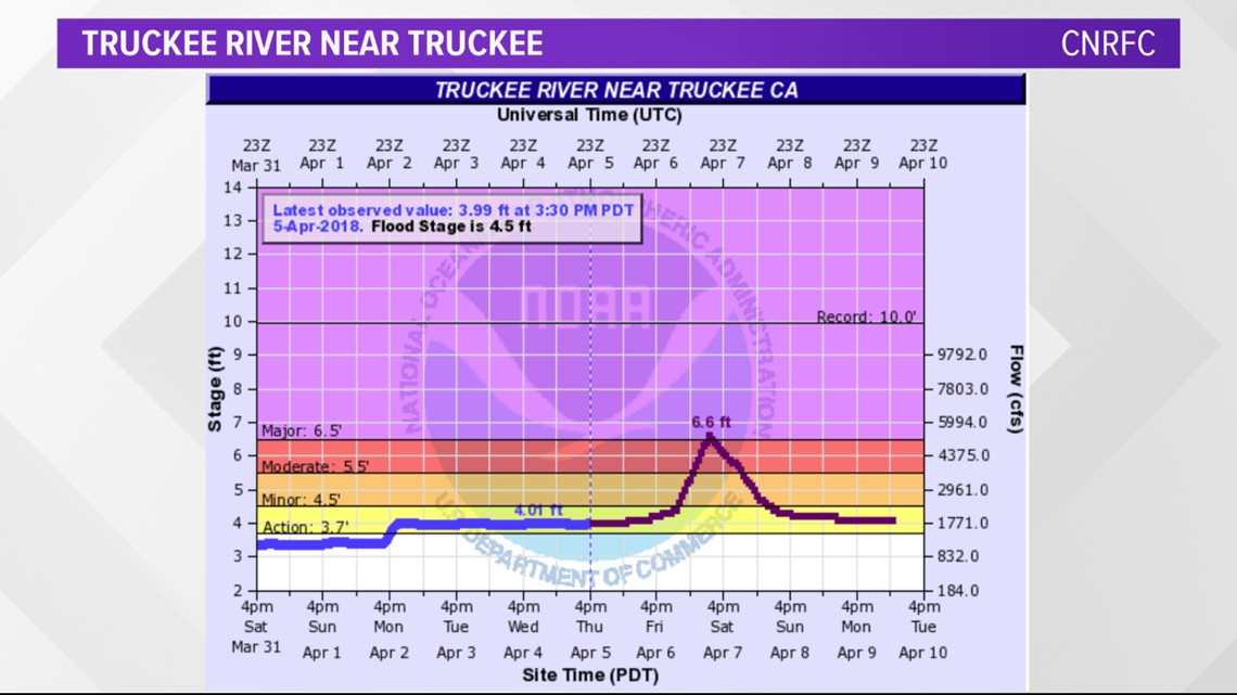
Update from Tracy Thursday -- 9:30 a.m.
Friday is going to get messy. Rain is forecasted to move in late Thursday, but the heaviest rainfall is expected during the afternoon and evening on Friday. The foothills and Sierra will see the heaviest rain overnight Friday into early Saturday with over seven inches of rain possible in some areas by Saturday night.
A cold front approaches the area late Friday into Saturday which will generate breezy conditions with winds gusting up to 20 mph. As the colder air moves in, there will be a threat for thunderstorms Saturday after 11am.
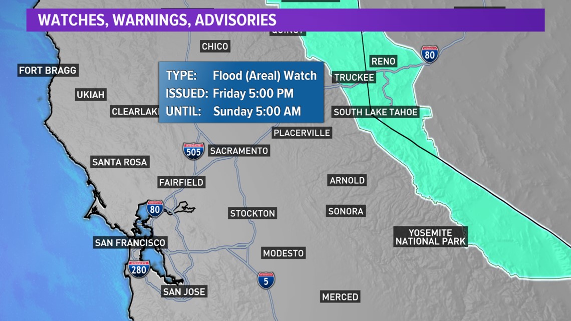
Flooding potential is expanding now through the valley with a Flood Watch in effect for minor flooding issues including creeks, streams, and minor street flooding.


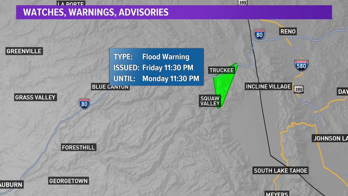
The Truckee River may see major flooding by midday Saturday. A Flood Warning is still in effect for this area.

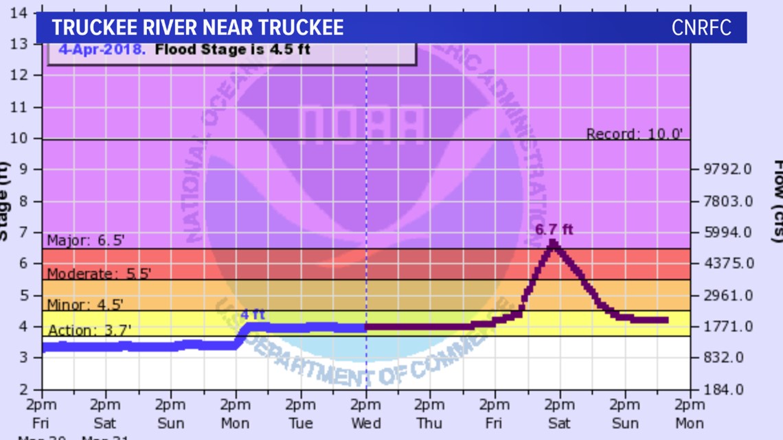
Update from Monica -- 5:30 p.m.
We're getting a clearer picture of how this storm will come together Friday through Saturday.
Rain will be heavy at times Friday with gusty winds. The heaviest rain is expected Friday afternoon with some minor valley flooding.
I am mostly looking at the risk for bigger flood issues in the Sierra with snow levels high until early Saturday.

There is already a Flood Warning and Flood Watch issued starting late Friday.


Update from Rob -- 10:00 a.m.
Alrighty, we have a ripper of a storm on the way.
A big storm is set for Thursday to Saturday afternoon for the Valley and extended for mountains, with snow into Saturday night.
This is a true "Pineapple Express," one of my favorite weather slang. I like this because, while it is an Atmospheric River (sounds scary), it tells us a bit more...namely it will be a very warm storm.
A big Pacific Low will dig deep down to the sub-tropics (Aloha!) and will find very warm and wet air. The warmer the air, the more water it can hold and these storms tend to be very wet.

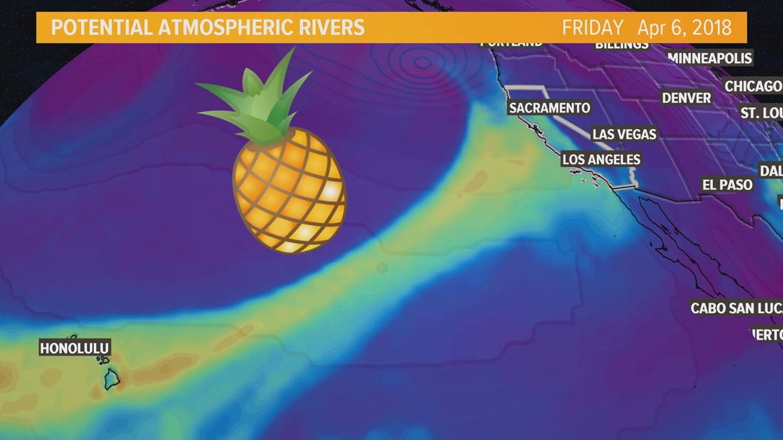
In any given year, California gets 40-60 percent of its precipitation from this setup, so they are really important for our water year.
Come Thursday, it will be cloudy, feel warm and semi-humid, and then it will rain. I think we get some rain by Thursday night, but most of it comes Friday, with some leftover showery stuff Saturday morning as things clearing late in the day. We could see 1-2" of Valley rain, but I also wouldn't be surprised if we see more in some spots.
Some localized flooding and poor driving conditions are common with this type of storm. It will also be windy, with 20-30 mph gusts possible during peak on Friday.

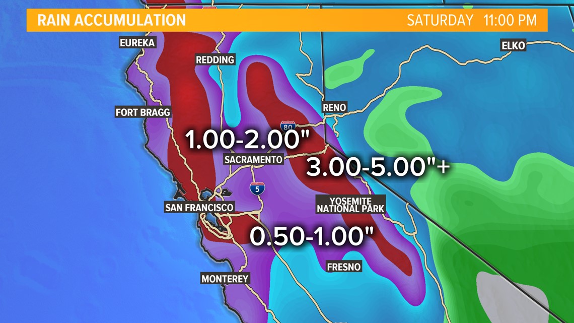
For the Sierra, it becomes a bigger deal. Nobody wants to see rain on snow, but it is April and this tends to happen. The problem is that the snow level might rise to 10k feet, so that means rain for everyone. Warmer temps and rain can melt additional snow, so the local creeks, streams and Sierra Rivers may see rapid rises and some flooding.
That is my biggest concern, along with mudslides in areas where wildfires occurred, like Butte County. Additionally, the snow shows up Saturday and we could see 4-8" over the passes...or more...or less. It all depends on when the rain switches over.
This is when your classic guy in shorts putting on chains on Donner Pass scene will happen. It happens every year.
So, plan for this; warmer storm, rain, snow (eventually) and stronger winds. This could cap off our rainy season, although there might be something at end of next week.
One side benefit is that, depending on how things go, I think most reservoirs will be able to capture most, if not all, of the rain and runoff since we are so late in the season, they are not really worried about flooding and now they move into more of a water capture mode. This will be good for Oroville. However, if we get too much, we may get to see the new, temporary spillway in action. I think we are about 20 feet away from that possibility.

