SACRAMENTO, Calif —
Another warm, mainly precipitation-free week is on tap for Northern California.
A strong ridge of high pressure overhead is the main influence on the region's weather this upcoming week. High pressure been the dominant driver of the weather pattern for the past week and Sacramento has seen above average afternoon high temperatures since Wednesday.
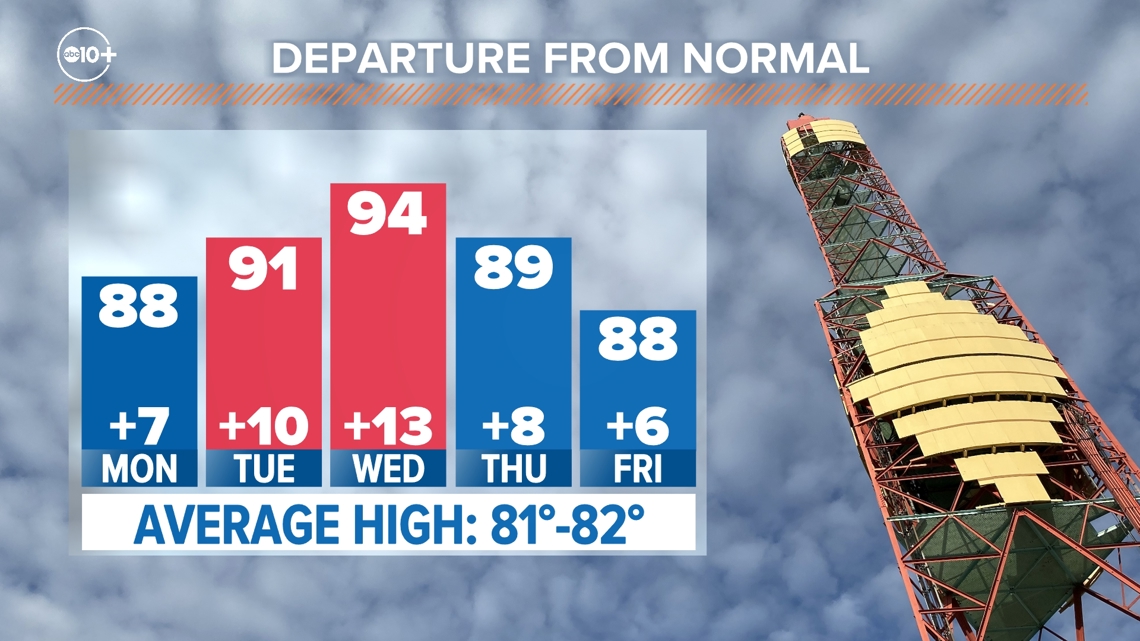
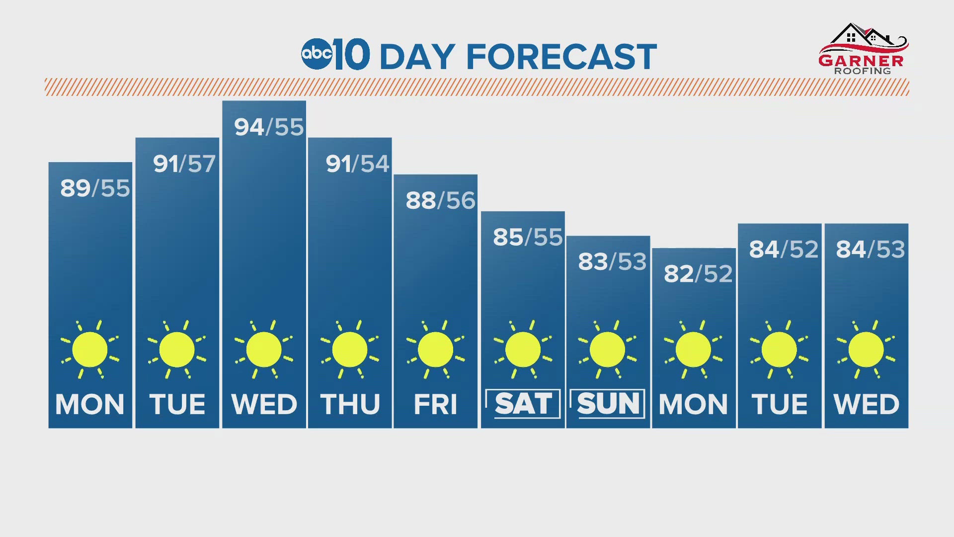
Saturday was the warmest day of the year so far in Northern California and Sacramento reached 95 degrees. Sunday was cooler than Saturday in Sacramento by five degrees and Monday will be a degree or two cooler than Sunday. Tuesday will be the beginning of a short-lived warming trend and temperatures will return to the low 90s in the valley, 80s in the foothills and lower 70s in the Sierra.
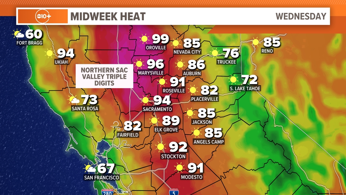
Wednesday will be the hottest day of the week. The forecast high in Sacramento is 94 degrees and further north a few locations, such as Redding and Chico, could approach 100 degrees for the first time this year. The average high in Sacramento this time of year is 81-82 degrees.


The delta's cooling influence will be felt in the southern Sacramento and northern Sacramento valleys and temperatures will be warmer north and south of those areas. Areas like Stockton and Sacramento will feel the delta breeze kick in during the evening hours and high temperatures will still be hot, but not as hot as areas further away from the delta.
Isolated showers and thunderstorms are possible in the Sierra the next couple of days. The greatest instability and moisture are located south of Highway 50 and therefore if storms develop, it will be along the Sierra crest south of 50 and the main threats will be lightning, heavy downpours and gusty winds.
Following the peak of the heat Wednesday, a cooling trend will develop and continue through the weekend. This means high temperatures in the mid 80s Saturday and low 80s by Sunday.


Looking ahead to next week, the Climate Prediction Center favors the return of cooler than normal temperatures across California.

