CALIFORNIA, USA — Do this season's early rainfall and snowfall mean we're gonna have a wet winter? That's the question ABC10 is getting from viewers.
This 2021-2022 Water Year is off to a great start. Since Oct. 1, Sacramento Executive Airport has picked up 7.37" of rainfall. The average amount of rainfall the area would normally pick up this time of the year is 1.23". This means the area is looking at a pretty healthy surplus of 6.14" of rainfall.

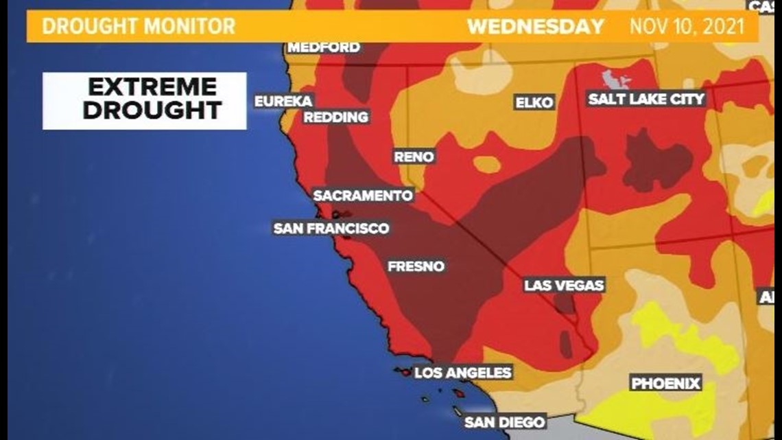
However, more than 80% of the state of California is looking at Exceptional to Extreme Drought Conditions. It begs the question as to whether the rest of the season will be this wet.

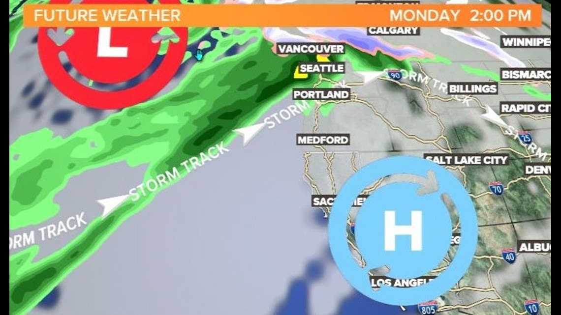
The future weather graphic above is based on long-range weather models. It shows that an upper-level high-pressure system, also known as a ridge, is centered over California next Monday. This is what's called a blocking high.
Unfortunately, this weather system will help steer any oncoming storms up and over Northern California. It will send weather systems well above the state toward Oregon and Washington.

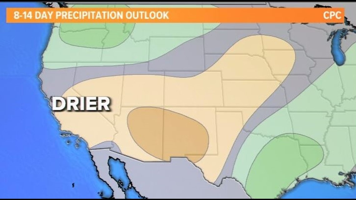
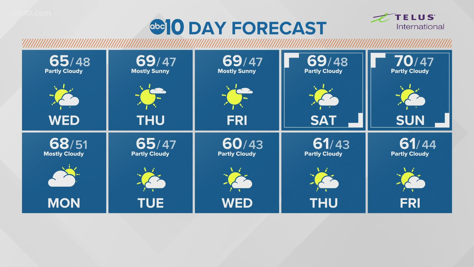
The latest eight to 14 day precipitation outlook from the Climate Prediction Center takes this blocking high into consideration in its latest forecast. Much of California is expected to be drier than average for the next two weeks. Keep in mind, if this ridge of high pressure continues to declare residency, so to speak, over our region, the region will remain dry.
The takeaway is, unfortunately, early-season rainfall is not indicative of what will happen for the rest of the 2021-2022 Water Year. People just have to wait and see what the future holds.
WATCH ALSO:

