
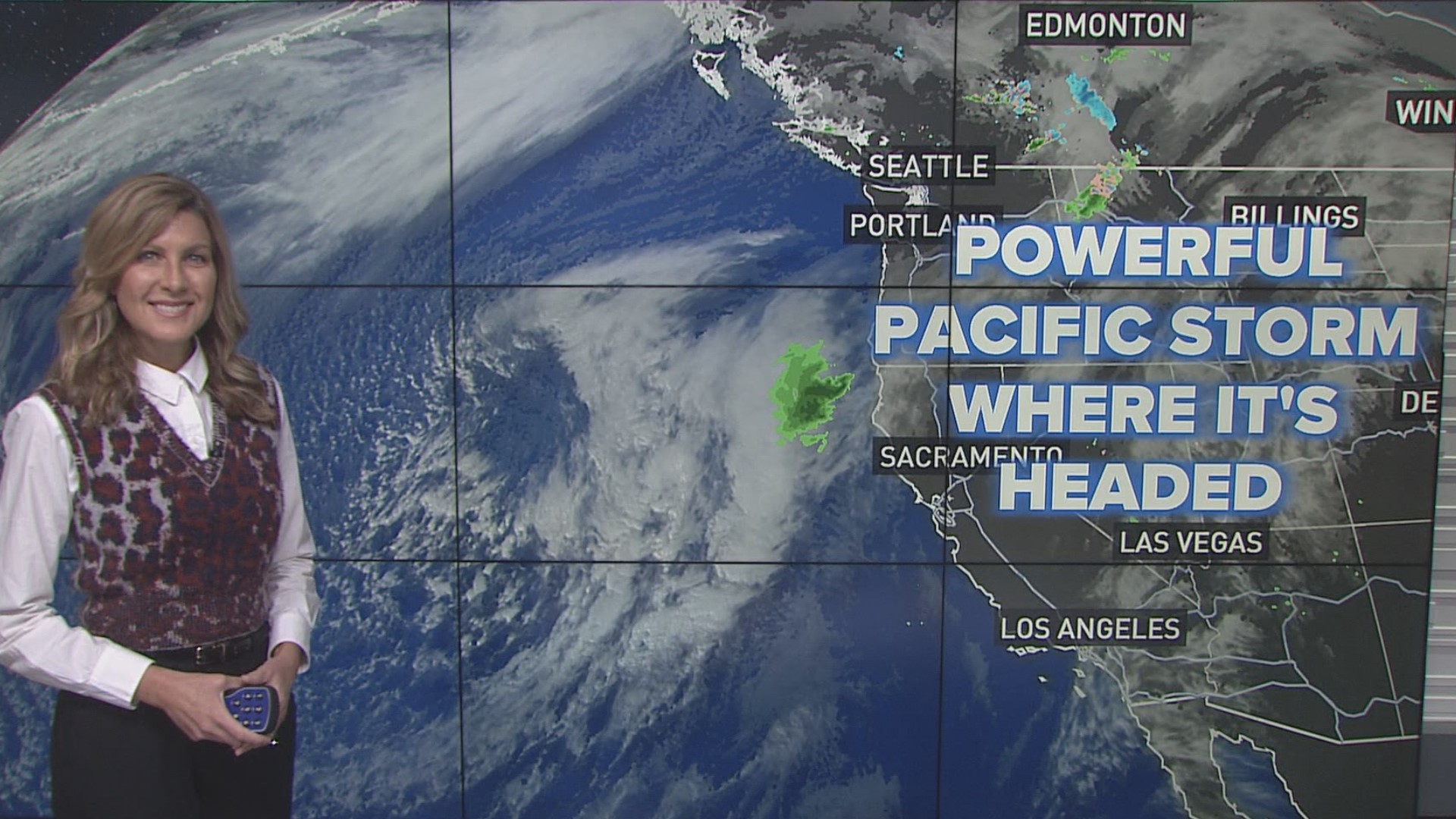
SACRAMENTO, California — A powerful system of low pressure is brewing in the Pacific and is set to bring impacts to California this week, but the storm's exact details are up in the air due to uncertainty in the weather models.
Regardless, a pattern change is on tap for this week, with a cooler and wetter pattern taking hold following a mild November weekend.
Speaking of this past weekend, Northern California residents were treated to what will likely be the warmest weekend for months with temperatures reaching into the 70s under mostly clear skies.
Temperatures Monday will drop a few degrees but will still be near the Nov. 13 average high of 67 for Sacramento.
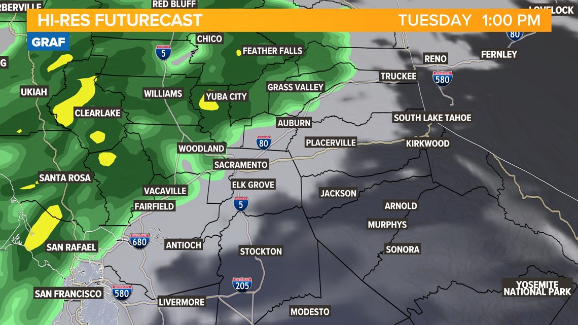
Tuesday will also be near climatological average, with highs in the mid to upper 60s in the valley, and 40s and 50s for the Sierra depending on the elevation. Tuesday will also bring the first impacts of the storm as a few rain bands push onshore.
Temperatures the rest of the week will be in the mid 60s in the valley, and 40s and 50s will continue in the Sierra as well.
The two main global weather models – the GFS and the European (Euro) – are showing differences in the strength and placement of the low pressure system this week.
The center of the low pressure in the European model is closer to the California coast, which will bring more rain to the state compared to the GFS which is too far west. Both models have been trending down in total precipitation amounts compared to a few days ago.
The models have been coming into more agreement in the past 24 hours, but disagreements continue to exist in how long the system sticks around and how much precipitation it drops across the state.
Rain is expected Tuesday for portions of Northern California. Due to how far east the center of the system will be, rain chances Tuesday will be highest along the coast north of Monterey and the western side of the Sacramento valley. Further east, including the Sacramento area, totals will be light to nonexistent.

The low pressure system will be mainly stuck in place throughout the work week due to a ridge of high pressure blocking it from moving onshore, along with being disassociated from the jet stream.
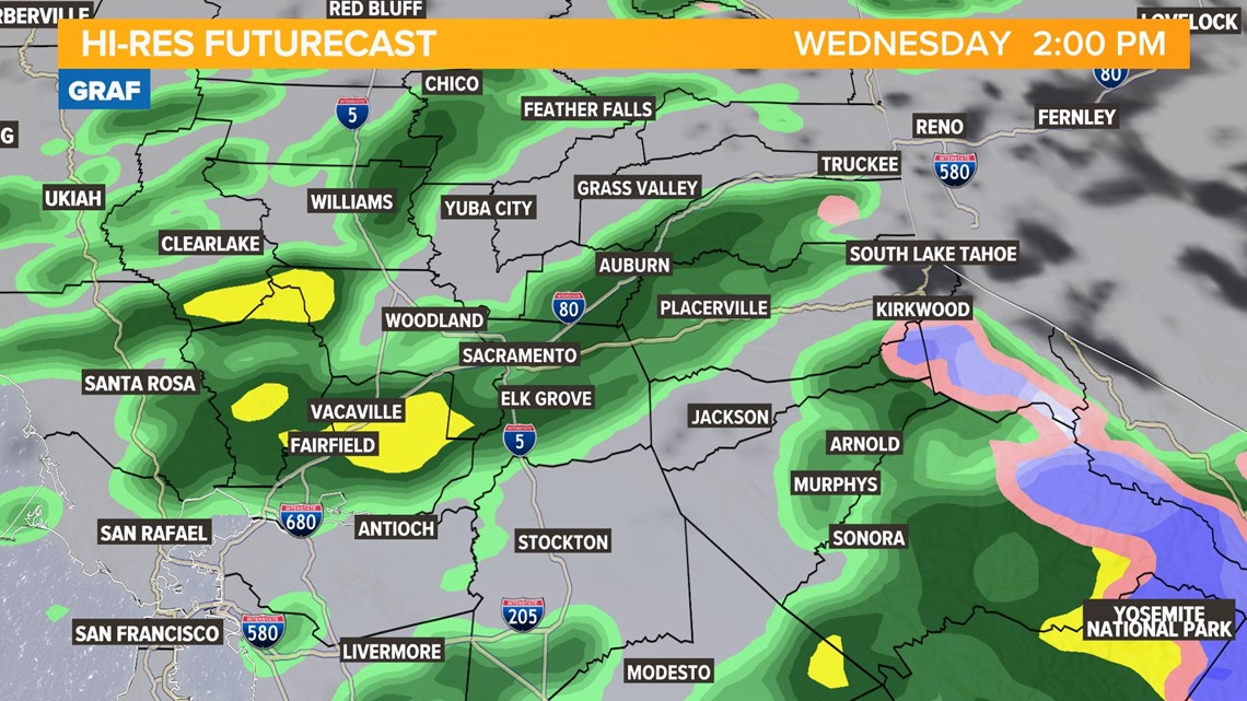
The next chances of rain for Northern California will be Wednesday as another band of rain pushes onshore.

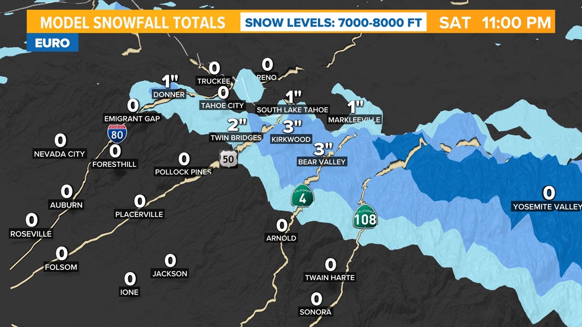
This storm has trended much warmer than previously forecast, which has led to a major decrease in snow totals due to the higher snow levels. Snow levels will stay above 7,000 feet for the duration of the storm.
Snow is expected mainly south of Highway 50, although an inch or two is possible from Donner Pass south. Most high passes in the area are around 7,000-7,500 feet so they will be right around the transition zone between rain and snow.

Going back to rain, totals as of now are expected to be below half an inch for most of the valley through Friday. More showers are expected Saturday and possibly into Sunday once the low finally pushes onshore.

