
SACRAMENTO, Calif. — Cold mornings, dense fog, and cooler than average high temperatures are expected this week after a powerful storm hit California this past weekend.
In the valley, the ground is saturated and the Sierra is blanketed under feet of fresh powder. The latest storm dropped 1 to 3 inches of rain in the valley and 2 to 5 feet of snow in the Sierra with local amounts up to nearly 6 feet.
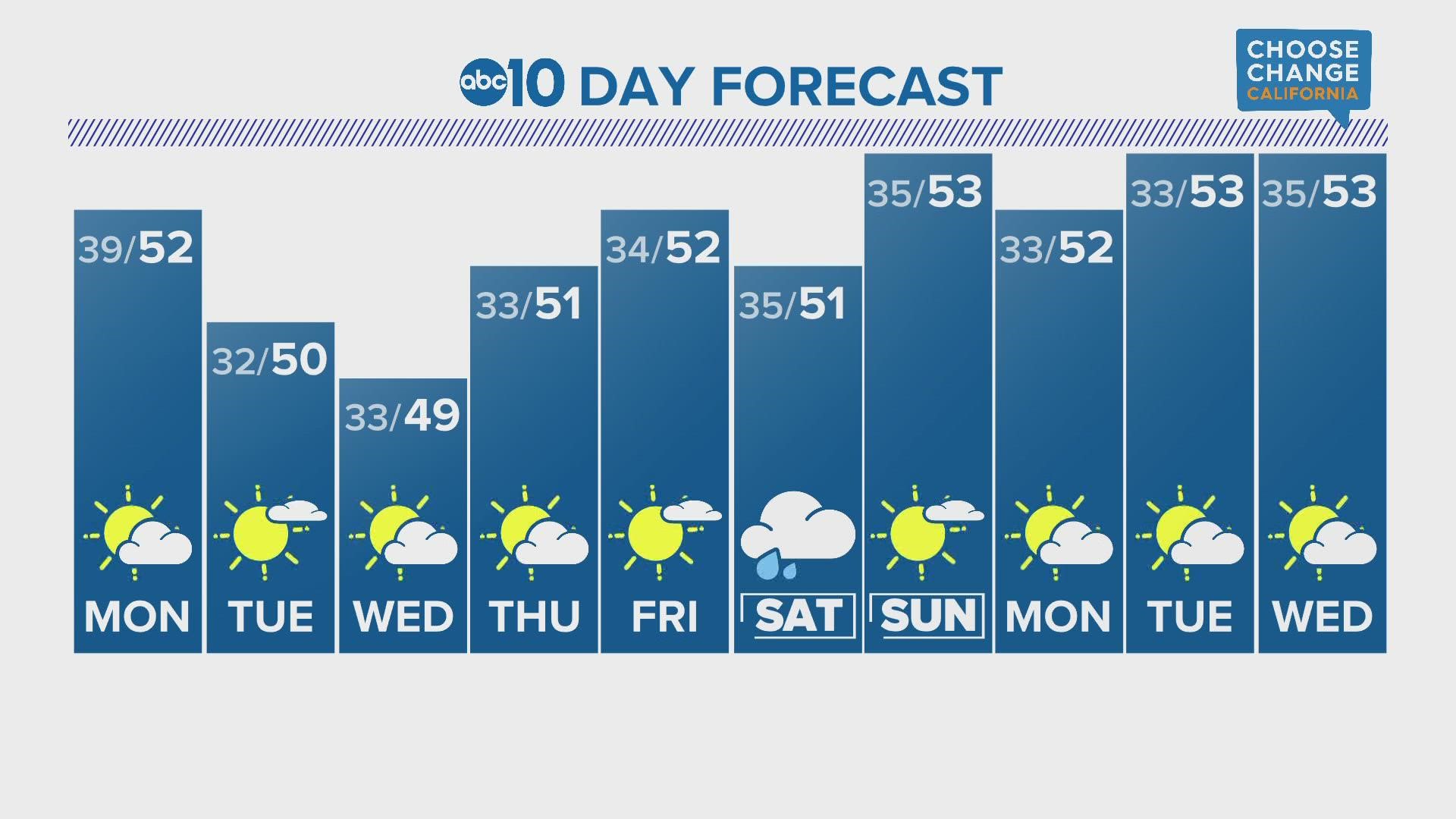
Limited cloud cover is expected to fill in behind the system, allowing for temperatures to drop rapidly overnight. High temperatures will be chilly as well with cold air moving into the region from the north. Expect high temperatures in the low 50s and upper 40s for the rest of the work week.
Temperatures near freezing are expected this week thanks to the presence of strong radiational cooling and the lack of cloud cover. When clouds are present, the heat trapped by the Earth's surface during daytime solar heating is retained in the atmosphere due to the cloud cover. This week, clear skies overnight will allow this heat to escape and temperatures will subsequently plummet in the valley.
The ingredients for fog formation are present this week as well. Low winds, a lack of cloud cover, high pressure overhead, drenched soil and saturated air are all present, signaling a strong possibility of overnight fog formation in the valley. This fog will likely be most dense in the southern Sacramento Valley and northern San Joaquin Valley, including the cities of Sacramento, Stockton and Modesto.
The next, very slim, rain chances are next weekend but look to be much lighter than what has been seen to start the month.
WATCH ALSO:


