
SACRAMENTO, Calif. — A powerful Pacific storm will bring an increased risk of multiple weather hazards, including severe weather, Monday.
Heavy rain will become more showery Monday morning. Skies will partially clear helping to further destabilize the already unstable atmosphere.
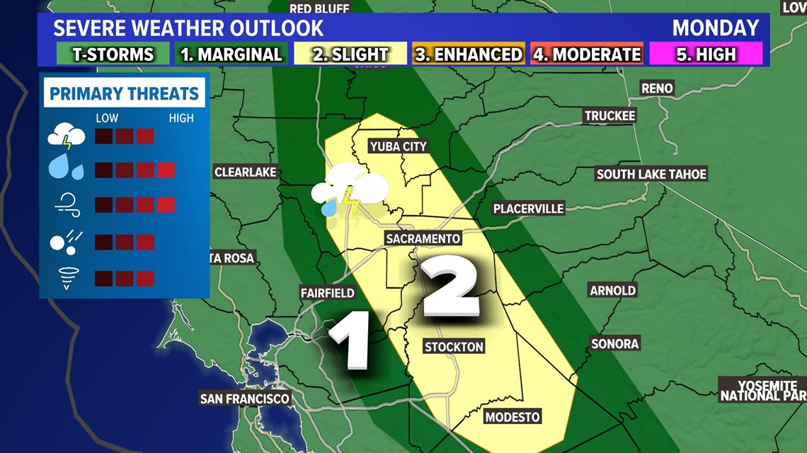
Slight risk days in California are pretty rare. We don't get a lot of them here, but they do happen and Monday is one of those days.
The clearing skies during the morning will help to further prime the atmosphere for thunderstorms from mid-morning through the early evening. Not everyone will see thunderstorms, but everyone has a chance. In addition, not every storm will be severe, but some likely will be.
Monday has all the ingredients to be an impactful severe weather day. The Storm Prediction Center has issued a level 2 out of 5 “slight” risk for severe weather for Monday in the Southern Sacramento and northern San Joaquin Valley.

For more weather coverage, stream ABC10+ on your TV for free:
► Roku - click here
► Amazon Fire - click here
► Apple TV - click here
Thunderstorm development will be dependent on how much clearing there will be in the cloud field. Clearer skies early in the day will help to destabilize the atmosphere, aiding in the formation of thunderstorms in the afternoon.
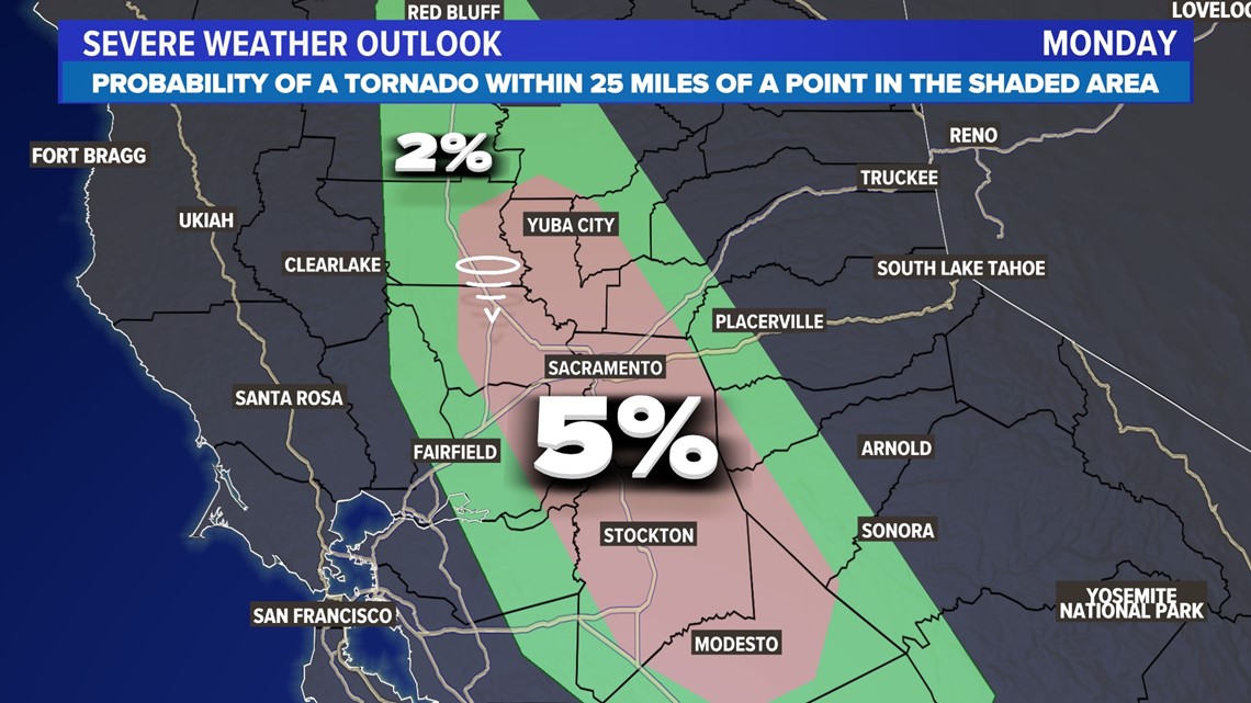
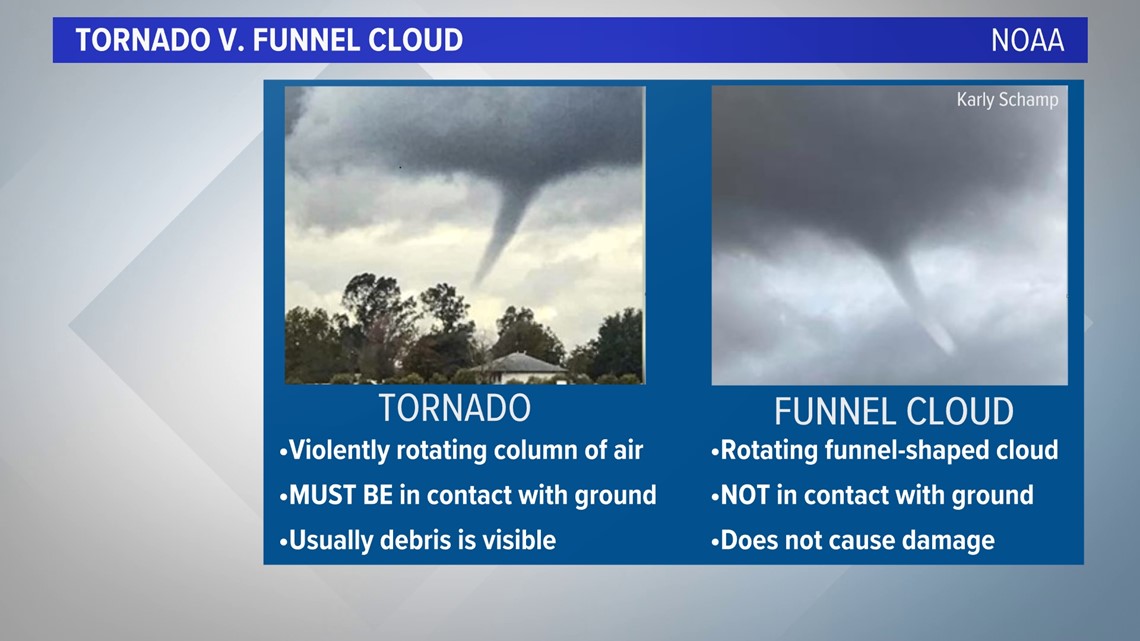
The environment will also be favorable for tornado or funnel cloud development, with a 5% probability, according to the Storm Prediction Center.

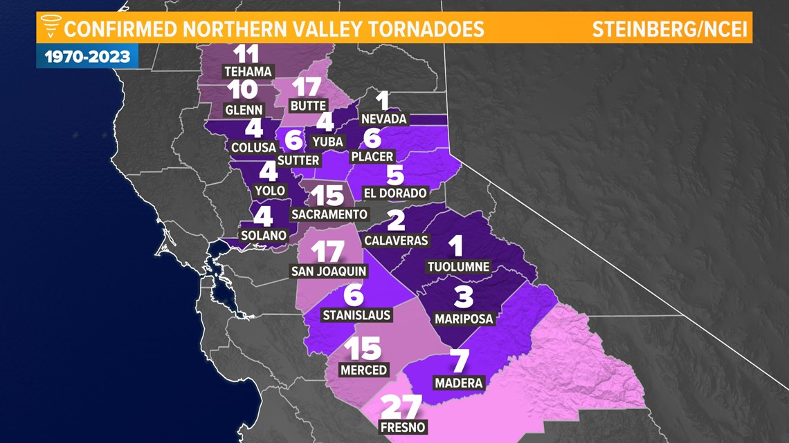
Since 1970, Sacramento County has had 15 confirmed tornadoes and San Joaquin County has had 17. Tuolumne County had its first confirmed tornado last March near Tuttletown.

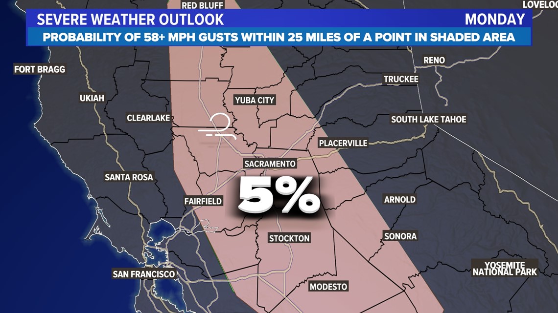
In addition to heavy rain, the primary threats are strong thunderstorm wind gusts of 58 mph or greater, with a 5% probability of wind gusts over 58 mph.

Thunderstorms will be discrete, meaning they will be pop-up and isolated. Supercell thunderstorms are possible in the valley Monday afternoon. Low-level winds will be out of the southeast while mid-level winds will be southwesterly. This is called wind shear, and this combined with the instability of the atmosphere is what gives us both the severe thunderstorm risk and the tornado risk Monday.
Usually, we see funnels and tornadoes form close to the foothills. The variable terrain helps create even more spin. But because of the widespread instability that will be present in the valley, even people in cities away from the foothills – Sacramento, Stockton, Modesto, Davis, Elk Grove, Woodland, Colusa, etc... – could see severe weather and funnels. Here is the difference between the two.

It's important that you have a way to receive weather warnings and stay up to date with the forecast. The ABC10 app is one way to get weather warnings, as is a NOAA weather radio.
More storms are possible Tuesday but right now, it looks like the risk of severe weather is lower.


