SACRAMENTO, Calif. — Hot weather will be sticking around for a while thanks to a meteorological feature known as a blocking high, pushing temperatures far above daily average high temperatures through the rest of the week.
Blocking patterns generally promote extended stretches of hot weather due to the influence of the stubborn high pressure overhead.
In this case, very strong high pressure is located to the north, centered over British Columbia. Even though it is centered north of us here in California, the state’s weather is still under its influence.
A weak low pressure system helped to moderate temperatures the past two days following mid to upper 90-degree heat Saturday, but high pressure will once again strengthen as the low dissipates.
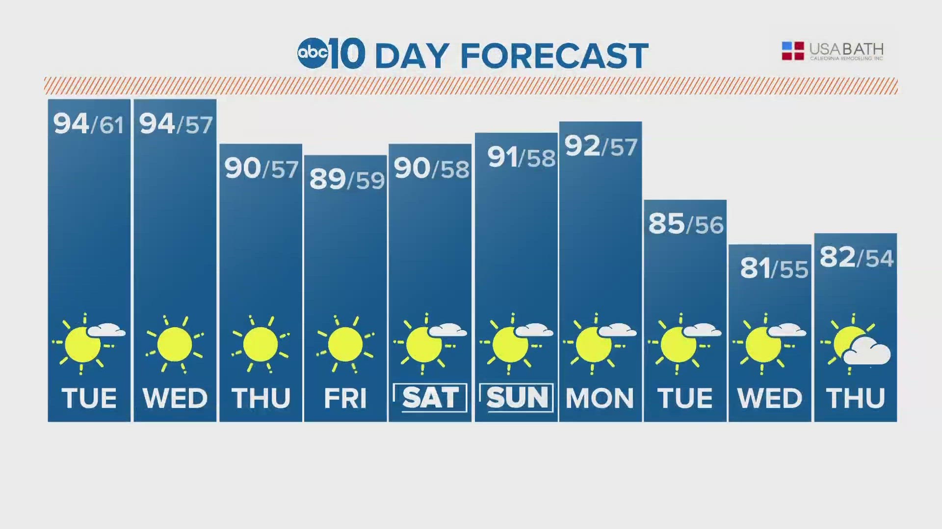
Highs will be in the mid 90s Tuesday and Wednesday in the Central Valley, and highs in the Sierra will reach into the 60s and 70s, further accelerating snow melt.
The high pressure will slightly weaken by Wednesday, allowing for minor drops in temperatures. Highs for Wednesday and the back half of the work week will hover around 90 in Sacramento.
May started off quite cold in Northern California before the heat ramped up this past weekend. In fact, downtown Sacramento recorded a high temperature of 59 on May 4, marking the first time since 2011 the high temperature failed to reach at least 60 degrees in May and only the fourth time this century.
The Climate Prediction Center has California being warmer than average for at least the next 10 days due to this blocking pattern. After that, it looks like the blocking pattern will finally be broken down and temperatures could return closer to average.
Even though the heat is an unwelcome preview of summer for many, May is no stranger to extended periods of hot weather. In fact, the last time downtown Sacramento didn’t have a 90 degree day in the month of May was in 2010.
Based on the persistence of the current pattern and high pressure being firmly planted overhead, the total number of 90 degree days could possibly reach double digits this month.
Dating back to the first reliable measurements in Sacramento (1877), the city didn't receive double digit 90 degree days in May until 1947. Since 2014, it has happened four times, yet another signal of a warming climate.
On the bright side, temperatures aren’t expected to reach 100 in the next two weeks. Three years ago, Sacramento had four straight 100 degree days, so although it will be a fairly hot this week, we won’t have anything like that to contend with in the upcoming forecast.


