SACRAMENTO, Calif. — A storm that packed quite the punch — heavy rain, several feet of snow, strong winds and even a first-ever San Francisco tornado warning — has come to an end.
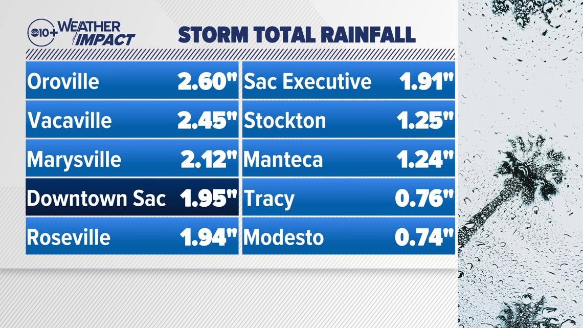
After what's been a largely dry December, there has finally been some good rain and snow numbers across Northern California. Much of the valley picked up between an inch and three inches of rain, with the highest rainfall numbers in the upper Sacramento Valley and the lowest in the San Joaquin Valley.
- Downtown Sacramento — 1.95"
- Stockton — 1.25"
- Modesto — 0.74"

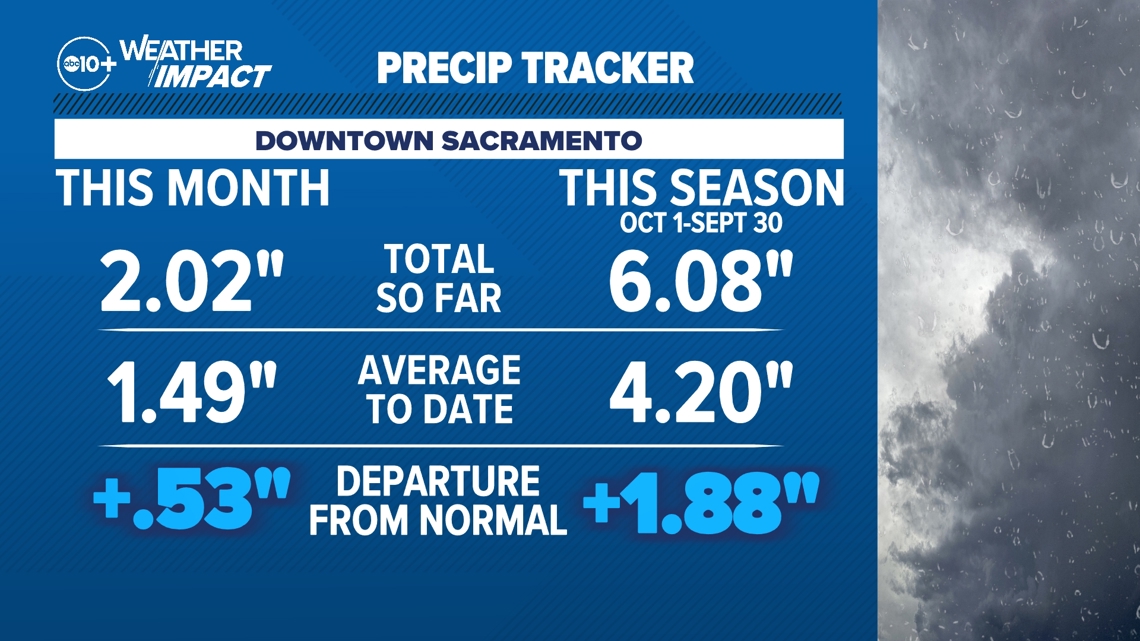
This most recent storm put us back above average for the month of December so far, with 2.02" of rain in Downtown Sacramento this month. Halfway through December, the average rainfall is about an inch and a half.
On the water year, we've been running above average ever since the big storm prior to Thanksgiving. The most recent round of rain only boosted our numbers. We're now over 6" on the water year, with an average to date of just over 4", putting us about 2" above normal with the rainy season just getting started.

In terms of snowfall, this was a good one.
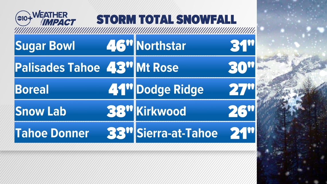
Many Central Sierra locations recorded anywhere between 2 feet and 4 feet of snow. Sugar Bowl was the big winner with 46" of snow. Palisades Tahoe and Boreal were close behind with 43" and 41" respectively. The UC Berkeley Central Sierra Snow Lab grabbed 38". Just about everywhere else in the Greater Tahoe region measured between 20 and 30 inches with this storm.

We know the snowpack is a critical piece of California's water puzzle, and storms like this are what build that snowpack up. So it's not only good for winter sports lovers, it's good for all Californians.
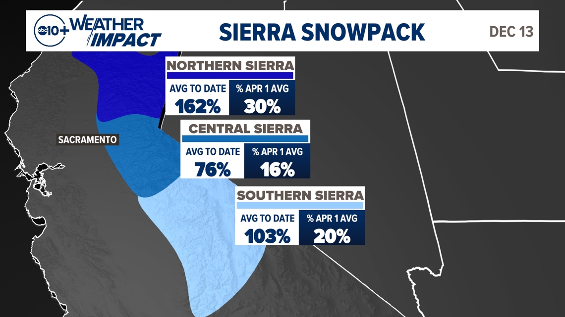
The latest snowpack numbers actually don't include the big dump that we had on Saturday because the state numbers don't update on the weekend. So in actuality, it's better than it looks.
The important number is the percent of April 1 average, because early April is usually peak snowpack. So while the average to date numbers are very inflated because it is still early in the season, the numbers we really care about for water storage are the percent of April 1 average.
- Northern Sierra: 30%
- Central Sierra: 16%
- Southern Sierra: 20%
- Statewide: 21%

So we're off to a good start in terms of both rain and snow across Northern California. This is what we want to see, considering December is our third-rainiest month, behind only January and February.
We won't have to wait long for our next round either.
Another system coming through on Monday will be much weaker and less impactful than the previous storm. Nonetheless, it's going to bring a bit of light to moderate rain to the valley during the first half of the day on Monday, along with a few more inches of Sierra snow.

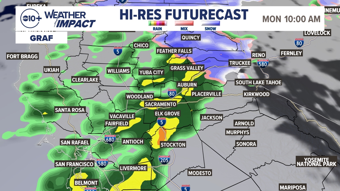
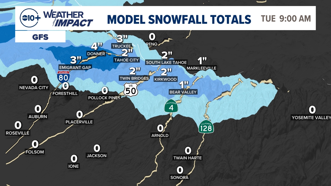
Monday's storm will likely bring an additional quarter-inch to half-inch of rain across the Sacramento Valley, and less in the San Joaquin Valley. Sierra snowfall is expected to be only a few inches, likely 3-6" at the high passes.
This system will be much less impactful than the recent storm that brought multiple inches of rain to the valley, gusts over 50 mph and feet of snow to the Sierra. For that reason, there is not a Weather Impact Alert for Monday. Yes, roads will be wet and chains may be needed in the Sierra, but this is a small December storm by comparison. Just plan for and be ready for wet weather during the first half of Monday.

WATCH ALSO:


