
SACRAMENTO, Calif. — The end of April will be warm, but the flipping of the calendar into May will bring more unsettled, cooler weather in California.
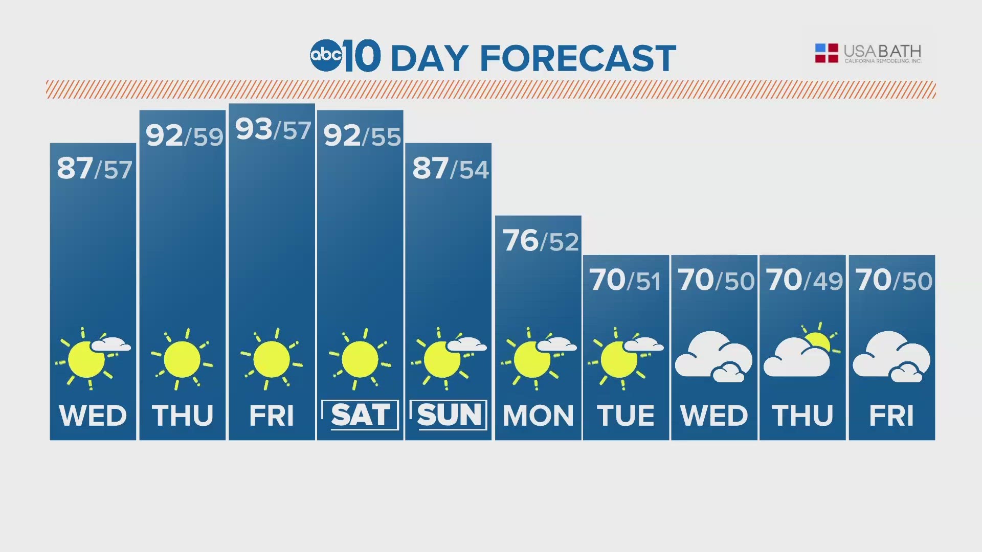
Just next week, temperatures will be in the 60s in the valley, a 25-30 degree drop in high temperatures following the outbreak of mid 90s in the valley to end April.
The high-pressure system over the west will not be able to advance to the east and will largely be stuck in place due to a blocking pattern over the East Coast where systems will be largely stationary. This will give the ridge (high-pressure system) time to amplify and bring the possible record heat Friday.
Once the ridge finally breaks down, it will be replaced by a low pressure system that will spin off the coast of California which will also have difficulty advancing east. This will be bring the renewed precipitation chances and cooler temperatures, especially in the higher elevations which will likely see more snow as well. Other impacts include periods of gusty winds and increased thunderstorm chances.
It's a bit too early to nail down any specifics on rain or snow totals, but rain and snow is much more of a certainty along the coast and in the Sierra rather than in the Central Valley. Showers will be possible for Northern California Tuesday through Friday with the highest chances Thursday.
The Pacific North American oscillation (PNA) is one of the most useful tools that can be utilized in determining upcoming large-scale conditions in California. The ongoing heat event, the first of the year, correlates to a strong positive PNA. The main feature associated with a positive PNA is high pressure over the West Coast, which will certainly be the case for the rest of the month.
Model agreement exists in positive PNA fading into neutral or negative conditions by the first of May. This helps to usher in renewed precipitation chances along with cooler temperatures.
Spring is a time of transition and is a difficult time to make long range weather forecasts. This looks especially true in May as California and the rest of the country could see a volatile weather pattern for at least the first half of the month. The jet happens to be extremely amplified, or wavy, hence the sudden drastic changes in weather conditions. When troughs set up over the West Coast and high pressure sits over the central United States, the threat of severe weather typically increases east of the Rocky Mountains.
The extent of the cooldown expected next week is still unknown as is the weather for the rest of the month. The Climate Prediction Center monthly outlook has May as being a cooler than average month, likely due to the presence of very cold ocean temperatures off the California coast. The cold temperatures off the coast will likely be replaced by warmer than normal sea temperatures once the effects of the upcoming El Niño become more pronounced.
May is typically the last month of major temperature swings before the trademark dry, hot Sacramento summer sets in.


