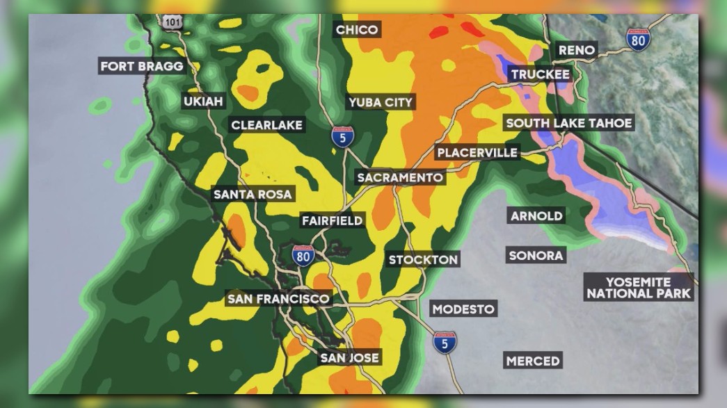
There's another storm coming.
Scattered showers are possible today, however, the next storm moves in Thursday and it will be in the form of a warm system. The atmospheric river is taking aim at the region, so plan on moderate to heavy rain and gusty winds. By the end of the week, Valley locations could receive one – three inches of rain, where as locations in the Foothills could receive two – four inches, with isolated spots up to five inches.
Here's five things you need to know and what to expect:
Rain Timing
The next storm could produce moderate to heavy rain, mainly starting after the Thursday morning commute.
Flood Warning
The National Weather Service in Sacramento has issued a Flood Warning that runs until Saturday morning. The ground is already saturated from recent rain, therefore increased runoff will be a concern. Periods of heavy rain are possible for the rest of the week.
Rising River Levels
Select rivers across the region will see high river levels. A flood warning continues for Yolo Bypass near Lisbon. Any additional rainfall and controlled releases will maintain a raised river level.
The Cosumnes River at Michigan Bar is no longer under a flood warning, however, the river level will hold steady at a raised level over the next few days.
Wind Advisory
It will be windy on Thursday, mainly during the morning commute. A wind advisory starts at 4 a.m. Thursday and end at 4 p.m.. Winds will come from the south at 20 – 30 mph, with wind gusts to 40 – 50 mph.
High Snow Levels
- Wednesday snow levels: above 9,000’.
- Thursday snow levels: Starts off at 8,300’ and will drop to 7,500’.
- Friday snow levels: Colder air moves in with snow levels will be below lake level. Starts off at 6,000’ and will drop to 4,700’.


