
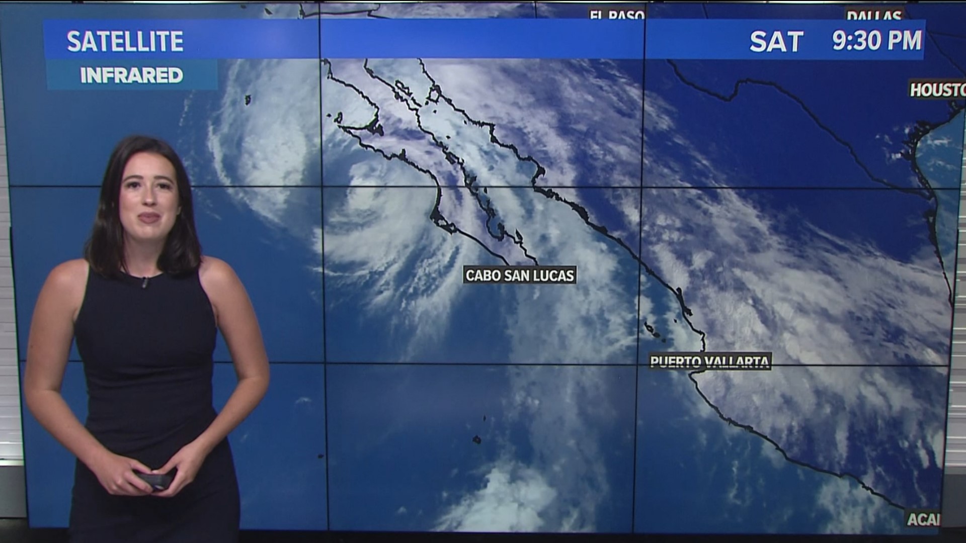
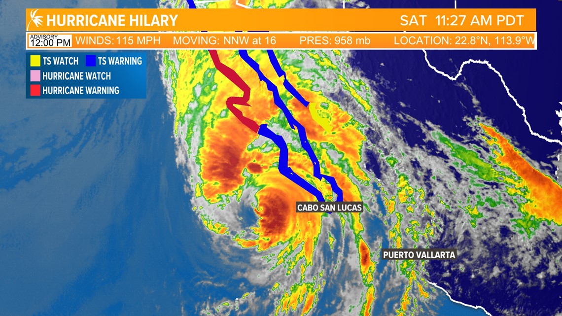
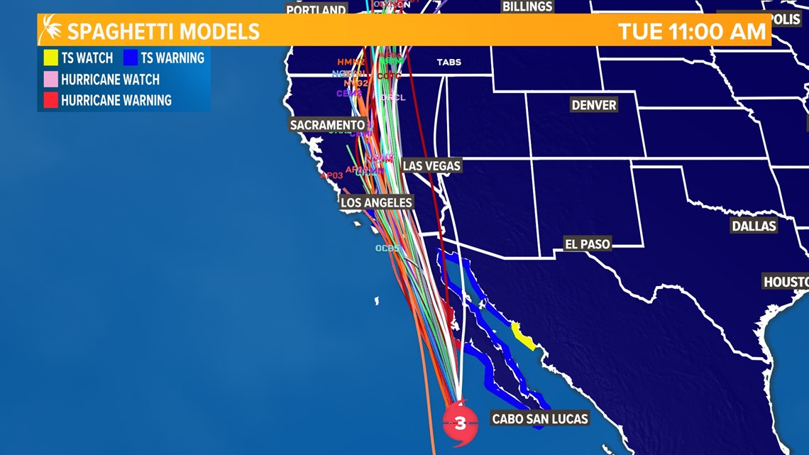
CALIFORNIA, USA — Hurricane Hilary has weakened overnight as it begins to move over significantly cooler ocean waters. As of the 8 a.m. update from the National Hurricane Center, the storm is now a category 3 in strength with sustained winds of 125 mph.
Further weakening is expected from here on out as it travels through sub-80°F sea surface temperatures and interacts with the mountains of the Baja Peninsula.
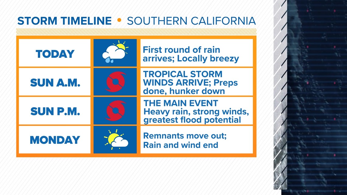
If you have family or friends in Southern California, let them know that Saturday is the last day for any preparations that still need to be completed.
Some rain is moving through SoCal today but this is just the moisture out ahead of the hurricane and not the storm itself.
Final preps need to be completed before you go to sleep tonight. Tropical storm winds arrive Sunday morning in Southern California between 8 a.m. and 10 a.m. So by sunrise, you need to be in your safe place and plan to stay there all day long Sunday unless told otherwise by local officials.
Strong winds and stronger gusts accompanied by heavy, flooding rains means you do not want to be out and about in this weather.

The main event happens after lunchtime Sunday when the strongest winds, heaviest rain, and greatest flood potential will be present.

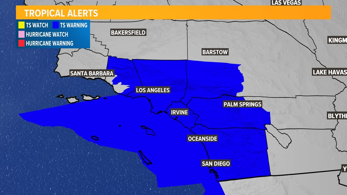
For the first time ever, Tropical Storm Warnings are in effect for Southern California ahead of Hilary's arrival. Sustained winds of 40-60 mph are likely, with wind gusts higher than that possible.

As much as this is a wind event though, this is an even bigger rain event. We're looking at the possibility of five or more inches of rainfall for the eastern side of the Peninsular Ranges and into the deserts of Southern California.
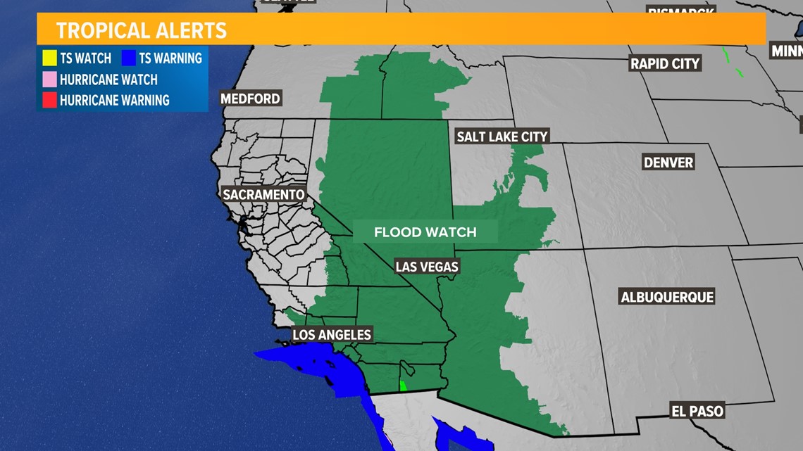
For some places, this is more than double the average rainfall for an entire year! Flood Watch is out for all of Southern California, western Arizona, southern Nevada, and even parts of Utah, Oregon, and Idaho. As important as it is to prepare for wind impacts, it's especially important to prepare for rain and flooding impacts.
If you're in Southern California, prepare for this storm the same way you would for an atmospheric river storm. In addition to the wind, there will be a lot of rain and don't overlook that fact. Prepare for some power outages and to have enough food to last a couple of days.

Hilary will very quickly move out of SoCal and into Nevada by Sunday night and early Monday. It's at this point that Northern California begins to feel the impacts.
The first thing we'll likely notice is that winds on Sunday evening will be coming out of the north instead of getting the usual westerly Delta Breeze. This could give us a brief window of increased fire danger, but the north winds will quickly shift to become southerly and very humid.
The best rain chances arrive Sunday night into Monday morning. The Sierra will see the rain first, then spreading into the valley before sunrise. This is likely to be the period with the strongest winds as well, gusting up to 30 mph in the valley.
Valley rain chances range from about 30% for areas west of I-5, to 60% for areas east of I-5. In general, the closer to the Pacific coast you are, the less chance you have of seeing rain. San Francisco has only a 10-20% chance of rain on Monday.

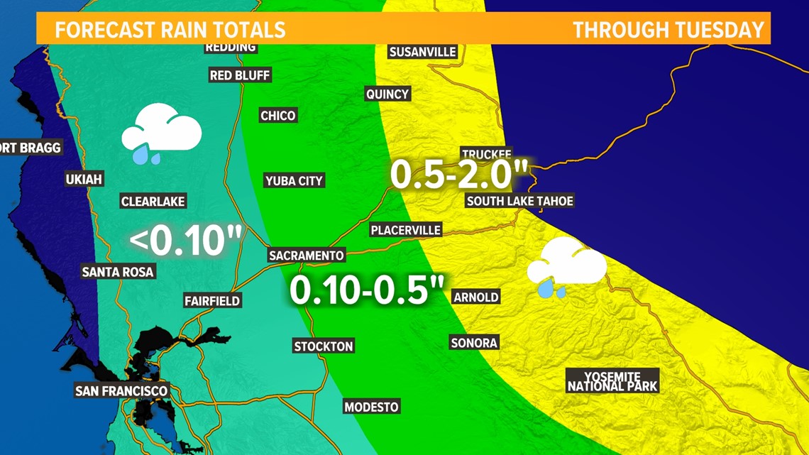
In terms of rainfall totals, Sierra locations are likely to see up to two inches of rain, while valley and foothill totals range from a tenth to half an inch.
This may seem like nothing by November, December, or January standards, and I would agree. But for August, when Sacramento's average monthly rainfall is 0.02", even a tenth or two would be a lot.
Our impacts will not be nearly as significant as what Southern California will see, but it will still be a highly unusual wet and tropical day across Northern California on Monday.

What Happened on August 18 with Hurricane Hilary
Hurricane Hilary maintained strength as a category 4 storm and continued to track toward California.
- Tropical Storm Warnings were issued for the first time ever for Southern California, including San Diego, Los Angeles, and Palm Springs
- Flood Watches were issued for Southern California as the risk for flooding is extremely high
Live radar:
Watch more: Hurricane Hilary update: California emergency officials provide update ahead of impacts to the state


