SACRAMENTO, Calif —
A series of storms this weekend produced multiple inches of rain and impressive snow totals statewide.
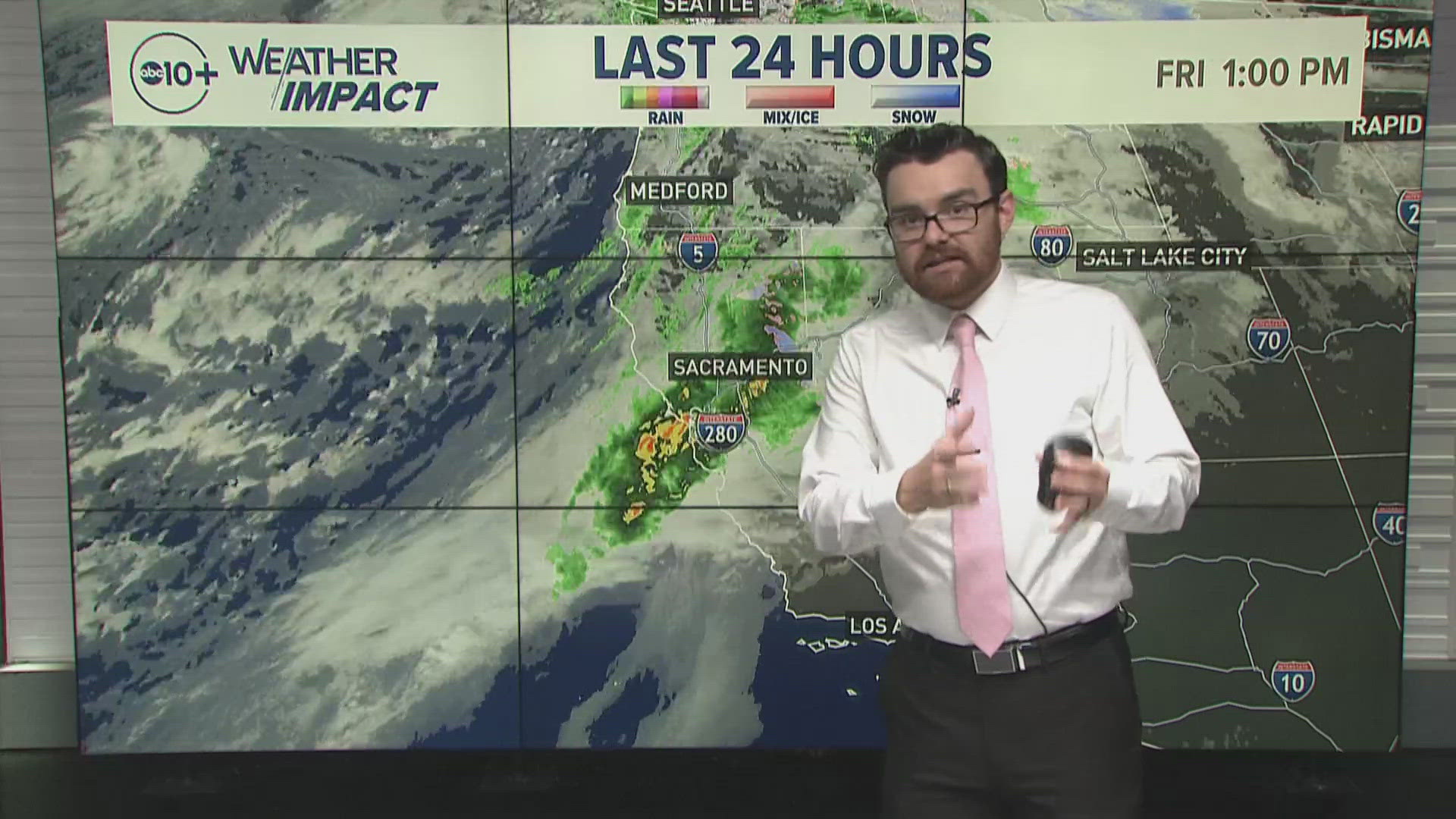
Although isolated rain and snow showers will continue throughout Monday, the storm is over for most Northern Californians. The region will dry out the rest of the day Monday and Tuesday before another storm system brings more rain and snow to Northern California late Tuesday night and into Wednesday.
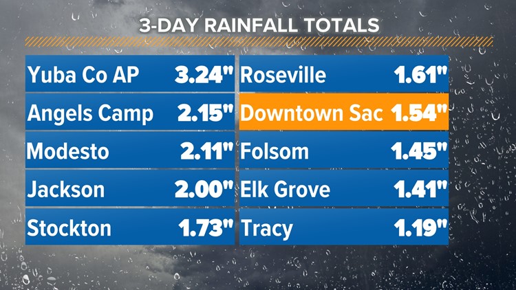
Rain totals since Friday have generally ranged from 1-3" in the valley but totals exceeded the 3" mark in Yuba County. Foothill and Sierra totals below the snow line were high, ranging from 2-7". Downtown Sacramento received just over 1.5".


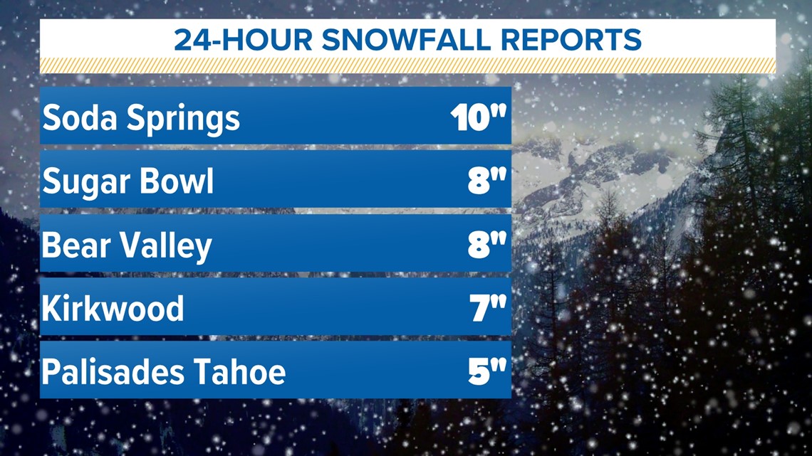
Over the last 24 hours, the Sierra saw 1-10" of fresh snow. Up to two feet of snow fell across the Sierra in the last three days.


The Tuesday/Wednesday event will be much less impactful than the weekend systems. As has been the case so far this winter, this will be a warmer storm with limited moisture and California is still waiting for a major atmospheric river event to bring heavy snow into the Sierra.
The snowpack is still running a deficit and is only at 55% of average to date. At the Central Sierra Snow Lab, located near Donner Summit, the percent of average snow water equivalent is at 60% while the combined rain and snow percent of average is 76%.
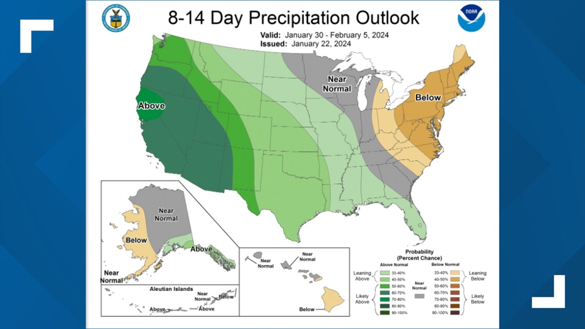
Hope remains for the snowpack to return to near normal levels even though time is running out. Early February is set up to be another wet period thanks to increased atmospheric river activity and the Climate Prediction Center favors much wetter than normal conditions during that period.


