SACRAMENTO, California — Northern California will have to contend with the heat for a few more days before an extended period of cooler weather settles into the region.
California will be directly under the influence of high pressure that moved in from the Pacific. This high pressure will be flanked by two cutoff low-pressure systems, so the weather pattern displays a shape similar to the Greek letter omega.
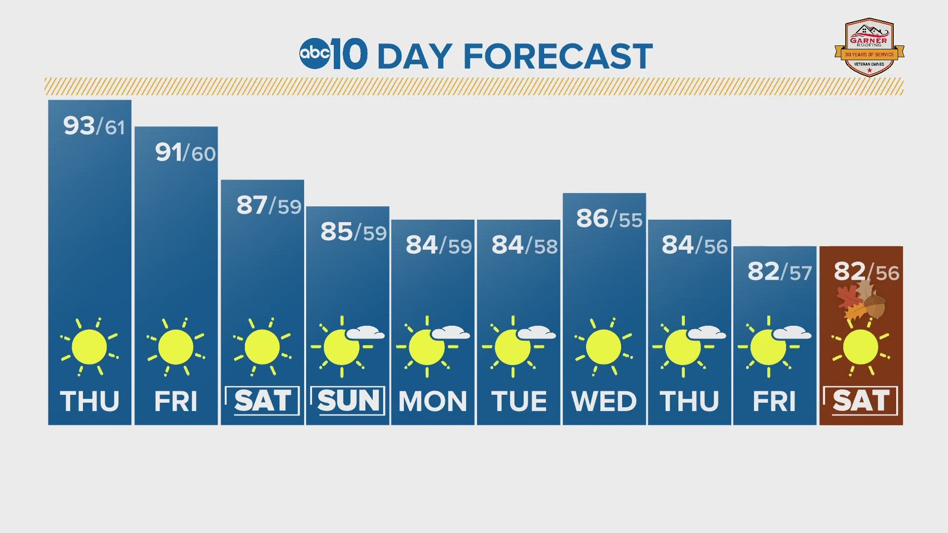
As a result, temperatures will be slightly above the average high of 90 for this time of year. Thursday is forecast to reach 93 and 91 Friday.
By Saturday, this pattern will still be in place, but the omega pattern will be shifting east, and the low-pressure system will be inching closer to the California coast. The result of the eastward shift will be a slight drop in temperatures thanks to the system pumping cooler marine air into the region. The position of the low off the coast by Friday night will help promote a robust Delta breeze in the evening hours through the weekend.
Temperatures will be a bit cooler than previous days with highs in the upper 80s to around 90 across the valley and 70s in the Sierra. By Sunday, expect highs in the mid-80s across the Central Valley.
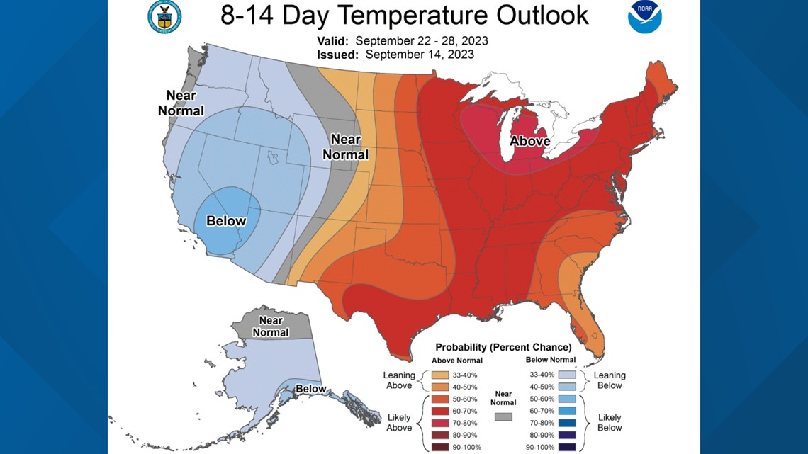
Once the moderate weekend heat passes and the low pressure moves onshore, California will be treated to mild weather through at least early next week. The Climate Prediction Center favors cooler-than-average weather for the next two weeks thanks to persistent low pressure over the West Coast.
The CPC also favors wetter-than-average conditions, which could be a common theme throughout the fall and winter due to the presence of El Nino.


