Not even Fleetwood Mac would want to deal with this landslide.
A large landslide has spread debris over a stretch of California’s iconic Hwy. 1 just north of Monterey. According to the California Department of Transportation, on May 20, 2017, more than a million tons of rocks and dirt spilled over the roadway.
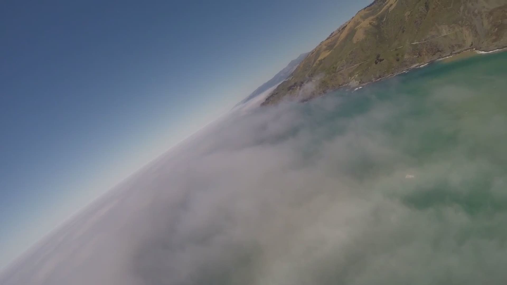
Aerial footage of the slide, courtesy Brian Mack, helped put in perspective the monumental task that lies ahead for cleanup crews.
Massive fires last summer and record rain have taken their toll on the area resulting in major closures. The latest closure is just south of Gorda, one of the only places to get gas along the road. There is a closure south of that area near Ragged Point and two closures to the north. There is one near Lucia, and another South of Big Sur to replace the Pfeiffer Bridge.
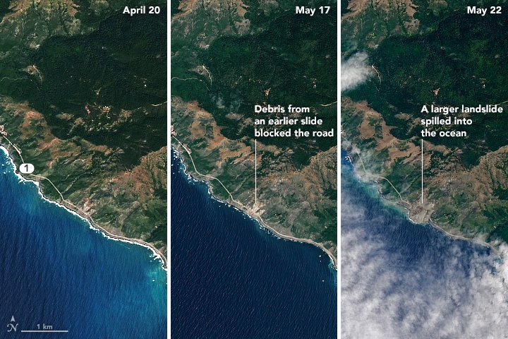
Now, we have an idea of what the area looks like from space. NASA tweeted several photos
NASA's Operational Land Imager on Landsat 8, snapped a few photos of the area on April 20 and May 22. The center image shows the same location as it appeared after a previous, smaller landslide this spring.
According to Caltrans, the highway will remain closed for the foreseeable future.
Landslide Buries Scenic California Highway https://t.co/WtXNRYnO4I #NASA pic.twitter.com/71UXroqNzK
— NASA Earth (@NASAEarth) May 24, 2017