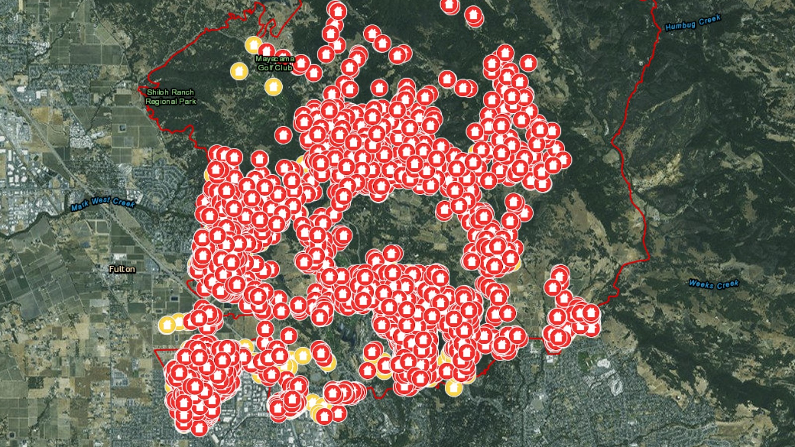
A new map from Cal Fire is tracking homes and businesses destroyed or damaged in the California Wildfires.
The map looks specifically at the fires in Wine Country. You can zoom in to see the damage block-by-block.
The October Wildfires have burned over 245,000 acres and destroyed about 6,900 buildings. At least 41 people were killed.
Cal Fire says as many as 100,000 people were forced to evacuate because of the fires. About 15,000 people are still under evacuation orders.
Firefighters have been gaining control of the wildfires.
Tubbs Fire
36,432 acres
92% contained
Pocket Fire
16,552 acres
73% contained
Nuns Fire
54,423 acres
82% contained
Atlas Fire
51,624 acres
83% contained