SACRAMENTO, Calif. — Sacramento and other Northern California cities are experiencing a summer heat wave lasting well into next week.
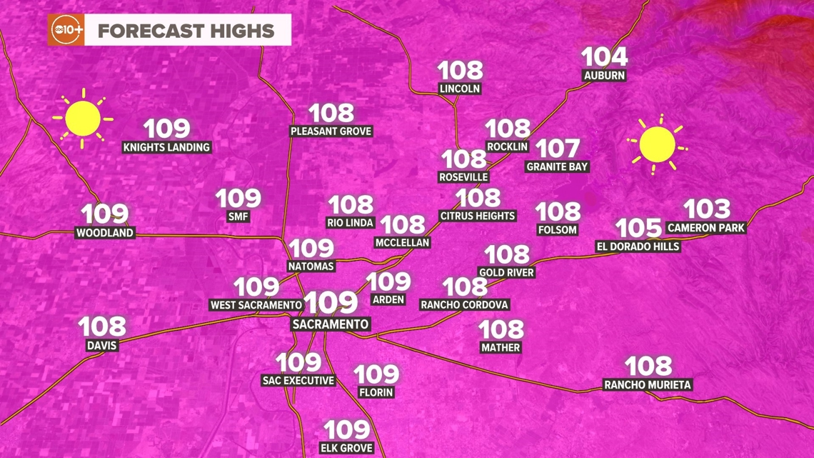
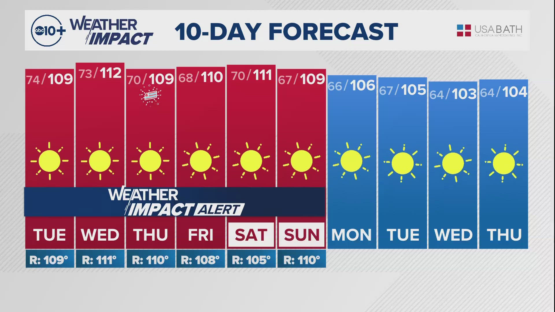
Sunday began the current stretch of 100 degree days with a high of 100 at the downtown Sacramento location. Monday was hotter with a high of 103 degrees and Tuesday will be even hotter with a high near 109 degrees.
The record for Sacramento is 108 degrees, so if the forecast holds true we will have a new record for July 2.
A huge area of high pressure is dominating the West Coast and pinching off critical onshore wind and humidity from the Pacific Ocean.
This allows the very high sun angle to maximize warming and keep inland areas well above 100 during the day starting at noon and lasting until about sunset.
The morning temperatures will remain elevated as well with lows in the mid 60s to the mid 70s.


When there is an onshore component to the weather, you will see a variation of temperatures related to the proximity of the cooler wind. When the pattern is set up like it is now, you see temperatures and conditions that are almost uniform and only see some variation at the immediate coastline or higher in elevation.
Foothill communities will see hot temperatures as well and often warmer overnight temperatures resulting in a higher risk for heat in some areas and populations.
The forecast calls for similar temperatures in the 105-112 range for the rest of the week and the upcoming weekend making for a very challenging forecast for any and all events related to the Fourth of July.
A stretch of 100 degree heat will last into next week and a record for consecutive days 100 or hotter will be threatened by the end of next week. We could end up with 12 in a row or more and the current record is 11 set back in 2006.
In the background, we also have a critical fire risk from dry north winds Tuesday and Wednesday for elevations below 1,000 feet.
WATCH MORE ON ABC10: Power shutoffs in some counties amid fire danger


