SACRAMENTO, Calif —
A relatively warm storm Tuesday will bring moderate rain to the valley and light snow to the highest elevations of the Sierra as another active weather week begins.
Monday will be mostly cloudy in the valley thanks to a persistent layer of stratus clouds blocking out the sun and also preventing fog formation Monday morning.
Meanwhile, satellite shows sunny, bluebird skies across the Sierra along with a fresh coat of snow following the weekend storm.
High temperatures will be in the mid 50s in the valley and 30s in the Sierra. The forecast high in Sacramento is 57 degrees, which is two degrees above the climatological normal for the middle of January.
Fog development is possible Tuesday morning depending on how much clearing there is in the overnight hours.A Dense Fog Advisory is in effect beginning at 11 pm Monday.
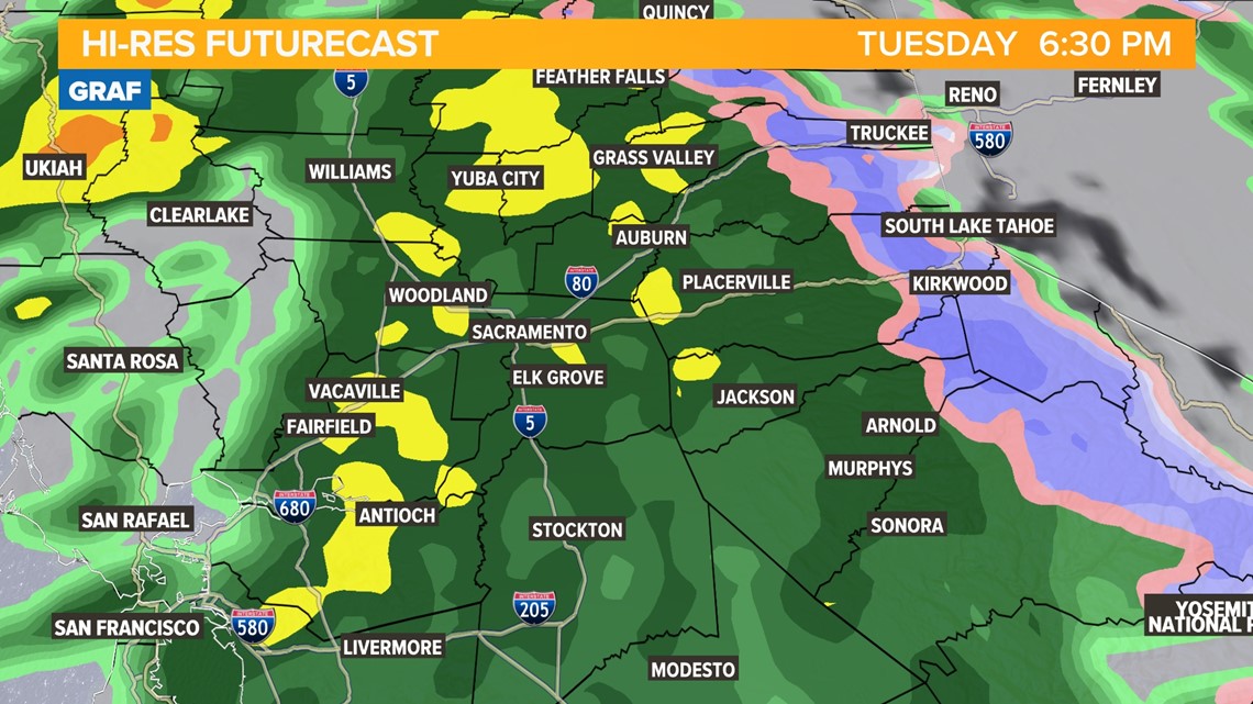
A few showers are possible in the Sacramento Valley after noon, but the main event isn’t expected until later Tuesday evening.

This storm is the tail end of a low pressure system slamming into the Washington coast, which will bring more winter weather to the Pacific Northwest.
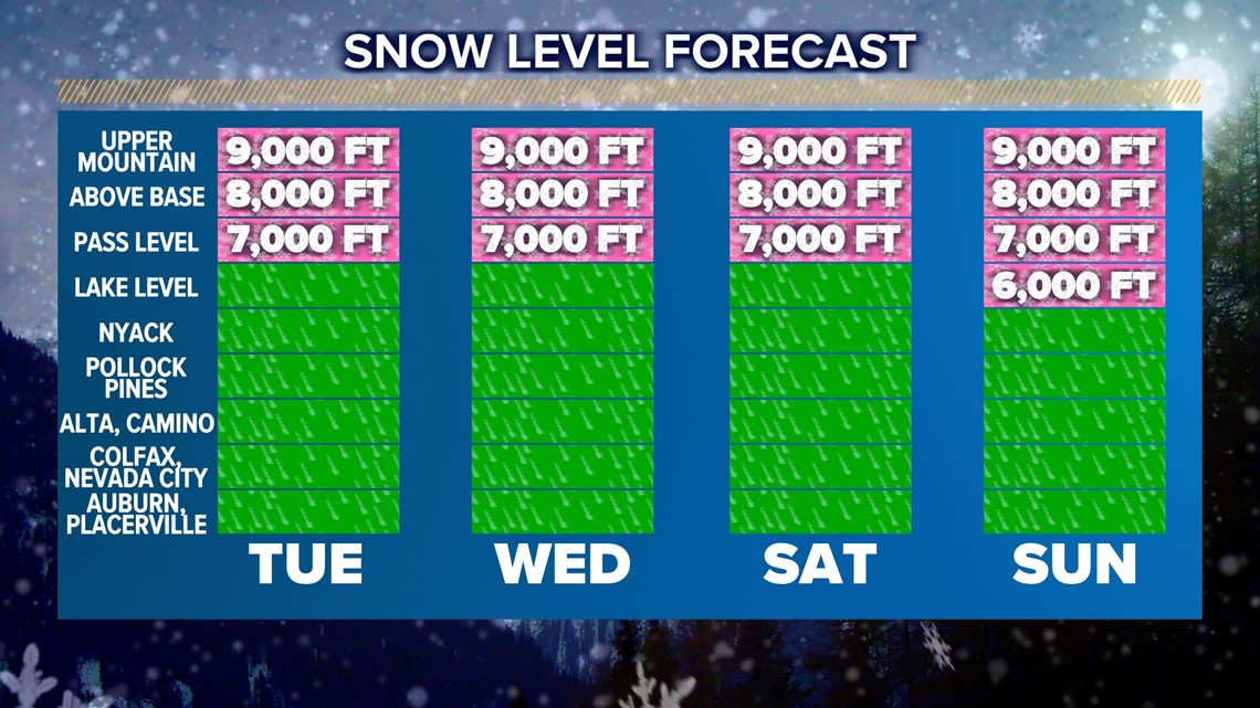
Throughout the day Tuesday, the counterclockwise rotation of the low pressure system will be pumping warmer, moist air into the region. While high temperatures are only supposed to be in the low 50s across the valley, snow levels will be very high in the Sierra due to the influx of warmer air. As a result, this will be a rain event for all locations below 7,500 feet.
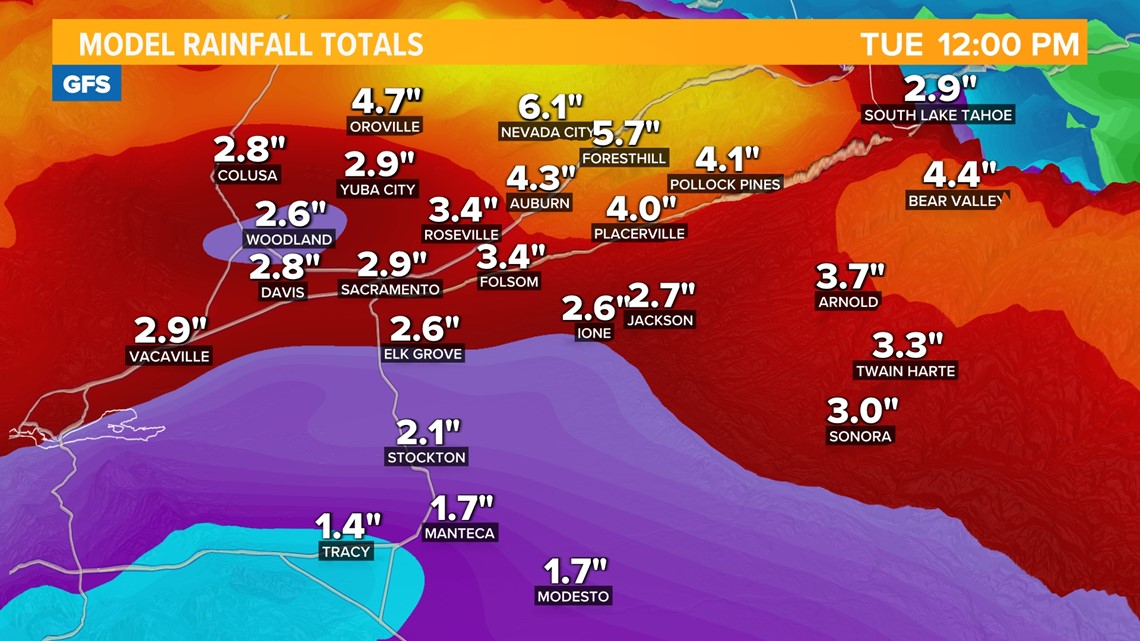
As for totals, 0.25-0.5” of rain is expected up and down the valley with closer to an inch possible near Redding. Most of it will fall late Tuesday and into the overnight hours before the system exits to the south.
Snow totals will be light and only a few inches are expected above 7,500 feet. Spotty snow showers will continue into Wednesday morning and snow levels will have lowered slightly to around 6,000 feet.

The rest of Wednesday will be dry, along with Thursday, before the arrival of a series of atmospheric river events this weekend. Rain will be possible every day from Friday through at least Tuesday with 1-3" of rain expected in the valley during this period along with heavy snow above 6,000 feet. Around 2-6" of rain is possible in the foothills and mountain areas below the snow line.