
SACRAMENTO, Calif. — It's clear the rainy season for 2023-24 has been off to to a slow start, but that will change in the coming days as colder storms move through the area.
Here is a simple timeline to keep track of periods of rain and snow, as well as more quiet weather better suited for travel.
TUESDAY
Fog in the morning then high clouds. Not many major weather issues for Northern or Southern California.
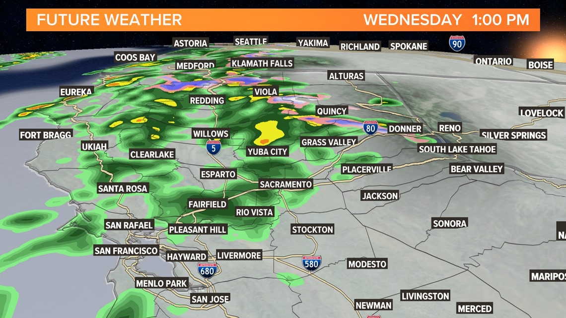
WEDNESDAY
Rain and snow move into the area. Rain will be spotty at times with rain rates ranging from light to heavy but only for a short period. Between 0.1-0.5" of rain is possible for most valley locations. The Sierra will get light snow down to about 6,000 feet. The duration of the storm is shorter so higher amounts will be harder to come by.

THURSDAY
Clearing for all locations with highs in the 50s.
FRIDAY
A new storm moves in with more valley rain and likely higher totals than Wednesday's storm. The Sierra will be colder and could see snow drop to 5,000 feet at times into Saturday.
SATURDAY
Clearing between storms but a new system gets closer Saturday night
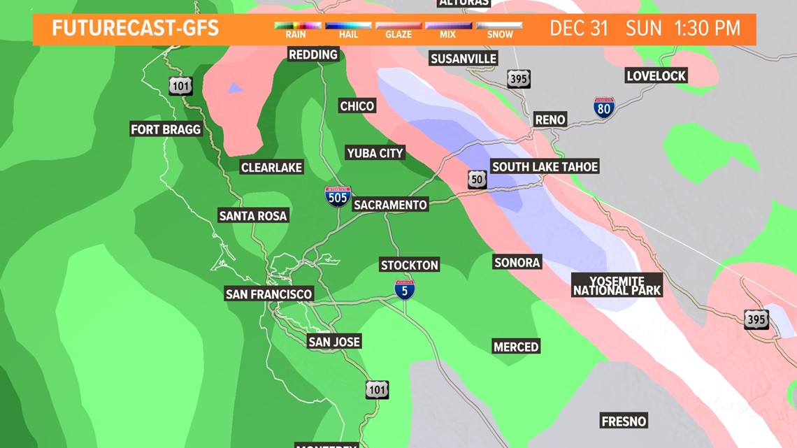
SUNDAY (NEW YEAR'S EVE)
This is far out in the forecasting window but there is a chance of rain and Sierra snow into New Year's Day. This storm has more moisture so higher amounts and likely enough for chain control should be a concern for both New Year's Eve and New Year's Day.

MONDAY (NEW YEAR'S DAY)
Lingering rain and snow. Again, since this is far in the forecasting window, things are subject to change.
WATCH MORE ON ABC10: Low snow turnout at Lake Tahoe ski resorts limits access to trails