SACRAMENTO, Calif —
A change in the forecast has raised thunderstorm chances in the valley and the foothills through Tuesday evening.
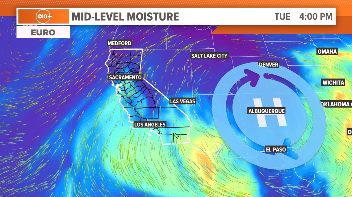
Upper level moisture from the remnants of Tropical Storm Alberto, the first named tropical storm of the year, will continue moving north through California Monday and Tuesday.
It was originally expected the moisture would spark thunderstorms as it interacted with the Sierra but thunderstorms have developed in the southern and central San Joaquin valley Monday. The radar, as of 3 p.m., shows showers spanning the San Joaquin Valley and pushing north toward Stockton and Modesto.
At the surface, it will be too dry in most areas for rain to make it to the ground, a phenomenon known as virga. When this occurs, the risk for dry lightning increases, so the potential for new fire starts also increases.
The only other impact from this influx of moisture for most of Northern California will be increasing cloud cover beginning Monday night and continuing through Tuesday.


National Weather Service Sacramento places the odds of development in the valley at 10-15% and 15-30% in the mountains south of Highway 50. Potential impacts would be lightning, gusty winds, small hail, brief heavy rain and lightning, wrote NWS Sacramento in its Monday afternoon area forecast discussion.
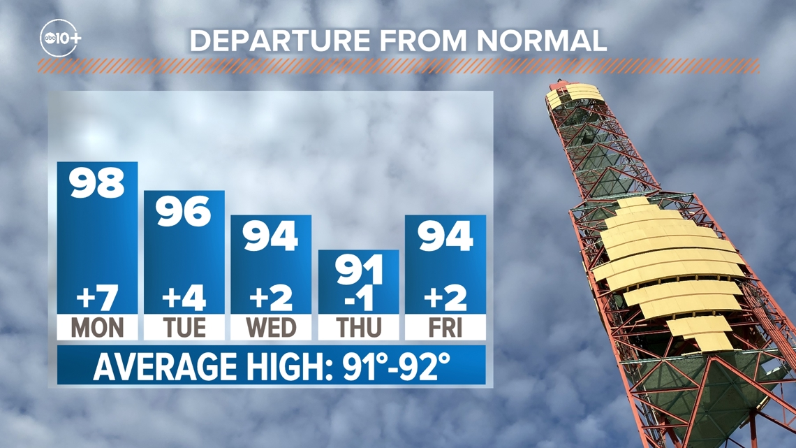
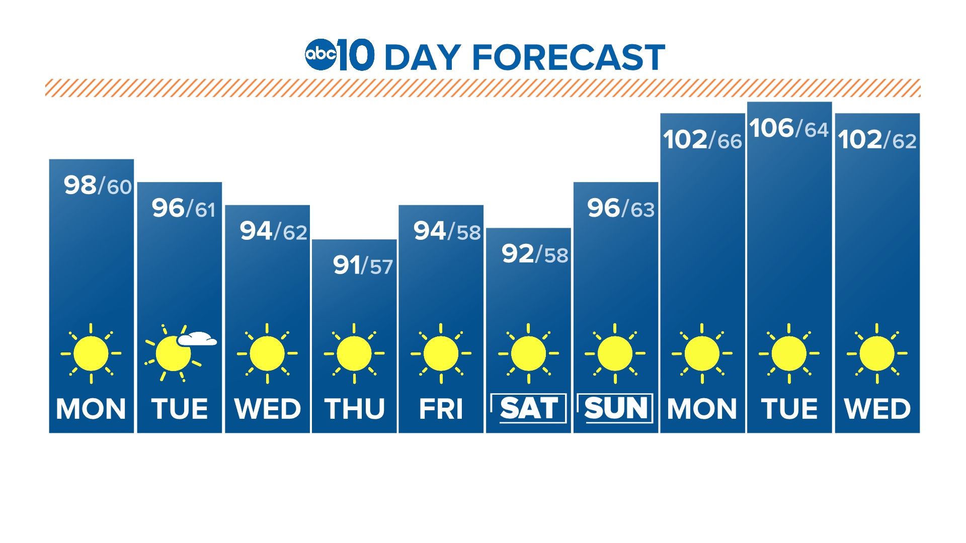
Otherwise, a slight cooling trend will drop temperatures to near normal by Thursday but the valley will remain in the 90s all week.


