SOLANO COUNTY, Calif. — Solano County residents have multiple ways to get emergency alerts and additional critical information for their area. As fire season ramps up, here's what you need to know about these systems and how to sign up for them.
The Solano County Office of Emergency Services has two main ways to get information from them: Alert Solano, Nixle for police announcements and the Genasys Protect evacuation map.
Alert Solano
Alert Solano notifies registered residents of unexpected road closures, severe weather, missing persons, evacuations, natural disasters and more. Once you register, you can select what alerts from which cities you want to be sent and how — text, call or email.
Solano OES sends emergency notifications to the unincorporated areas of the county and when events impact the entire county. City-wide notifications will be sent through city officials.
Sign up for Alert Solano HERE.
Nixle
Nixle is oftentimes used by law enforcement agencies to release information about "critical events."
It's used to alert residents to missing persons, sudden road closures, crashes, evacuations and more. Nixle is oftentimes used by public safety departments and can be used by others.
The Fairfield Police Department and the Fairfield Fire Department appear to be the only agencies actively using Nixle.
Sign up for Nixle alerts online HERE or text your zip code to 888777 to opt-in to text alerts from your area's agencies.
Genasys Protect
The Solano County Office of Emergency Services joined Genasys Protect, formerly known as Zonehaven AWARE, in 2023 as part of their "Know Your Zone" campaign which aimed to "better prepare residents and businesses for emergencies and evacuations."
What is Genasys Protect?
It's is an online system with the goal to "save lives with tools that help communities and first responders more effectively plan, communicate, and execute evacuations," according to their website.
The new tool will be used countywide, in all cities and unincorporated areas.
The new system does not replace Alert Solano and they will be used hand-in-hand. Sign up to receive emergency notifications HERE.
"It's a good tool we have now that we didn't before," said Sergeant Rex Hawkins, spokesperson for the Solano County Sheriff’s Office. "Tools are only useful if you use them. More tools are better than less tools."
How to use Genasys Protect:
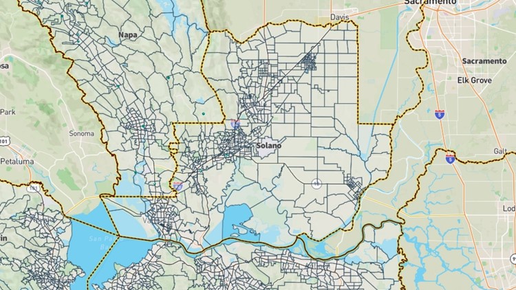
The Genasys Protect map — which can be found HERE and below — includes all evacuation zones outlined by emergency officials. To find your evacuation zone, type in your address or city in the search bar, allow location sharing or scroll down to view the map and move it around. You can also download the Genasys Protect app HERE.
Each evacuation zone will have three letters, representing a city or the county's name, followed by a four digit code. Each zone has a unique number to prevent confusion about what alerts are for which zones. Examples include: SOL for unincorporated Solano County, FRF for Fairfield, VLJ for Vallejo, BNC for Benicia, SUC for Suisun City, VAC for Vacaville, DIX for Dixon and RVS for Rio Vista.
Officials with OES strongly encourage residents know their evacuation zone name so they can understand alerts and react to emergency information faster.
"I cannot stress the importance of residents knowing their zones," said Hawkins, going on to say Genasys Protect is a more user-friendly experience and will mostly be used for evacuations.
In the event of an emergency, first responders and officials will use Genasys Protect to assist in issuing evacuations. Officials will then publish evacuation orders and zone statuses to Genasys Protect and send emergency notifications via Alert Solano.
Along with Solano County; Siskiyou, Modoc, Lassen, Shasta, Humboldt, Tehama, Plumas, Sierra, Yuba, Nevada, Sutter, Mendocino, Lake, Napa, Marin, Contra Costa, Calaveras, Alameda, San Mateo, Santa Clara, Santa Cruz, Madera, Monterey, Tulare, Kern, San Luis Obispo, parts of Los Angeles and Orange, Riverside and San Diego counties also use Genasys Protect for evacuation information.
What alerts will be on Genasys Protect?
Evacuations, road closings, fires, weather conditions, sand bag locations and more will be accessible through the webpage or app.
Emergency alerts will be color coded on the map.
- Blue - Advisory
- Yellow - Evacuation warning (There is a potential threat to life and/or property. Those who require additional time to evacuate and those with pets and/or livestock are encouraged to leave now.)
- Red - Evacuation order (There is an immediate threat to life. It is a lawful order to leave now and the area is lawfully closed to public access. It is important to note that not all evacuation orders begin with an evacuation warning.)
- Green - Evacuation order lifted
Find more information about the Know Your Zone campaign and emergency response HERE.