
SACRAMENTO, California —
An unseasonably warm weekend is ahead for Northern California.
The jet stream is barreling across the Pacific towards the Northwest, soaking Oregon and Washington this weekend along with parts of far Northern California.
Since most of Northern California will be to the south of the jet, temperatures will be mild this weekend with highs above climatological normal for early November. The average high in Sacramento this time of year is 70 degrees and high temperatures will exceed that each day this weekend.
Friday will likely be the warmest day for the rest of the year with highs approaching 80 degrees in certain valley locations. In Sacramento, the high will be around 76 under partly cloudy skies.
Saturday will be a few degrees cooler, with highs reaching into the low to mid 70s and valley highs will be in the low 70s Sunday. Daily high temperatures will continue to fall into next week.
The warmer than average temperatures will be paired with partly to mostly cloudy skies across the region and winds of 5-10 mph from the south. Overnight lows will also be much warmer than they were earlier in the week, only dropping into the 50s in the valley and 20s and 30s in the Sierra.
Even though temperatures will be above average, rain showers are also possible this weekend though chances are higher next week.

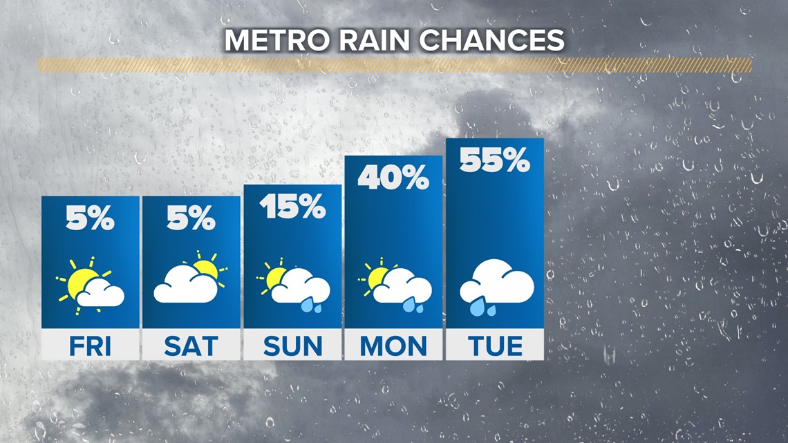
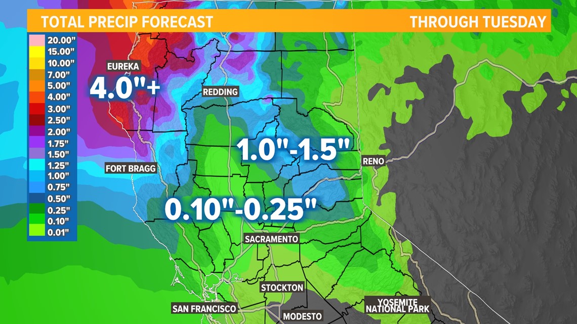
A few passing showers are possible Sunday but the main action will be early next week. Through Tuesday, the Sacramento area will be likely looking at totals ranging from 0.10-0.25" with totals decreasing as you head south of Interstate 80. This will be a much more impactful event for far Northern California and along the coast.

Snow will also be part of the weather story next week thanks to the storms ushering cooler air by Monday and Tuesday. Snow levels will be above 7,500 feet Monday and will drop further Tuesday to around 6,000 feet.
Totals will be modest with only a few inches likely. Totals will be higher in the higher elevations and on Lassen Peak but below a foot is expected.