SACRAMENTO, Calif. — As we move into the heart of the rain season, water is rightfully on the brain. A big player in whether or not we see a wet winter in Northern California is La Niña, specifically the El Niño Southern Oscillation (ENSO).
The El Niño Southern Oscillation comes in three phases: El Niño, La Niña or Neutral. These phases tell us the condition of the waters in the equatorial Pacific.
In the El Niño phase, the water in the equatorial Pacific is warmer than average. In La Niña it's cooler than average, and in neutral conditions the water is near average.
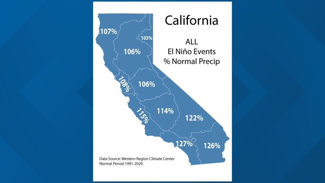
There are exceptions, but generally speaking, the El Niño phase is typically what produces the wettest winters across California. In fact, last winter was an El Niño winter, and the statewide precipitation average for Water Year 2023-24 was 106%, although the Sacramento Valley was below that at 96%.

The El Niño transitioned to neutral by the summertime and we knew months ago this winter was shaping up to be a La Niña winter. What we weren't sure of was how strong the La Niña conditions would be.
On December12, the National Weather Service released its latest ENSO report.
"The dynamical models... continue to predict a weak and a short duration La Niña, as indicated by the Niño-3.4 index values less than -0.5°C."

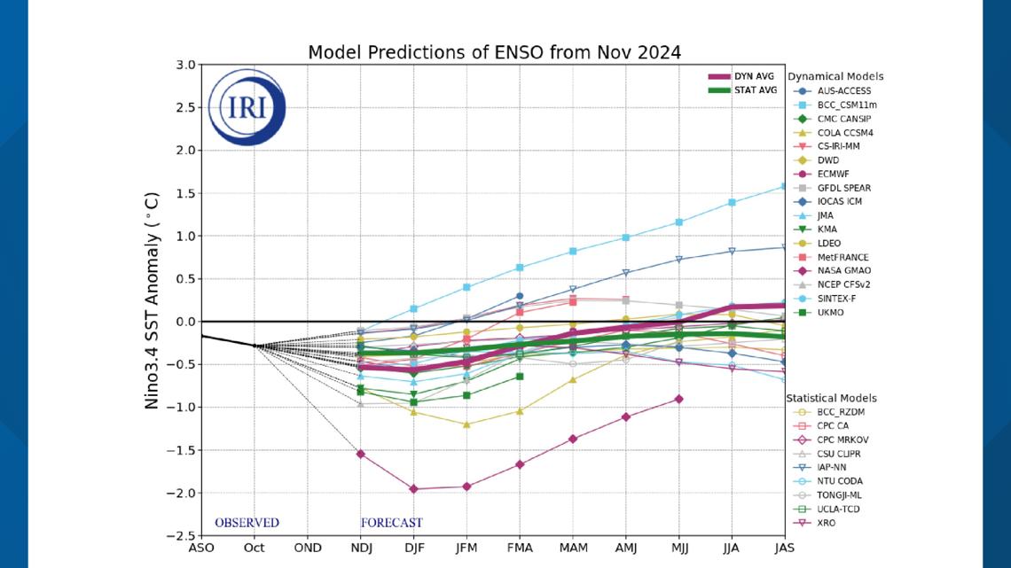
So, a weak and short duration La Niña is expected this winter. What does that mean?
The gut reaction is it's La Niña, so expect below average precipitation. That's usually true for moderate (-1.0°C to -1.5°C) to strong (-1.5°C+) La Niñas, but actually, a weak La Niña (-0.5°C - 1.0°C) isn't necessarily a lock to be dry. Some of the wettest winters in Northern California have come when the equatorial Pacific is running just a bit cooler than average, aka a weak La Niña.

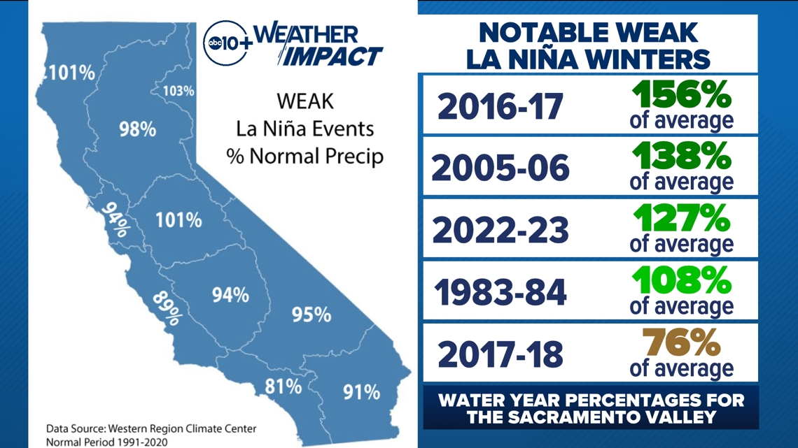
The recent drought-busting winters of 2016-17 and 2022-23 — when the Sacramento Valley recorded 156% and 127% of average precipitation, respectively — occurred in weak La Niña conditions. However, we've also seen drier than average years, with 2017-18 bringing us just three-quarters of our average precipitation.
When looking at every weak La Niña winter between 1991 and 2020, the Sacramento Valley averages about 98% of average precipitation. In other words, an average precipitation winter.
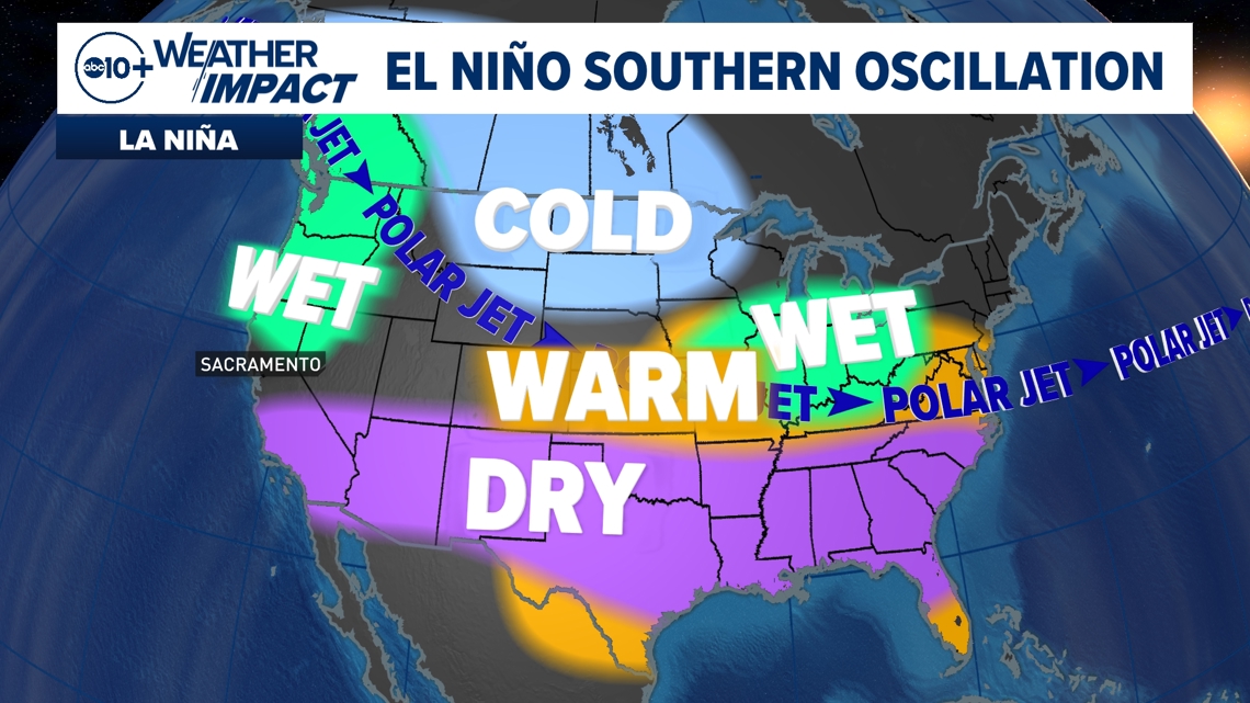
A weak La Niña winter can be one of the hardest to predict. Recent climatology doesn't give us a clear answer, which means we have to rely on medium-range climate models and a textbook understanding of La Niña, which typically would mean a drier than average year for much of California.

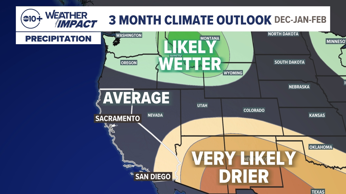
The three-month precipitation outlook from the Climate Prediction Center shows a likely near-average winter across most of the state, with the models leaning towards below average precipitation in Southern California.
It's important to note, however, that La Niña is not the only determining factor in wet weeks, months and years. It's a good indicator, for sure, but there are other forces at play in the atmosphere like the Pacific-North American Oscillation and the Madden-Julian Oscillation. The PNA and MJO are both shorter in duration than La Niña, but both play a bigger role in week-to-week weather patterns for Northern California than La Niña.
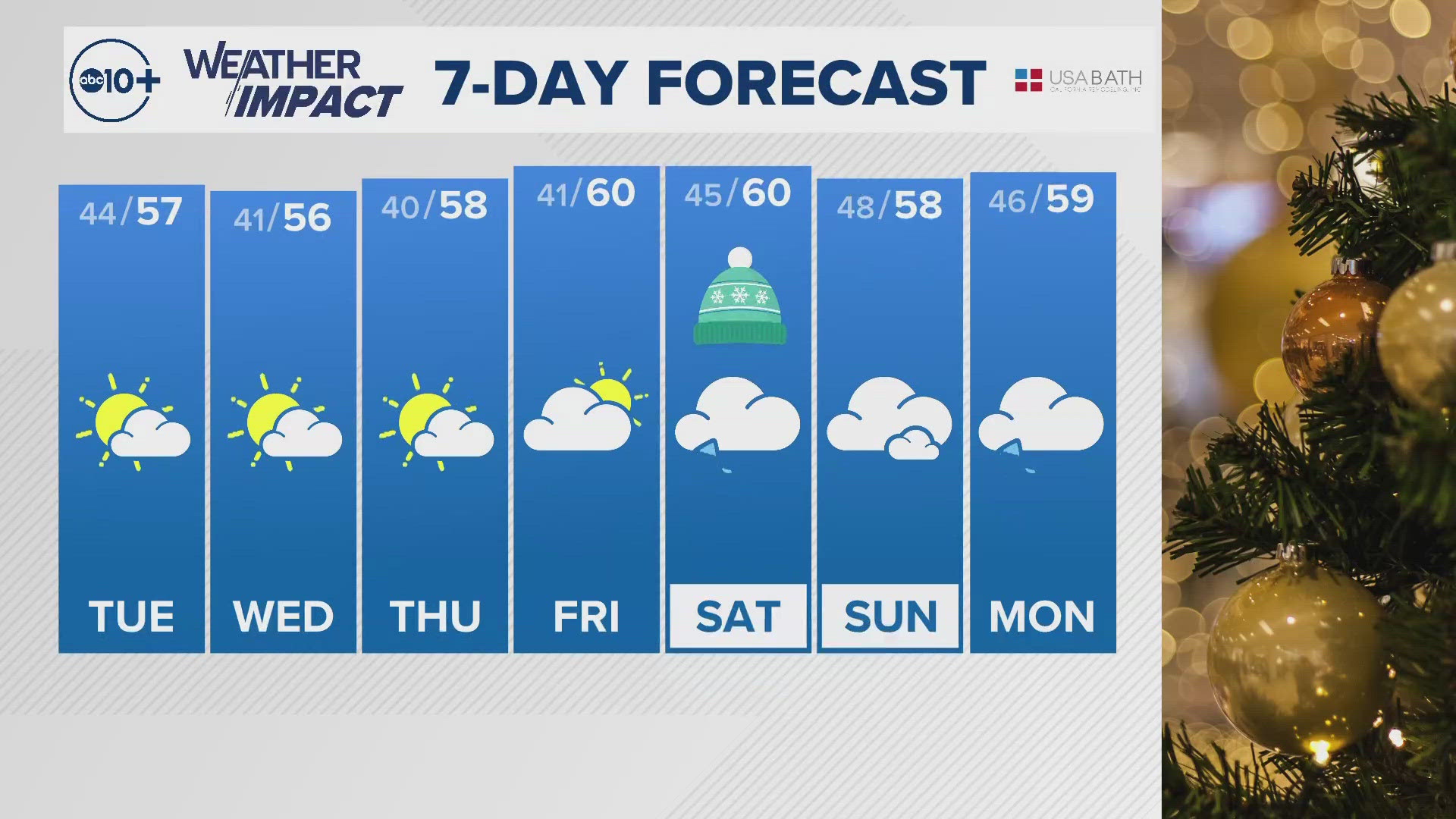
All that to say, don't look away! Remember how historically wet it was just a couple of winters ago in 2022-23? That was a weak La Niña winter.

