SACRAMENTO, California — Not only have temperatures exceeded 100 degrees across the Central Valley this week, high humidity has pushed heat index values or "feels like" temperatures higher than the actual temperature.
A surge of monsoonal moisture has pushed into the region, supplying the high humidity, along with patchy cloud cover and thunderstorms in many areas.
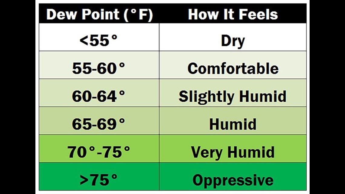
The dew point, the temperature at which water droplets condense, is the preferred metric in deciphering how muggy it feels outside. Meteorologists prefer dew point over relative humidity because the relative humidity is dependent on temperature while dew point relates only to the amount of water vapor in the air.
For example, say it is 75 degrees with 50% humidity. This combination produces a dew point of 55, which falls in the comfortable range. However, 95 degrees paired with 50% humidity equates to a sultry dew of 74, which is nearly oppressive. This is because warm air has the ability to hold more water than cooler air.

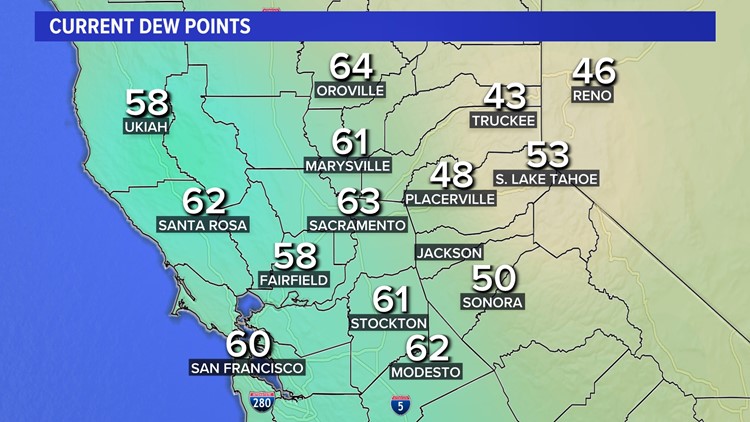
Around midnight last night, the dew point at Sacramento International Airport hit 70 degrees and the Stockton airport hit a dew point of 70 Sunday. Values this high are not common in the Central Valley, especially this far north. Most of the year, the cool Pacific waters keep dew point values much lower due to lower evaporation rates.
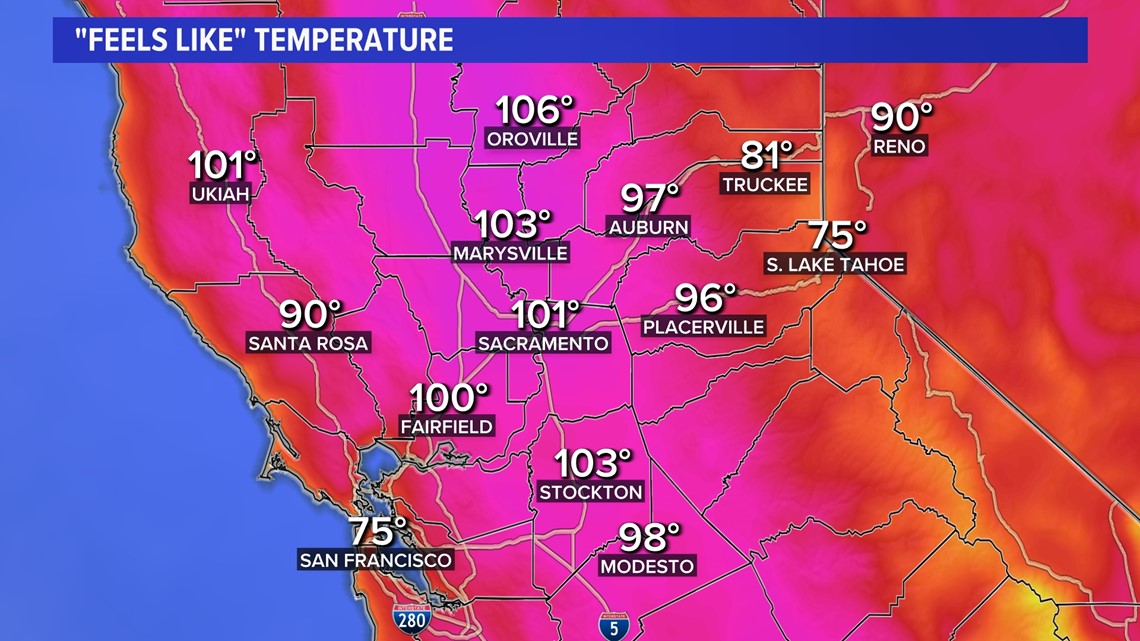
Dew points were well into the 60s for much of the valley as of 1 p.m. Tuesday. As a result, "feels like" temperatures were a few degrees hotter than the actual temperature. In Sacramento, a temperature of 98 paired with a dew point of 63 placed the "feels like" temperature at 101 degrees.
Dew points in the 60s are expected in the Sacramento area for the rest of the week.

Looking ahead
A tropical disturbance off the coast of Mexico is likely to form into a tropical depression in the next 48 hours. This system has an 80% chance of strengthening in the next few days into a tropical storm. If the storm intensifies, we could see the formation of tropical storm and possibly hurricane “Hilary.”
Currently the disturbance is bringing showers and thunderstorm activity to southern and southwest Mexico. Areas of Baja California are already seeing hurricane advisories for Hurricane Fernanda a few hundred miles offshore.
By Sunday into Monday, there is a decent chance to see the still forming tropical disturbance make its way onshore into Southern California. Although still a week away, current European models show the storm strengthening offshore in warming water and moving up the Baja California Peninsula.
Here in Northern California, it is too early to tell what the impacts, if any, will be. However, another stretch of high humidity, cloud cover and high elevation thunderstorms could be on the way.