SANTA BARBARA, Calif. — Click HERE for the latest updates on the Alisal Fire.
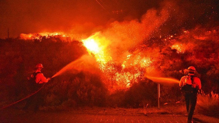
A wildfire near Santa Barbara is now at more than 14,500 acres and is 5% contained.
The Alisal Fire, which is located near Refugio Canyon along the Gaviota Coast broke out Monday, Oct. 11 around 2:30 p.m.
Firefighters stood on the northbound lanes of Highway 101 early Tuesday morning to fight back the flames, according to Mike Eliason, the public information officer for Santa Baraba County Fire.
According to Eliason, the department is using air support helicopters to drop water onto the fire.
Evacuation orders and warnings began Monday and are still in place.
The fire is burning dry grass and brush and is growing quickly because of the strong winds.
Key Figures
- Acres: 14,500
- Containment: 5%
- Structures threatened: 100-120
- 1,200 personnel
Accounts to follow
Evacuation Maps
A map of evacuations from the Santa Barbara Office of Emergency Management is available below.
Wildfire map
Click here for a map of the Alisal Fire.
Evacuations and Road Closures
Evacuation orders have been issued for Arroyo Hondo Canyon and Refugio Canyon west of Goleta. Residents should leave the area immediately.
An Evacuation Warning has been issued for the area between El Capitan Beach State Park, west of Dos Pueblos Canyon Road and south of West Camino Cielo.
An additional evacuation warning for the area east of Calle Mariposa Reina, west of Arroyo Hondo, and south of West Camino Cielo. Residents should be prepared to leave.
Highway 101 is closed between Highway 1 and Winchester Canyon Road/Cathedral Oaks in both directions. Highway 154 remains open.
Click HERE for in-depth evacuation orders and warnings in Santa Barbara County. For current state highway/route information visit roads.dot.ca.gov.
Evacuation centers
A Temporary Evacuation Point is at the Dos Pueblos High School upper parking lot at 7266 Alameda Avenue in Goleta. Evacuees can go to this location to get information from personnel on-site, according to the Santa Barbara Office of Emergency Management.
RELATED: How ash falling from wildfires can help future predictions of extreme fire weather | Scorched Earth
►Stay in the know! Sign up now for the Daily Blend Newsletter
Wildfire Preps
If you live in a wildfire-prone zone, Cal Fire suggests creating a defensible space around your home. Defensible space is an area around a building in which vegetation and other debris are completely cleared. At least 100 feet is recommended.
The Department of Homeland Security suggests assembling an emergency kit that has important documents, N95 respirator masks, supplies to grab with you if you’re forced to leave at a moment’s notice. The agency also suggests signing up for local warning system notifications and know your community’s evacuation plans best to prepare yourself and your family in cases of wildfires.
Some counties use Nixle alerts to update residents on severe weather, wildfires, and other news. To sign up, visit www.nixle.com or text your zip code to 888777 to start receiving alerts.
PG&E customers can also subscribe to alerts via text, email, or phone call. If you're a PG&E customer, visit the Profile & Alerts section of your account to register.
ABC10: Watch, Download, Read
WATCH MORE:


