
PLUMAS COUNTY, Calif. — The messages from fire officials on Friday morning for the Beckwourth Complex was things stayed the same.
The Beckwourth Complex Fire was formed after two fires — the Dotta Fire in the area of Dotta Conyon on the Beckwourth Ranger District of the Plumas National Forest and the Sugar Fire in the Sugarloaf Peak on the Beckwourth Ranger District of the Plumas National Forest — merged. Both the Dotta and Sugar fires were caused by lightning strikes. The complex was formed on July 4, 2021.
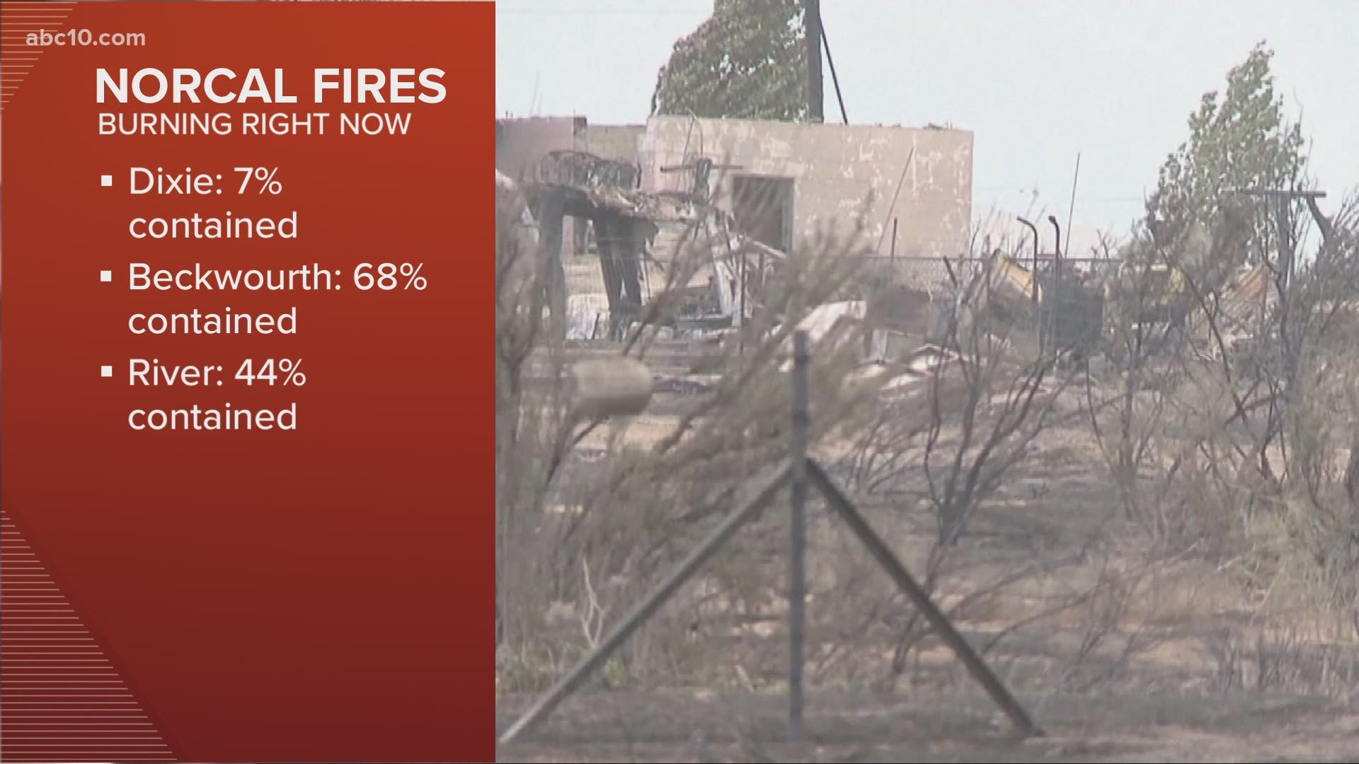
According to the latest figures from U.S. Forest Service, the Beckwourth Fire Complex sits at 105,161 acres burned and 68% contained.
"Fire crews were able to contain an area of the Sugar fire within the Beckwourth Complex, which escaped containment lines adjacent to Highway 395, west of Doyle, yesterday," the latest incident report said. "The fire encroached on the highway; however, firefighters were able to use air and ground suppression to engage the fire and prevent it from spreading."
The high way temporarily closed at that time, but has since reopened.
Stay on top of evacuations from the following accounts:
Accounts to follow:
Wildfire Map
WILDFIRE PREPS
According to Cal Fire, 2020 was one of the most severe fire seasons on record as 9,917 wildfires burned 4.2 million acres. Over 9,000 structures were destroyed, and 31 people (civilians and firefighters) were killed.
California also experienced its first "Gigafire" because of the August Complex Fire, burning over 1 million acres by itself. Four of California's top five largest wildfires in state history happened in 2020.
If you live in a wildfire-prone zone, Cal Fire suggests creating a defensible space around your home. Defensible space is an area around a building in which vegetation and other debris are completely cleared. At least 100 feet is recommended.
The Department of Homeland Security suggests assembling an emergency kit that has important documents, N95 respirator masks, supplies to grab with you if you’re forced to leave at a moment’s notice. The agency also suggests signing up for local warning system notifications and know your community’s evacuation plans best to prepare yourself and your family in cases of wildfires.
Some counties use Nixle alerts to update residents on severe weather, wildfires, and other news. To sign up, visit www.nixle.com or text your zip code to 888777 to start receiving alerts.
PG&E customers can also subscribe to alerts via text, email, or phone call. If you're a PG&E customer, visit the Profile & Alerts section of your account to register.
ABC10: Watch, Download, Read


Watch more from ABC10
California Wildfires: When should we be worried about air quality?