PLUMAS COUNTY, Calif. — Friday 9:30 p.m. update:
Some mandatory evacuation orders have been reduced to warnings, according to the Lassen County Sheriff's Office.
In a Facebook post Friday evening, the sheriff's office said the mandatory evacuation orders for those living on the south side of Highway 70 between Beckwourth-Genesee Road and the Plumas and Lassen County line are reduced to an evacuation warning.
Friday 6:25 p.m. update:
Evacuation orders have been expanded after homes in Lassen County are threatened by the Beckwourth Complex.
Friday afternoon the Lassen County Sheriff's Office posted evacuation orders for:
- Lassen County residents on the north and south sides of Doyle Grade from the Lassen/Plumas County line east to the intersection of State Route 395 but not including Laura Drive.
- Lassen County residents from the Doyle Grade where it intersects with Highway 395 South to Red Rock Road on the west side of Highway 395 only.
- An Evacuation Warning is still in place for residents west of Highway 395 from County Road A26 south to Doyle Grade and from Red Rock Road south to the Sierra/Lassen County line.
Washoe County Sheriff's Office says their deputies are at the north end of Rancho Haven at the state to prepare to help residents evacuate from the Beckwourth fire.
Lightning strikes were reported along the east side of the Beckwourth Complex, according to the National Weather Service's tweet. They say hot, dry and unstable conditions allowed the wildfires to create pyrocumulonimbus clouds, which could produce lightning.
Here are the following locations, according to the NWS, that could be impacted:
- Big Cove Campground
- Chilcoot Campground
- Chilcoot-Vinton
- Doyle
- Frenchman Lake
- Frenchman Campground
- Herlong
- Spring Creek Campground
- State Line Peak
Original story:
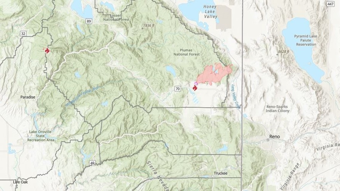
Flames that threaten homes and campgrounds have prompted evacuations and closed off a nearly 200-square-mile section of a Northern California forest as the state prepares for a weekend of dry, scorching weather and the continuing threat of wildfires.
"The fire remained active all night, progressing east towards Adam’s Peak where it crossed the escarpment west of Doyle," Plumas National Forest said in its latest update. "The fire is burning around the lake with numerous spot fires on the eastern side of the lake."
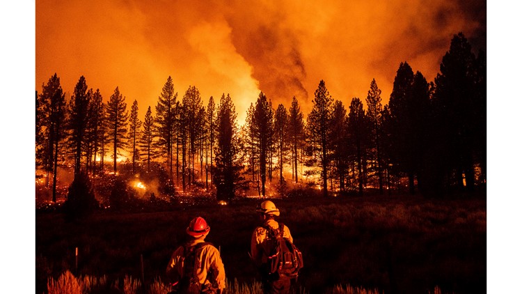
Hundreds of firefighters are battling the Beckwourth Complex, two blazes sparked by lightning that are carving their way through the eastern edge of the Plumas National Forest.
After a day and night of explosive growth, the fire covered more than 38 square miles at midmorning Friday, causing containment to drop to 11%. The fire is currently at 24,525 acres in total.
Meanwhile, forecasters warn that much of California will see dangerous triple-digit weekend highs. As the blaze grows, more evacuations were ordered for Lassen and Plumas County.
Accounts to follow:
MAPS


Wildfire preps
According to Cal Fire, 2020 was one of the most severe fire seasons on record as 9,917 wildfires burned 4.2 million acres. Over 9,000 structures were destroyed, and 31 people (civilians and firefighters) were killed.
California also experienced its first "Gigafire" because of the August Complex Fire, burning over 1 million acres by itself. Four of California's top five largest wildfires in state history happened in 2020.
If you live in a wildfire-prone zone, Cal Fire suggests creating a defensible space around your home. Defensible space is an area around a building in which vegetation and other debris are completely cleared. At least 100 feet is recommended.
The Department of Homeland Security suggests assembling an emergency kit that has important documents, N95 respirator masks, supplies to grab with you if you’re forced to leave at a moment’s notice. The agency also suggests signing up for local warning system notifications and know your community’s evacuation plans best to prepare yourself and your family in cases of wildfires.
Some counties use Nixle alerts to update residents on severe weather, wildfires, and other news. To sign up, visit www.nixle.com or text your zip code to 888777 to start receiving alerts.
WATCH MORE: Experts: aftershocks for days following Thursday's earthquake


