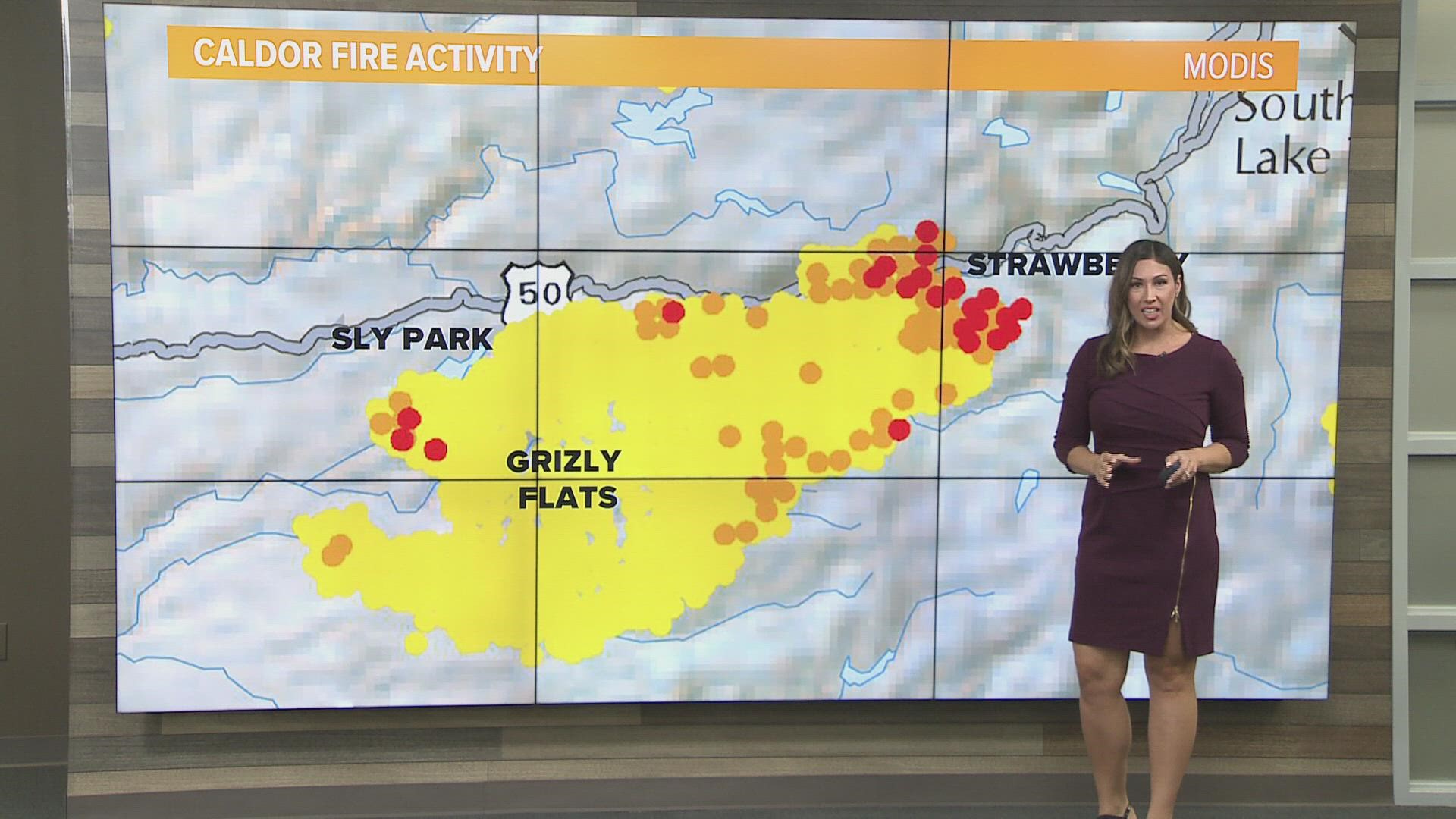
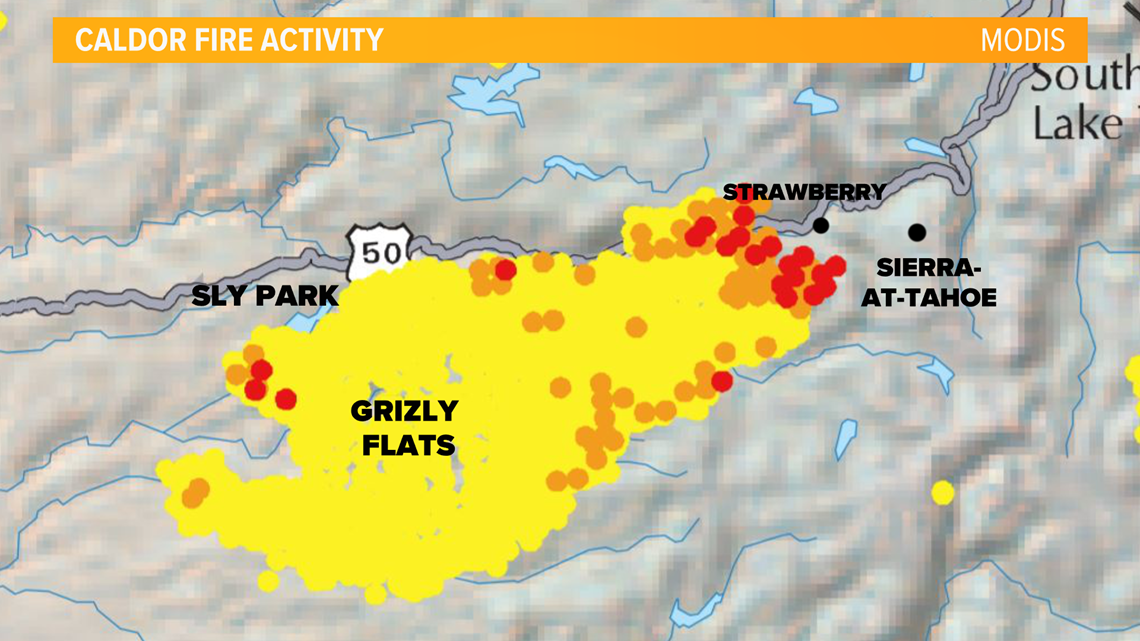
SACRAMENTO, Calif. — The Caldor Fire churned through mountains just southwest of the Tahoe Basin, cloaking much of the popular tourist area in toxic smoke.
Hot winds gusting at up to 35 mph were forecast for Saturday, raising concerns that winds could spread the wildfire embers from the tops of bone-dry trees and spark new fires.
Cal Fire Capt. Stephen Horner says Saturday will be "a very pivotal day."
Meteorologist Carly Gomez's Weather Outlook
Triple digit heat will bring about it’s own concern for fire growth. Strong atmospheric winds aren’t expected to play a part in the leading edge of the fire.

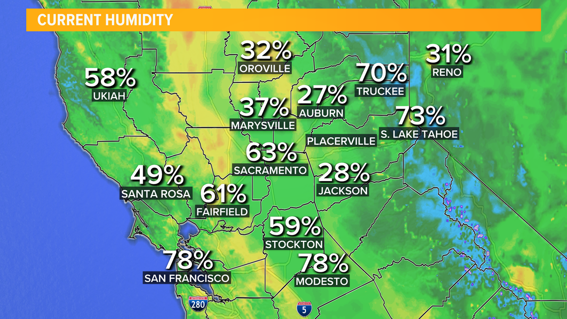
Hot temperatures continue to make it dry with very minimal overnight humidity recoveries. This means the air is so dry the margin for getting any sort of moisture in the air is much larger. We are looking at daytime humidity down to about 15-20%, while overnight humidity hasn't recovered to the typical 50-75%, instead overnight we've been seeing humidity around 25-30%. As of 3:30 am Saturday, humidity was around 26% near the Caldor Fire.
RELATED: Caldor Fire keeping region covered in smoke, firefighters busy | Evacuations, maps, updates

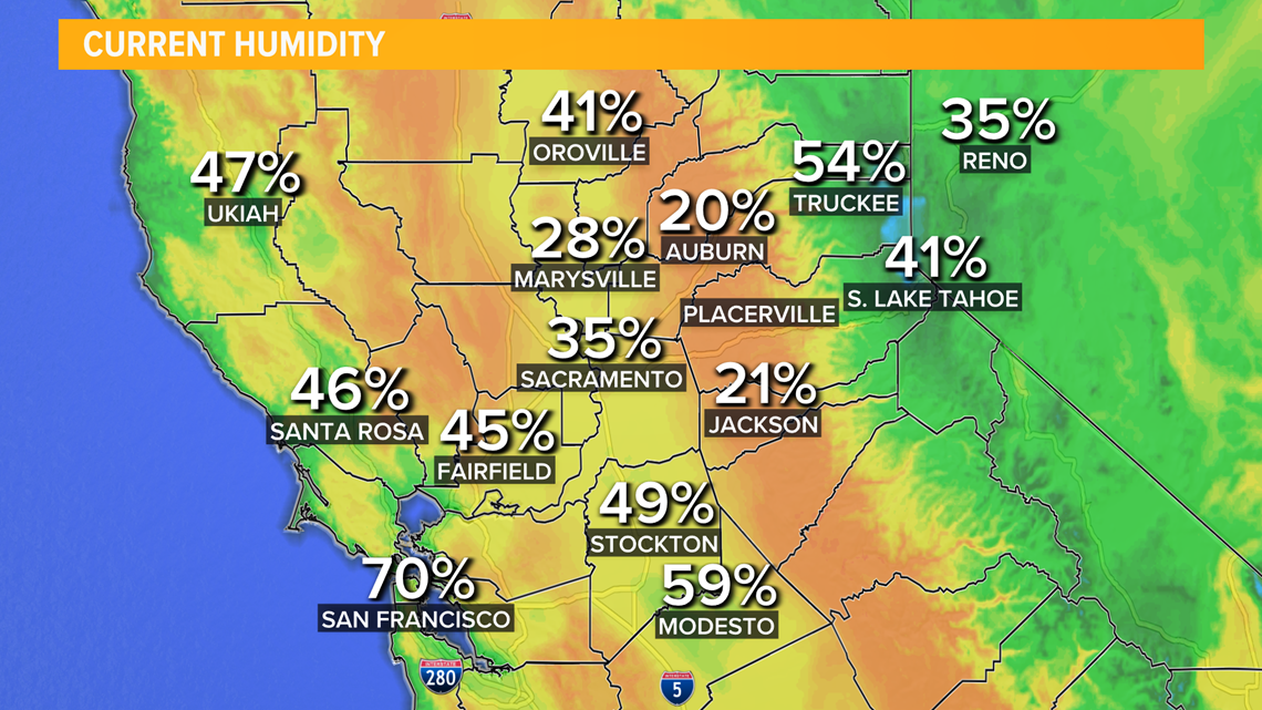
As of 9:45 am Saturday humidity dropped down to 20%

Humidity over the weekend is expected to be in the teens through Sunday.
Northern California summers don’t provide much dew on the grass in the mornings, but the dew point temperatures aren’t too far off. During triple digit heat the dew point temperatures get so far away, vegetation has no chance of even a slower burn. The tinder is so dry it will go up in an instant and could spread embers into a new area nearby. These lead to short range spot fires.
With these types of temperatures projected over the weekend, strong winds are limited and we’re more likely to see these shorter range spot fires. The problem now lays with the spot fires landing in difficult terrain.

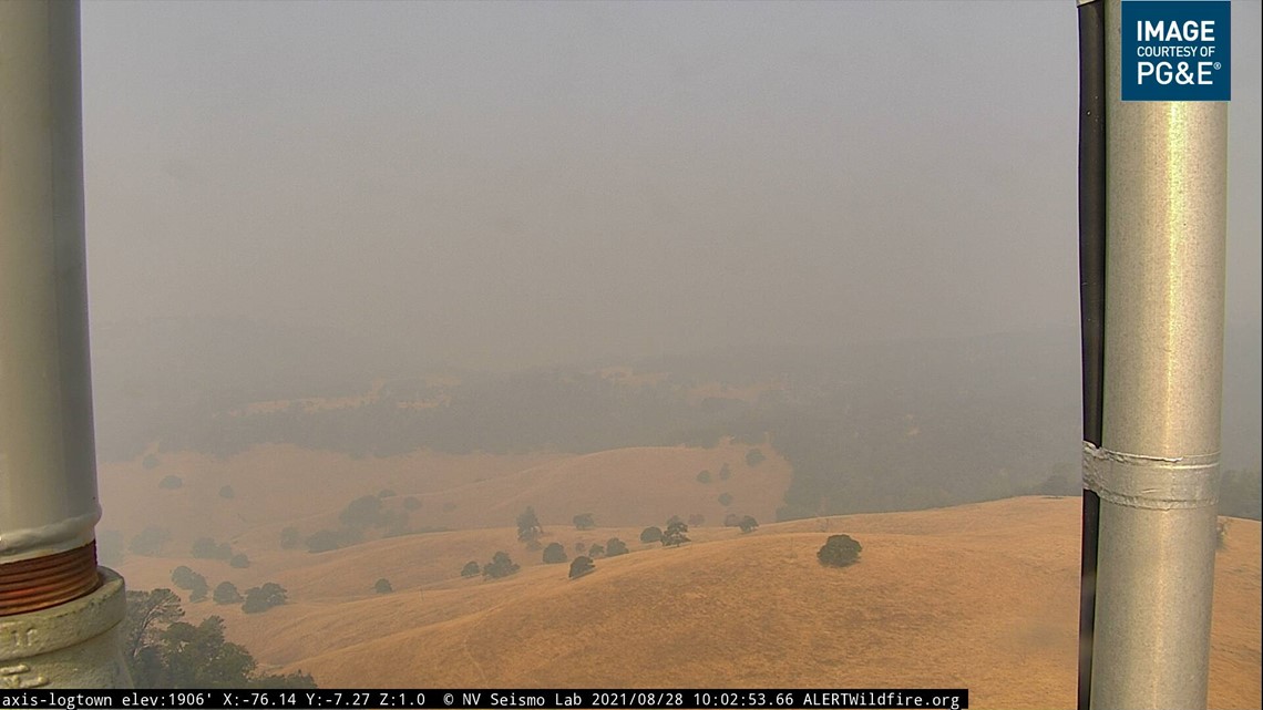
The Caldor fire is approaching steep canyons and areas where ski resorts thrive. These zones make it incredibly difficult for firefighters to get through. It also makes it near impossible for bulldozers to help with containment lines.
Upslope fires burn much faster as well, so that will be the main driving force for the fire this weekend. Imagine holding a match upright. It will burn at a normal pace. But as soon as you turn the match downward the flame burns faster, grabbing onto the higher points of the match stick. This is similar to thinking about uphill terrain. It’s not necessarily completely wind driven, but has more vegetation and wood to grab onto; allowing it to burn faster.
Smoke will continue to sit over northern California Saturday, bringing in hazardous to unhealthy air quality to most from the Sierra to the Sacramento Valley.

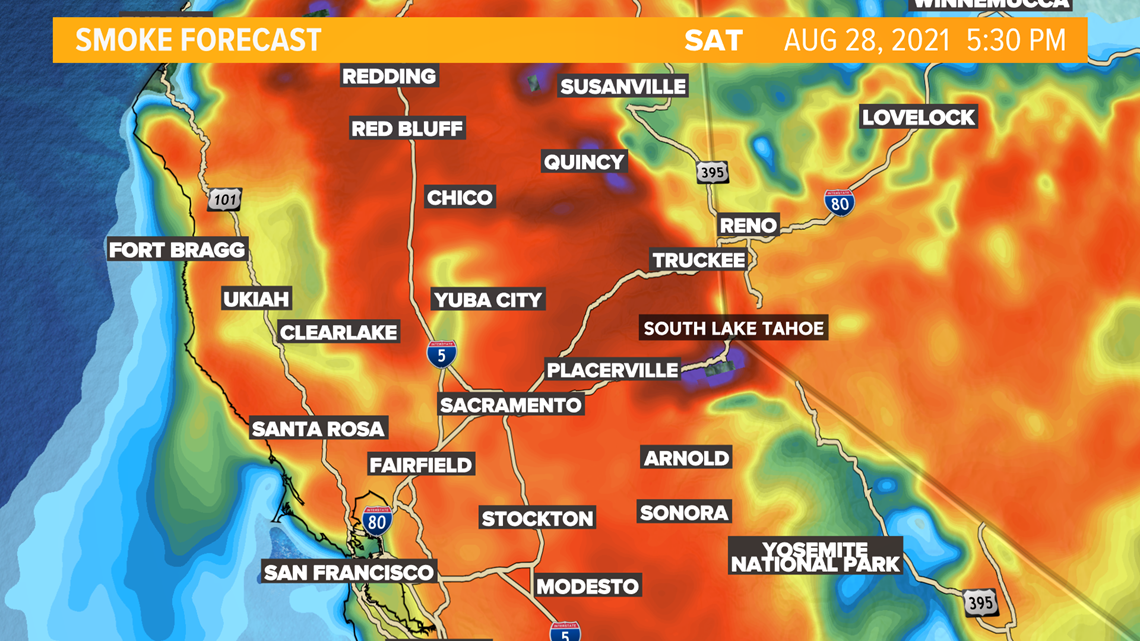
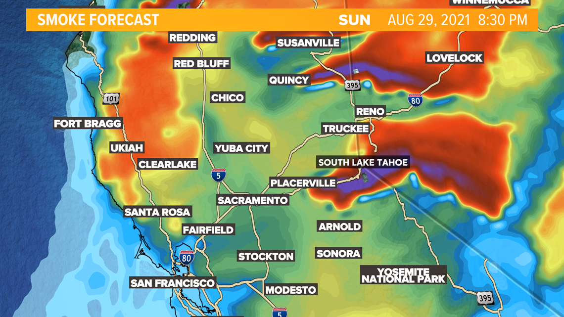
Improvements to air quality aren't expected until onshore winds push smoke east Sunday evening. This will bring in some better pollutant dispersion but also begin to fan flames northeast for the Caldor Fire.

WATCH MORE: As more evacuation orders are issued, the Caldor Fire approaches closer to South Lake Tahoe while firefighters combat the flames.

