
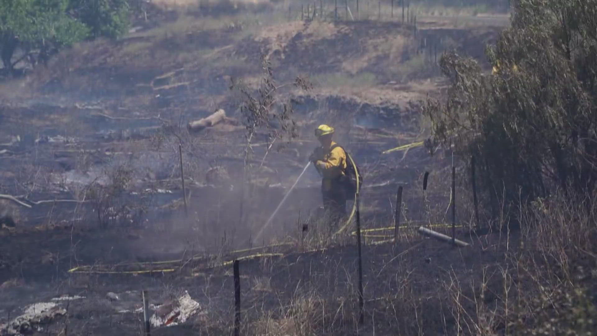
TRACY, Calif. — Cal Fire reported Sunday morning that the Corral Fire near Tracy has burned over 14,000 acres and is 30% contained.
The fire, which is at approximately 14,116 acres, destroyed one home, Cal Fire Battalion Chief Josh Silveira told ABC10 Sunday morning. Teams will be inspecting for more damage during the day.
Crews made "great progress overnight" due to the favorable winds, Silveira said. About 400 firefighters and air support will be used Sunday.
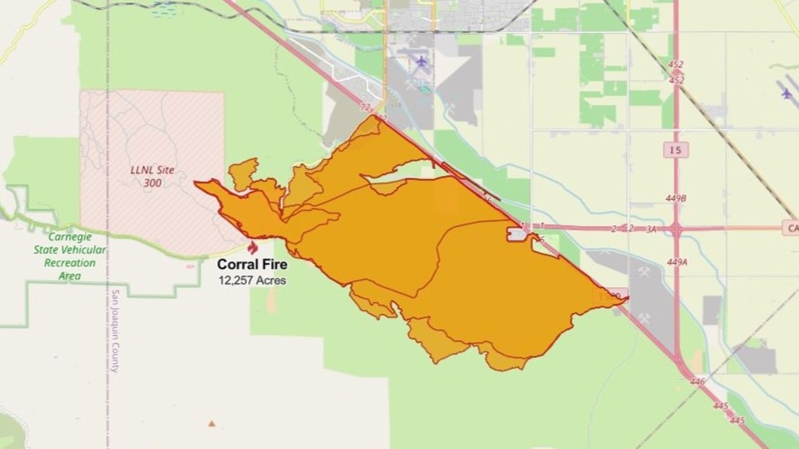
The fire started Saturday afternoon at the Lawrence Livermore National Laboratory site along Corral Hollow Road. The updated Cal Fire maps showed that it burned south and west of Interstate 580.
As of 1 p.m., Highway 132 and westbound Interstate 580 are open. Eastbound I-580 has the #2 lane closed from Corral Hollow Road to Bird Road. There's a ramp closure for Corral Hollow Road onto eastbound I-580. It's expected to reopen around 6 p.m.
Below are 6 maps that show the current conditions for everything from evacuations to fire perimeter and weather.
EVACUATIONS:
To access, click "I understand," then you can set your location and click "map" to see all zones.
FIRE PERIMETER MAP:
CalFire map from 6:20 Sunday morning:

FIRE LOCATION MAP:
This map from the National Interagency Fire Center shows fire activity (this may take a few seconds to load):
TRAFFIC MAP
Waze and ABC10's traffic map show the roads closed and delays.
WEATHER MAP
Radar map from ABC10.com. Adjust the layers with a filter on the bottom right corner to show heat, wind and other conditions:
STAY INFORMED:
WILDFIRE PREPS
According to Cal Fire, the 2022 fire season was quieter than previous years, but there were still several significant fires. January 2022 saw just one major incident with the Colorado Fire in Monterey County burning 687 acres. Fires picked up in May when the Lost Lake Fire burned through 5,856 acres. The largest fire in 2022, the Mosquito Fire, started in early September. It burned through more than 76,000 acres in El Dorado and Placer counties.
Overall, 331,360 acres burned in 2022 from 7,477 wildfires — well below the five-year average of 2.3 million acres. Over 870 structures were affected and nine people were killed, all civilians.
If you live in a wildfire-prone zone, Cal Fire suggests creating a defensible space around your home. Defensible space is an area around a building in which vegetation and other debris are completely cleared. At least 100 feet is recommended.
The Department of Homeland Security suggests assembling an emergency kit that has important documents, N95 respirator masks, and supplies to grab with you if you’re forced to leave at a moment’s notice. The agency also suggests signing up for local warning system notifications and knowing your community’s evacuation plans best to prepare yourself and your family in cases of wildfires.
Some counties use Nixle alerts to update residents on severe weather, wildfires, and other news. To sign up, visit www.nixle.com or text your zip code to 888777 to start receiving alerts.
PG&E customers can also subscribe to alerts via text, email, or phone call. If you're a PG&E customer, visit the Profile & Alerts section of your account to register.
What questions do you have about the latest wildfires? If you're impacted by the wildfires, what would you like to know? Text the ABC10 team at (916) 321-3310.
WATCH MORE: 100-degree heat is on the way. Here's the forecast


