SAN JOAQUIN COUNTY, Calif. — Find the latest updates on the Corral Fire HERE.
Cal Fire reported Sunday morning that the Corral Fire near Tracy has burned over 14,000 acres and is 50% contained.
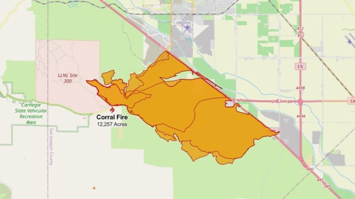
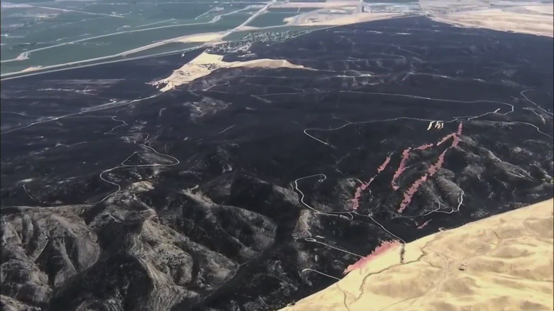
The fire, which Cal Fire said is at approximately 14,116 acres, started Saturday afternoon at the Lawrence Livermore National Laboratory site along Corral Hollow Road. Cal Fire maps showed that it burned south and west of Interstate 580.
The fire destroyed one home, Cal Fire Battalion Chief Josh Silveira told ABC10 on Sunday morning. Teams will be inspecting for more damage during the day.
Crews made "great progress overnight" due to the favorable winds, Silveira said. About 400 firefighters and air support will be used Sunday.
Multiple evacuation orders were temporarily issued, spanning from the area west of the California Aqueduct, south of Corral Hollow Creek, west to Alameda County and south to Stanislaus County, according to the San Joaquin County Office of Emergency Services. In an update, Cal Fire said all evacuation orders for the Corral Fire were downgraded to evacuation warnings at 6 p.m. However, officials said residents should remain vigilant and prepare for potential changes.
Two firefighters were also injured Saturday while battling the blaze, according to Cal Fire Battalion Chief Josh Silveira. One firefighter had moderate injuries and the other had minor injuries. Both were taken to the hospital for treatment and evaluation.
Michael Padilla, a spokesperson for the Lawrence Livermore National Laboratory, a nuclear, chemical and biological weapons research and development center, says Site 300 outside of Tracy is not threatened by the fire.
“The fire has moved away from the site. There was no on or off site contamination,” he said. “As a precaution, LLNL has activated their emergency operations center to monitor the situation through the weekend.”
The cause of the fire is being investigated.
STAY INFORMED:
EVACUATIONS:
To access, click "I understand," then you can set your location and click "map" to see all zones.
FIRE MAP:
Cal Fire map from 6:20 Sunday morning:


This map from the National Interagency Fire Center shows fire activity (this may take a few seconds to load):
WILDFIRE PREPS
If you live in a wildfire-prone zone, Cal Fire suggests creating a defensible space around your home. Defensible space is an area around a building in which vegetation and other debris are completely cleared. At least 100 feet is recommended.
The Department of Homeland Security suggests assembling an emergency kit that has important documents, N95 respirator masks, and supplies to grab with you if you’re forced to leave at a moment’s notice. The agency also suggests signing up for local warning system notifications and knowing your community’s evacuation plans best to prepare yourself and your family in cases of wildfires.
Some counties use Nixle alerts to update residents on severe weather, wildfires, and other news. To sign up, visit www.nixle.com or text your zip code to 888777 to start receiving alerts.
PG&E customers can also subscribe to alerts via text, email, or phone call. If you're a PG&E customer, visit the Profile & Alerts section of your account to register.
What questions do you have about the latest wildfires? If you're impacted by the wildfires, what would you like to know? Text the ABC10 team at (916) 321-3310.
For more ABC10 news and weather coverage on your time, stream ABC10+ on your TV for free:
► Roku - click here
► Amazon Fire - click here
► Apple TV - click here
WATCH MORE: 100-degree heat is on the way. Here's the forecast


