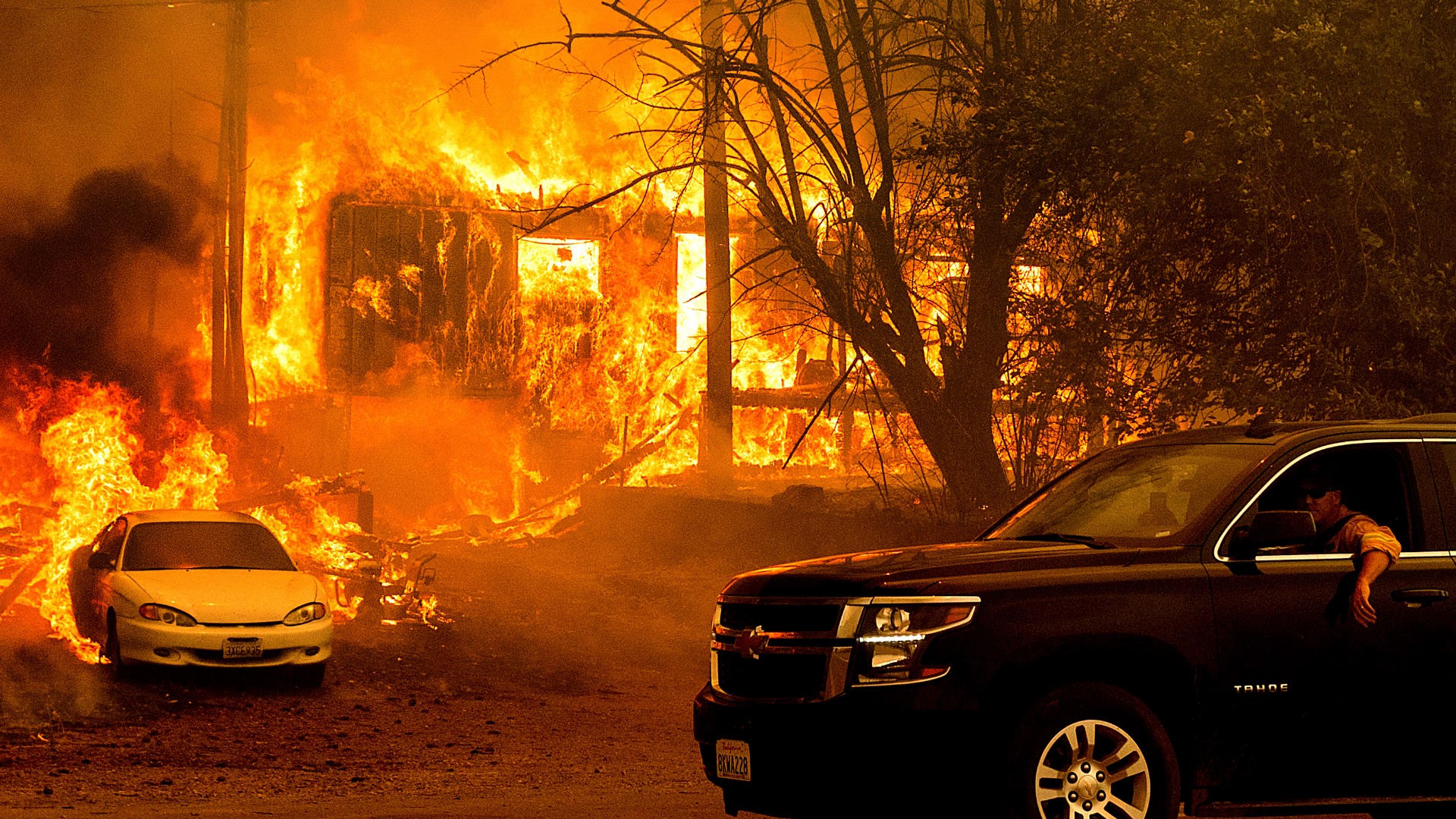
GREENVILLE, Calif. — People in the tiny mountain town of Greenville are mourning after California's largest fire incinerated much of the downtown. Authorities say at least 100 homes in and around the Sierra Nevada community burned as the wind-driven Dixie Fire exploded Wednesday and Thursday.
On Thursday, fire officials described the fire behavior as frightening. They say flames fueled by erratic gusts drove northeast through bone-dry forestland. However, fire officials say the winds should calm heading into the weekend.
Thousands of firefighters are battling the blaze, which has destroyed an area larger than the city of Los Angeles. Thousands of homes remained under threat. However, no deaths or injuries have been reported.
Plumas County Sheriff Todd Johns said four people remain unaccounted for in the fire and that officials are asking for a presidential declaration of emergency.
According to Plumas National Forest Supervisor Chris Carlton, said 31,000 people have been affected by evacuations. He said the Dixie Fire has taken 20% to 25% of all firefighter resources in the nation.
Crews said the fire remained "extremely explosive" throughout the day in the west zone with intense spot fires and torching and unpredictable fire behavior. In the east zone, crews said the fire reached Moonlight Ridge and that they're prioritizing structure protection and preservation of human life.
The fire also went around the town of Chester. Operations Section Chief Mike Wink said there were no reports of anything damaged or destroyed within Chester proper, but there were some structures damaged or destroyed just outside of the area.
The three-week-old wildfire grew another 40,000 acres as it continues to burn in Butte, Lassen, Plumas, and Tehama counties, burning a total of 361,812 acres with only 35% containment. It is the sixth-largest wildfire in state history.
On Thursday afternoon, the Plumas County Sheriff's Office gave another plea for people who stayed behind in Chester, Lake Almanor Peninsula, and Hamilton Branch to leave the area and evacuate east to Susanville.
Jake Cagle, the operations section chief for California Incident Management Team 4, confirmed reports of firefighting resources being diverted in order to rescue residents who chose to stay behind.
“When I talk about people not evacuating, I’m not trying to blame the people. I understand people want to stay there and we can’t force people to get out of their property,” Cagle said. “But when our resources…come in and they have to load up people in their fire vehicle and put them into a safe spot, that takes us away from fighting the fire.”
Cagle said the number one priority for firefighters is to protect life, even in instances when firefighters have had guns pulled on them by residents who refused to evacuate initially.
We’re not going to go into an area and go, ‘Oh, there’s people in there. Sorry, you chose to stay in here, but we’re going to fight the fire and put out the structure fire.’ No, we have to take care of life threat. That’s our job. That’s our mission and we’re going to continue to do that,” he said.
For Wednesday's updates, click HERE.
Accounts to follow:
Evacuation and road closure information
Click HERE for in-depth evacuation orders and warnings in Plumas, Butte, Tehama, and Lassen Counties. For current state highway/route information visit roads.dot.ca.gov.
Evacuation centers
- Spring of Hope Church, 59 Belle Lane Quincy, CA 95971(FULL)
- run by the American Red Cross California Gold Country Region
- Plumas County Animal Services, 201 N Mill Creek Rd Quincy, CA 95971
- Veterans Memorial Hall at 180 Gay St. in Chester, CA
- Lassen Community College at 478-200 CA-139 Susanville
- Plumas County Fairgrounds 204 Fairground Road, Quincy (large animals)
- Recreation Center 101 Meadowview Lane, Chester
- Tehama County Complex 1830 Walnut Street, Red Bluff (large and small animals)
- Portola Station Baptist Church, 171 South Gulling St., Portola, Calif.
- run by the American Red Cross California Gold Country Region
- Lassen High School, 1110 Main Street, Susanville, Calif.
- Lassen National Forest: Eagle Lake Road and Hat Creek Road campsites are available to evacuees. Make sure the campgrounds are not under any evacuation warnings. For details, contact Brian Newman at brian.newman@usda.gov or on 530-338-8745.
Butte County Evacuation Map
A live evacuation map from Butte County is available below.
Wildfire Map
An updated map of the acreage of the Dixie Fire
WILDFIRE PREPS
According to Cal Fire, 2020 was one of the most severe fire seasons on record as 9,917 wildfires burned 4.2 million acres. Over 9,000 structures were destroyed, and 31 people (civilians and firefighters) were killed.
California also experienced its first "Gigafire" because of the August Complex Fire, burning over 1 million acres by itself. Four of California's top five largest wildfires in state history happened in 2020.
If you live in a wildfire-prone zone, Cal Fire suggests creating a defensible space around your home. Defensible space is an area around a building in which vegetation and other debris are completely cleared. At least 100 feet is recommended.
The Department of Homeland Security suggests assembling an emergency kit that has important documents, N95 respirator masks, supplies to grab with you if you’re forced to leave at a moment’s notice. The agency also suggests signing up for local warning system notifications and know your community’s evacuation plans best to prepare yourself and your family in cases of wildfires.
Some counties use Nixle alerts to update residents on severe weather, wildfires, and other news. To sign up, www.nixle.com or text your zip code to 888777 to start receiving alerts.
PG&E customers can also subscribe to alerts via text, email, or phone call. If you're a PG&E customer, visit the Profile & Alerts section of your account to register.
ABC10: Watch, Download, Read
Watch more from ABC10: What led to the Dixie Fire becoming one of the largest ever?


