
BUTTE COUNTY, Calif. — According to the latest figures from Cal Fire, The Dixie Fire is 699,666 acres and 35% contained.
According to the fire map, the fire is now affecting five different counties, including Butte, Plumas, Tehama, Lassen and Shasta.
Dan Olsen, a representative for Cal Fire, said nearly 4,000 people were able to go back home but 25,000 are still impacted. Meanwhile, others are still waiting to find out if there's anything left to go home to.
"All of my friends are suffering. All my friends are suffering and they’ve lost everything," said Melody Hamilton, a Greenville resident.
The small historic town of Greenville was devastated by the Dixie Fire. It remains under evacuation orders. Hamilton's house survived the flames, but the home of her best friend Lisa Roberts did not.
They both came to a newly opened Local Assistance Center in Quincy which is providing resources on the road to recovery. Both have hope that their small town will rebuild.
Another small town looking to rebuild is Chester. As people repopulate the area, officials say the hospital in town is still closed and they are asking people to check on the status of their drinking water.
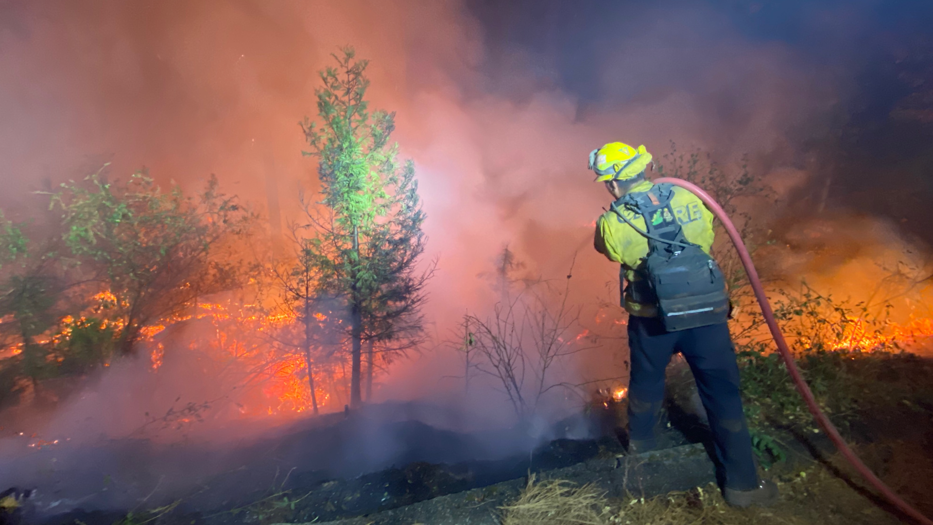
In the west zone, the fire stayed active under northeast winds as spotting and torching added to the fire's growth. However, smoke over the area dampened fire activity in some places but not enough to prevent growth. In east zone, there's been a lot of engagement on a portion of the fire near Janesville.
Lisa Bernard, spokesperson for the Lassen County Sheriff's Office, said Westwood is staying under evacuation orders due to bad roads and no electricity in the area.
At this time, more than 1,224 structures have been destroyed in the fire and 89 structures have been damaged. Of the structures destroyed, more than 650 were homes.
Accounts to follow:
Evacuations and road closures
Click HERE for in-depth evacuation orders and warnings in Plumas, Butte, Tehama, and Lassen Counties. For current state highway/route information visit roads.dot.ca.gov.
Evacuation centers
- Spring of Hope Church, 59 Belle Lane Quincy, CA 95971
- run by the American Red Cross California Gold Country Region
- Lassen Community College at 478-200 CA-139 Susanville
- Lassen High School 1110 Main St., Susanville, CA
- Holy Family Catholic Church 108 Taylor Ave. Portola, CA
- Recreation Center 101 Meadowview Lane, Chester
- 201 Mill Creek Rd. Quincy (small animals)
- Plumas County Fairgrounds 204 Fairground Road, Quincy (large animals)
- Tehama County Complex 1830 Walnut Street, Red Bluff (large and small animals)
Dixie Fire Structure Status Map
A live map showing which structures have been destroyed or at risk is available below.
Butte County Evacuation Map
A live evacuation map from Butte County is available below.
Wildfire Map
An updated map of the acreage of the Dixie Fire.
►Stay in the know! Sign up now for the Daily Blend Newsletter
WILDFIRE PREPS
According to Cal Fire, 2020 was one of the most severe fire seasons on record as 9,917 wildfires burned 4.2 million acres. Over 9,000 structures were destroyed, and 31 people (civilians and firefighters) were killed.
California also experienced its first "Gigafire" because of the August Complex Fire, burning over 1 million acres by itself. Four of California's top five largest wildfires in state history happened in 2020.
If you live in a wildfire-prone zone, Cal Fire suggests creating a defensible space around your home. Defensible space is an area around a building in which vegetation and other debris are completely cleared. At least 100 feet is recommended.
The Department of Homeland Security suggests assembling an emergency kit that has important documents, N95 respirator masks, supplies to grab with you if you’re forced to leave at a moment’s notice. The agency also suggests signing up for local warning system notifications and know your community’s evacuation plans best to prepare yourself and your family in cases of wildfires.
Some counties use Nixle alerts to update residents on severe weather, wildfires, and other news. To sign up, www.nixle.com or text your zip code to 888777 to start receiving alerts.
PG&E customers can also subscribe to alerts via text, email, or phone call. If you're a PG&E customer, visit the Profile & Alerts section of your account to register.