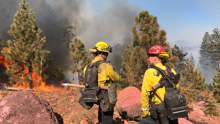
OROVILLE, Calif — The Dixie Fire has grown to 18,702 acres burned, and fire crews have contained roughly 15% of the fire area in Butte and Plumas counties.
On Sunday, Operations Section Chief Tony Brownell for Cal Fire said fuels, topography, and weather came together to make the fight against the Dixie Fire more active. He said the fire made a run over toward Philbrook, but he believes there's a good chance firefighters will be able to keep the fire out of the area.
Another active area of the fire came about when the fire got across the Feather River and over toward Tobin. Brownell said crews and engines are in the area and that he hasn't heard of any structure loss in the Tobin area so far.
With strong winds, warm weather, and the potential for thunder and lightning, the National Weather Service issued a Fire Weather Watch starting Sunday due to the increased weather conditions favorable to fires.
Multiple portions of State Route 70 is closed due to the fire, according to fire officials.
Sunday afternoon, the Butte County Sheriff's Office issued an evacuation order for Jonesville and Philbrook areas. The American Red Cross has opened a shelter at the Oroville Church of the Nazarene for Dixie Fire evacuees. Plumas County also issued evacuation orders due to the blaze.
Officials said the evacuations were done out of an abundance of caution. The fire is currently burning in remote areas with limited access, extended travel times and steep terrain challenges with containment, according to Cal Fire.
Accounts to follow:
Mandatory evacuations
- Jonesville and Philbrook areas in Butte County
- High Lakes in Plumas County: Recreational area of Plumas County east of the Butte/Plumas County line
- Plumas/Butte County line east to Twain in Plumas County: Includes both sides of Highway 70 in the areas of Rock Creek, Storrie, Tobin, Belden, Caribou Rich Bar, and Twain
- Meadow Valley & Bucks Lake: Bucks Lake Road at Snake Lake Road west to the Plumas/Butte County line, including the area of Tollgate.
Evacuation Warnings
- Butte Meadows and Inskip areas in Butte County
Road Closures
- State Route 70 from 14.3 miles east of the State Route 191 junction in Butte County
- State Route 70 at the north junction of State Route 89 and Greenville Wye
- Camp Creek Road
- State Route 70 is closed from Grandview Station to the junction with State Route 89
Butte County Evacuation Map
A live evacuation map from Butte County is available below.
Wildfire Map
WILDFIRE PREPS
According to Cal Fire, 2020 was one of the most severe fire seasons on record as 9,917 wildfires burned 4.2 million acres. Over 9,000 structures were destroyed, and 31 people (civilians and firefighters) were killed.
California also experienced its first "Gigafire" because of the August Complex Fire, burning over 1 million acres by itself. Four of California's top five largest wildfires in state history happened in 2020.
If you live in a wildfire-prone zone, Cal Fire suggests creating a defensible space around your home. Defensible space is an area around a building in which vegetation and other debris are completely cleared. At least 100 feet is recommended.
The Department of Homeland Security suggests assembling an emergency kit that has important documents, N95 respirator masks, supplies to grab with you if you’re forced to leave at a moment’s notice. The agency also suggests signing up for local warning system notifications and know your community’s evacuation plans best to prepare yourself and your family in cases of wildfires.
Some counties use Nixle alerts to update residents on severe weather, wildfires, and other news. To sign up, visit www.nixle.com or text your zip code to 888777 to start receiving alerts.
PG&E customers can also subscribe to alerts via text, email, or phone call. If you're a PG&E customer, visit the Profile & Alerts section of your account to register.


