
TUOLUMNE COUNTY, Calif. — Find the latest updates on the Woods Fire HERE.
The Tuolumne County Sheriff's Office is calling for some areas near Jamestown to evacuate due to a wildfire.
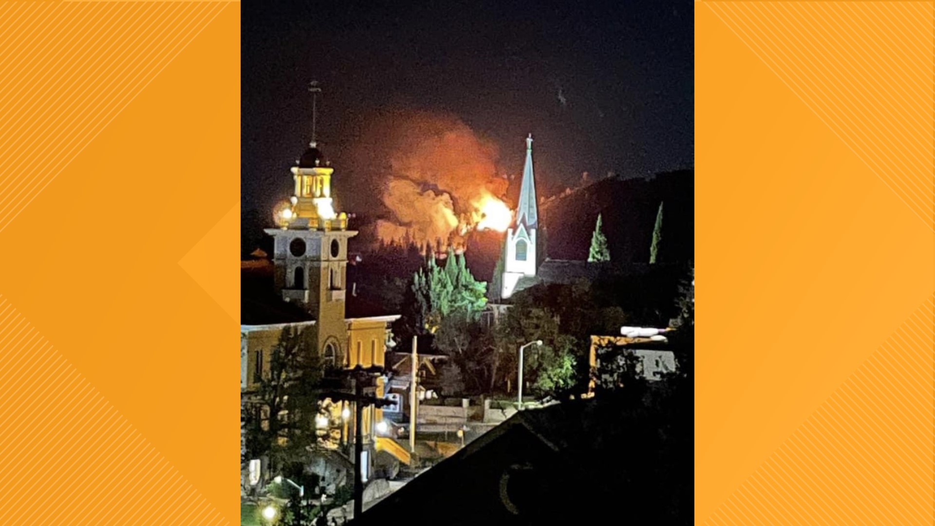
The so-called Woods Fire has burned 40 acres so far and caused the sheriff's office to issue evacuation orders for North Drive, Fairway, Outlook Drive, Martha Lane, Golden Dove, Silver Pine, Circle Lane, Alley Drive, Charbroullian Lane, Constance Lane, Gold Links Road east of Chabroullian, Mountain Vista Court and McKibbin due to the Woods Fire near Jamestown. The fire sparked at Highway 108 and Stockton Road in Sonora around 8:40 p.m.
Evacuation warnings are in place for Golf Links Road West of Chabroullian, Gibbs Drive, Jamestown Road, Racetrack Road, Ponderosa Way, Cottage Court and Woodside Drive.
Crews are dealing with heavy fuels and steep terrain as the Woods Fire backs down into the Golf Links Subdivision. Cal Fire spokesperson Emily Kilgore said the fire was burning at a moderate rate of spread.
Deputies have also closed Stockton Road from Highway 108 to Ponderosa Way and Highway 108 at Golf Links Road.
Authorities are asking people to avoid the area. PG&E is expected to de-energize in the area of North Drive and Outlook Drive. The outages are planned but could affect other areas.
Accounts to Follow:
Fire Map
This map from ESRI shows fire activity (this may take a few seconds to load).
Evacuation Center
An evacuation center is in place at the Posse Grounds on Rawhide Road. An animal shelter location is at 10040 Victoria Way.
Wildfire Preps
According to Cal Fire, the 2021 fire season started earlier than previous years, but also ended earlier, as well. January 2021 saw just under 1,200 acres burned from nearly 300 wildfires. Fires picked up in the summer when the Dixie Fire burned in five Northern California counties — Butte, Plumas, Shasta, Lassen and Tehama. The Dixie Fire started on July 13 and wasn't contained until Oct. 25, burning nearly 1 million acres. It has since become the second-largest wildfire in state history and the largest non-complex fire.
Overall, 2.5 million acres were burned in 2021 from 8,835 wildfires. Over 3,600 structures were destroyed and 3 people were killed.
If you live in a wildfire-prone zone, Cal Fire suggests creating a defensible space around your home. Defensible space is an area around a building in which vegetation and other debris are completely cleared. At least 100 feet is recommended.
The Department of Homeland Security suggests assembling an emergency kit that has important documents, N95 respirator masks, and supplies to grab with you if you’re forced to leave at a moment’s notice. The agency also suggests signing up for local warning system notifications and knowing your community’s evacuation plans best to prepare yourself and your family in cases of wildfires.
Some counties use Nixle alerts to update residents on severe weather, wildfires, and other news. To sign up, visit www.nixle.com or text your zip code to 888777 to start receiving alerts.
PG&E customers can also subscribe to alerts via text, email, or phone call. If you're a PG&E customer, visit the Profile & Alerts section of your account to register.
What questions do you have about the latest wildfires? If you're impacted by the wildfires, what would you like to know? Text the ABC10 team at (916) 321-3310.
WATCH ALSO:


