
RIVERSIDE COUNTY, Calif — Find the latest updates on the Highland Fire HERE.
The Highland Fire is burning in Riverside County and has caused authorities to issue evacuation orders for about 4,000 residents in the nearby areas.
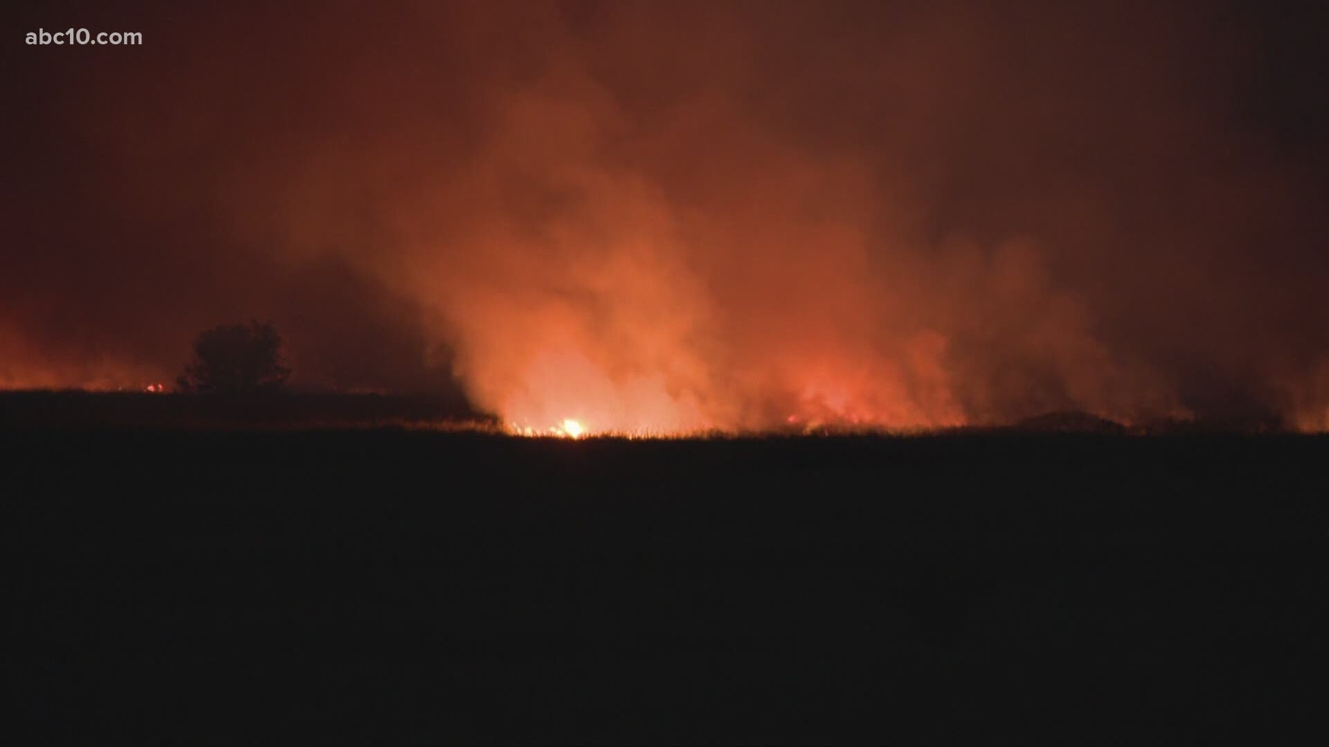
The wildfire has grown to 2,487 acres, according to Cal Fire. Containment of the blaze is at 10%.
The fire broke out near the intersection of Highland Road and Aguanga Ranchos Road in Aguanga around 12:45 p.m. Monday.
The fire forced authorities to issue evacuation orders for 4,000 residents. A full list of areas under evacuation orders and warnings is below. Fire authorities say about 2,400 homes and other buildings are threatened. About 1,300 homes are under evacuation orders
Three structures were destroyed, including at least one home, and six others have been damaged. One firefighter has been injured but authorities haven't provided details.
While the fire showed only minimal growth Tuesday, winds were forecast to remain in the area through Thursday evening and could spread the blaze west and southwest, the Riverside County Fire Department said.
Air tankers, helicopters and bulldozers were called in to fight the fire, one of the few large and active blazes to have erupted so far in California this year.
The Highland Fire erupted as Southern California experienced its first significant Santa Ana wind conditions of the season. The witheringly dry winds typically form as air flows from the the interior of the West and descends to the Pacific Coast during the fall, often stoking destructive wildfires.
Links to follow:
Evacuation Order
An evacuation order is in effect for the following locations as of 7:30 a.m. Tuesday.
- South of Sage Road/Golden Eagle Drive
- East of Becker Lane
- West of Boulder Vista
- North of Cottonwood Creek
- South of Highway 371
- West of Sorenson Road
- North of San Diego County Road
- East of Vail Lake Resort
- West of Shirley Way
- North of David Street
- South of Pueblo Road/Exa Ely Road
- North of San Diego County line
- South of Highway 79
- East of Forest Route 8S07
- West of Crosley Truck Trail
Evacuation Warning
An evacuation warning is in effect for the following locations as of 7:30 a.m. Tuesday.
- West of Cahuilla Tribal Reservation Boundary
- North of County Line Road
- North of Cleveland National Forest
- South of Watts Road, Esplendida Way, Avenida Bravura
- East of Pauba Road, De Portola Road
- West of Round Top Canyon Road
Evacuation Map
An evacuation map for Riverside County is available below.
Animal Shelters
Large and small animals can be taken to San Jacinto Animal Shelter at 581 South Grand Avenue in San Jacinto.
Wildfire Map
This map from ESRI shows fire activity (this may take a few seconds to load).
WILDFIRE PREPS
According to Cal Fire, the 2022 fire season was quieter than previous years, but there were still several significant fires. January 2022 saw just one major incident with the Colorado Fire in Monterey County burning 687 acres. Fires picked up in May when the Lost Lake Fire burned through 5,856 acres. The largest fire in 2022, the Mosquito Fire, started in early September. It burned through more than 76,000 acres in El Dorado and Placer counties.
Overall, 331,360 acres burned in 2022 from 7,477 wildfires — well below the five-year average of 2.3 million acres. Over 870 structures were affected and nine people were killed, all civilians.
If you live in a wildfire-prone zone, Cal Fire suggests creating a defensible space around your home. Defensible space is an area around a building in which vegetation and other debris are completely cleared. At least 100 feet is recommended.
The Department of Homeland Security suggests assembling an emergency kit that has important documents, N95 respirator masks, and supplies to grab with you if you’re forced to leave at a moment’s notice. The agency also suggests signing up for local warning system notifications and knowing your community’s evacuation plans best to prepare yourself and your family in cases of wildfires.
WATCH ALSO:


