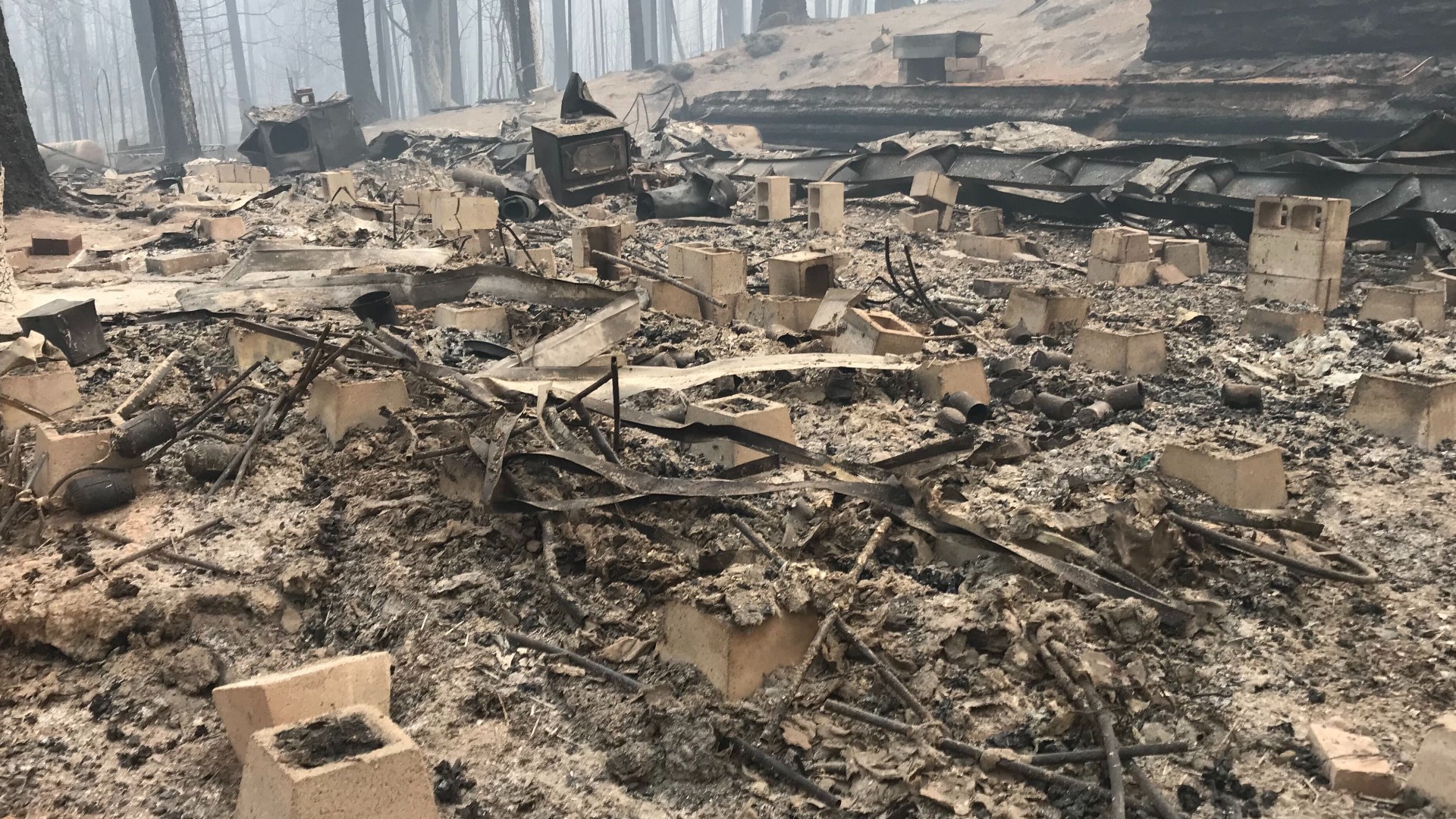
BUTTE COUNTY, Calif. — 10:00 p.m. update:
The Butte County Sheriff's Office confirmed the names of three people confirmed to have died in the North Complex West Zone Fire: Khawar Bhatti, 58 of Berry Creek; Millicent Catarancuic, 77 of Berry Creek; and Josiah Williams,16 of Berry Creek.
7:30 p.m. update:
On Sunday, officials announced that the number of deaths from the North Complex Fire has risen to 14, up two from their last update.
As the death toll rises, the number of missing persons dropped. Butte County Sheriff Kory Honea said seven people are still missing, a number that's down from 13 on Saturday.
In the West Zone of the North Complex Fire, the flames have burned 74,200 acres with only 18% containment so far.
The flames have destroyed 253 homes, 39 commercial structures, and have destroyed 125 structures of other types. 21 homes, 2 commercial structures, and 15 structures of other types were damaged.
Firefighters are preparing for more winds and Red Flag conditions, however, officials said the winds won't be of the same strength that was seen from Sept. 8 to Sept. 9.
Officials said these winds could clear out more of the smoke and allow them to use their air assets in the fire fight once they get some clear air. However, the winds are still a concern since areas could increase to fire behavior and rapid rates of spread.
6:30 p.m. update:
The number of deaths in the North Complex Fire has risen to 14, according to Butte County Sheriff Kory Honea.
On Sunday, Sheriff Honea announced that officials recovered the remains of two more people.
4:45 p.m. update:
An evacuation warning for most of the City of Oroville was lifted by the Butte County Sheriff's Office.
In a Cal Fire update, officials said the North Complex Fire has grown to more than 258,000 acres with 26% containment. Most work is being done in the West Zone of the fire near the City of Oroville. Officials said the West Zone of the Complex is at 74,000 acres and 15% contained.
9:30 a.m. update:
State Route 162 is closed near Oroville, according to Caltrans. The route is closed from Forbestown Rd to Forman Rd due to the North Complex Fire.
8:30 a.m. update:
Butte County Sheriff's Office issued a new evacuation warning this morning due to the North Complex Fire and some expected winds.
The area west of Table mountain to Highway 70 and north of Garden Dr and the water canal is now under an evacuation warning.
According to Cal Fire, the total Acres of the North Complex Fire is now 258,802 acres and 26% contained. The North Complex West Zone is now 74,000 acres an 15% contained.
7:27 p.m. update:
Twelve people have died in the North Complex fire, according to Butte County Sheriff Kory Honea during a Saturday news conference.
Honea said 13 people are still missing.
The North Complex West Zone is 73,000 acres and is 10% contained. The total acres of the North Complex fire is 252,313 acres and is 21% contained.
Cal Fire officials said 132 homes were destroyed and 13 were damaged in the fire. Officials also said 36 commercial buildings were damaged.
Original story:
Low winds are working in favor of firefighters who are attempting to contain the North Complex fire, according to Cal Fire.
Heavy smoke is stopping firefighters from launching aircraft in the air. Officials said they will be able to launch an aircraft once that smoke clears.
Officials said the North Complex Fire is 252,313 acres and 21% contained.
The North Complex West Zone Fire, which used to be known as the Bear Fire, is now 72,500 acres and is 7% contained. 82 structures were destroyed, 10 damaged and 23,356 are threatened by the flames.
As of publication, Cal Fire officials reported that 9 people died from the North Complex Fire.
Evacuations
- Feather Falls, Clipper Mills, Berry Creek, Brush Creek, Forbestown, Kelly Ridge, Copley Acres
- Residents east of Miners Ranch Road at 162 and Oro-Bangor Road, which includes Bangor and parts of Mt. Ida
- Highway 70 at Cherokee Rd south to Thompson Flat Cemetery Road, and all points east to Lake Oroville.
- The area west of Table Mountain to Highway 70 and north of Garden Dr and the water canal
- La Porte – Little Grass Valley Reservoir: All residents, campgrounds, and recreational facilities near Little Grass Valley Reservoir and the town of La Porte. Onion Valley south to the county line.
- Bucks Lake – From Bucks Lake Rd (Highway 162) at the Plumas / Butte County Line east to Bucks Lake Rd at Big Creek Road (east intersection). This includes Bucklin Road from Mill Creek Campground south to Bucks Lake Road, all residents, recreational facilities, campgrounds in the Bucks Lake area.
Butte County Sheriff's map of evacuation sites:
- Residents in the area of the La Porte Road and NY Flat Road, north of Brownsville to the county line.
- West of Bullards Bar Lake, east of La Porte Road and south of the county line. North of Bullards Bar and FOuntainhouse roads. North of Westcott Road, west of New York Flat Road, south and east of the county line.

