
PLACERVILLE, Calif. — A vegetation fire is threatening structures and has prompted evacuations in El Dorado County Saturday, officials said.
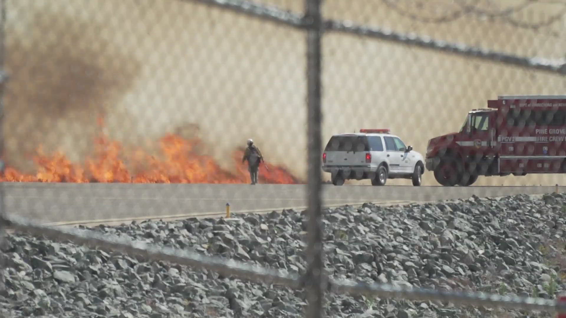
The Pay Fire is burning in the area of Paydirt Road, southeast of Placerville, the El Dorado County Fire Protection District says. The flames moved along the Placerville Airport.
According to firefighters, multiple structures are threatened and some airplane hangers are involved in the fire. Evacuation Orders and Evacuation Warnings have been issued. See a map below.
A overnight evacuation shelter opened at Union Mine Highschool at 6530 Koki Lane in El Dorado. Officials say leashed or kenneled animals are allowed. Animal evacuations can go to the El Dorado County Animal Services West Slope Animal Shelter at 6435 Capitol Ave. in Diamond Springs.
Cal Fire's Amador-El Dorado unit says the fire had a "dangerous rate of spread" due to high temperatures, steep topography and winds causing spotting.
There is a PG&E power outage impacting the same area, see the outage map HERE.
EVACUATION MAP:
Click or tap "I understand" and you will be able to access the map to see current Evacuation Orders and evacuation centers.
STAY INFORMED:
FIRE MAP:
This map from the National Interagency Fire Center shows fire activity (this may take a few seconds to load):
WILDFIRE PREPS
According to Cal Fire, the 2022 fire season was quieter than previous years, but there were still several significant fires. January 2022 saw just one major incident with the Colorado Fire in Monterey County burning 687 acres. Fires picked up in May when the Lost Lake Fire burned through 5,856 acres. The largest fire in 2022, the Mosquito Fire, started in early September. It burned through more than 76,000 acres in El Dorado and Placer counties.
Overall, 331,360 acres burned in 2022 from 7,477 wildfires — well below the five-year average of 2.3 million acres. Over 870 structures were affected and nine people were killed, all civilians.
If you live in a wildfire-prone zone, Cal Fire suggests creating a defensible space around your home. Defensible space is an area around a building in which vegetation and other debris are completely cleared. At least 100 feet is recommended.
The Department of Homeland Security suggests assembling an emergency kit that has important documents, N95 respirator masks, and supplies to grab with you if you’re forced to leave at a moment’s notice. The agency also suggests signing up for local warning system notifications and knowing your community’s evacuation plans best to prepare yourself and your family in cases of wildfires.
Some counties use Nixle alerts to update residents on severe weather, wildfires, and other news. To sign up, visit www.nixle.com or text your zip code to 888777 to start receiving alerts.
PG&E customers can also subscribe to alerts via text, email, or phone call. If you're a PG&E customer, visit the Profile & Alerts section of your account to register.
What questions do you have about the latest wildfires? If you're impacted by the wildfires, what would you like to know? Text the ABC10 team at (916) 321-3310.
Watch more from ABC10: Preparing your home for wildfire season | What To Know


