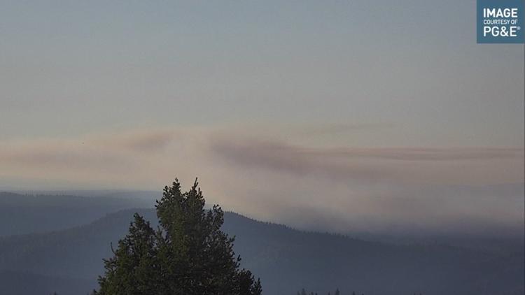
PLACER COUNTY, Calif. — The Hill Fire in Placer County has burned around 23 acres as of Tuesday morning, according to Cal Fire.
The fire is off of Iowa Hill Road, west of Big Dipper near Foresthill and is burning in steep terrain. There is an evacuation order for some campgrounds in the area.
Cal Fire Nevada-Yuba-Placer Unit said in a Tweet around 10 a.m. that firefighters are making good progress and air resources are looking for spot fires outside the fire.
Stay Informed
Road Closures
- Iowa Hill Road at Big Dipper Road
- Finning Mill Road at Brimstone and Old Hollow Log
- Finning Mill Road at Andersons Road
- Andersons Road at Foresthill Road
- Sugar Pine Road at Foresthill Road
- Elliott Ranch Road at Foresthill Road
Evacuations
There is an evacuation order for the following areas as of 8:05 a.m. on Tuesday.
- Giant Gap Campground
- Big Reservoir Campground
- Shirttail Creek Family Campground
- Morning Star Lake Campground
Evacuation Map
Here is a map of evacuations from the Placer County Sheriff's Office.
Fire Map
This map from ESRI shows fire activity (this may take a few seconds to load).
Wildfire Preps
According to Cal Fire, the 2021 fire season started earlier than previous years, but also ended earlier, as well. January 2021 saw just under 1,200 acres burned from nearly 300 wildfires. Fires picked up in the summer when the Dixie Fire burned in five Northern California counties — Butte, Plumas, Shasta, Lassen and Tehama. The Dixie Fire started on July 13 and wasn't contained until Oct. 25, burning nearly 1 million acres. It has since become the second-largest wildfire in state history and the largest non-complex fire.
Overall, 2.5 million acres were burned in 2021 from 8,835 wildfires. Over 3,600 structures were destroyed and 3 people were killed.
If you live in a wildfire-prone zone, Cal Fire suggests creating a defensible space around your home. Defensible space is an area around a building in which vegetation and other debris are completely cleared. At least 100 feet is recommended.
The Department of Homeland Security suggests assembling an emergency kit that has important documents, N95 respirator masks, and supplies to grab with you if you’re forced to leave at a moment’s notice. The agency also suggests signing up for local warning system notifications and knowing your community’s evacuation plans best to prepare yourself and your family in cases of wildfires.
Some counties use Nixle alerts to update residents on severe weather, wildfires, and other news. To sign up, visit www.nixle.com or text your zip code to 888777 to start receiving alerts.
PG&E customers can also subscribe to alerts via text, email, or phone call. If you're a PG&E customer, visit the Profile & Alerts section of your account to register.
What questions do you have about the latest wildfires? If you're impacted by the wildfires, what would you like to know? Text the ABC10 team at (916) 321-3310.
Watch more on ABC10