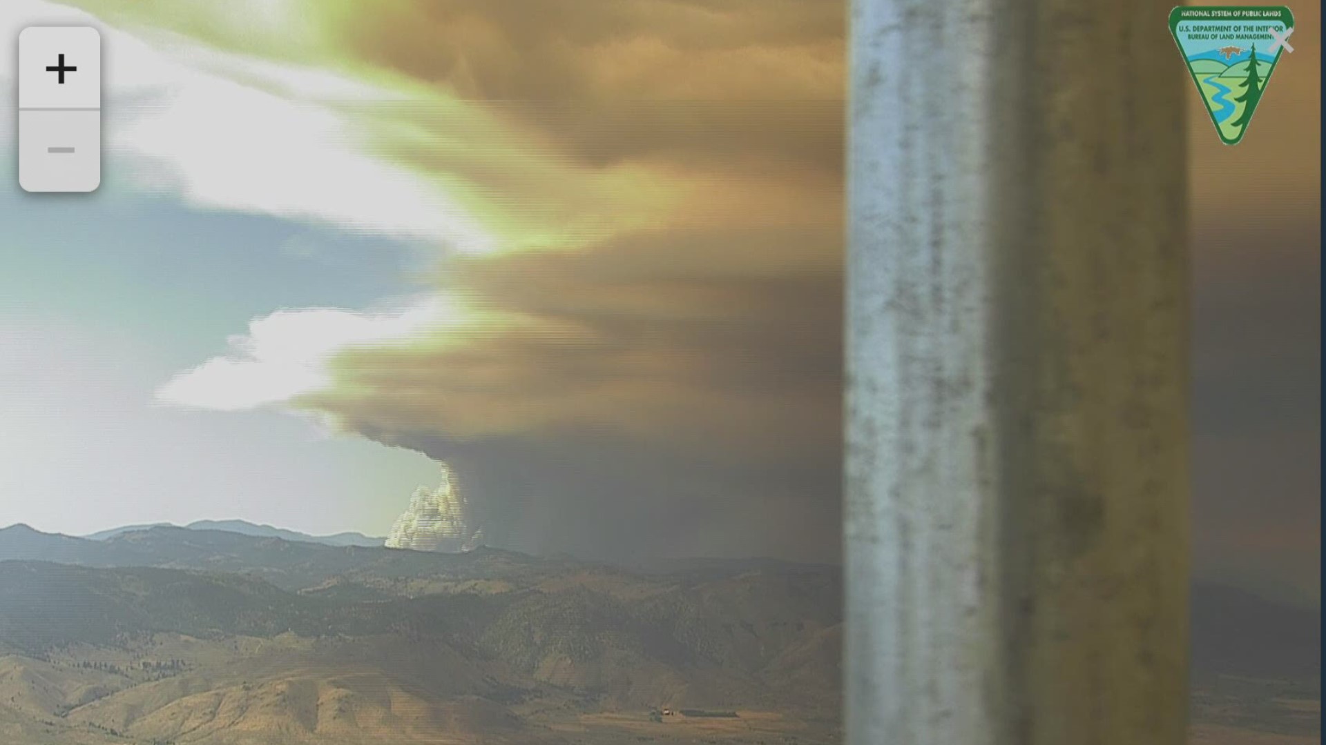
PLUMAS COUNTY, Calif. — Update: 9:30 p.m.
Firefighters have finally notched a level of containment on the Walker Fire that exploded in size on Friday and reached more 24,000 acres by Saturday.
The fire continues to burn on the Plumas National Forest, about 11 miles east of Taylorsville. The U.S. Forest Service for Plumas National Forest expects an updated acreage to come after an overnight mapping flight.
On Saturday, cloud cover and less fuel helped the fire progress slower. Fuel started reducing as it made its way to the previously burned Antelope Fire area. The fire went north up to Wheeler's Peak drainage and east around the Antelope Fire scar reaching a mile and half south of Murdock Crossing.
Some help from the air was also able to help crews on the ground make a fireline along the southern edge of the fire - something crews intend to advance around the fire Saturday evening.
Air tankers had been dropping up to 10,000 gallons of retardant to slow the fire's spread northeast and on the western flank in the Wheeler Peak drainage.
As the fire fight continues into the night, crews will be working on securing the 25N42 road while other crews look for places to make containment lines along the fire's edge and other areas which could have a high probability of containing the fire.
Current evacuation orders from the Plumas County Sheriff's Office include:
- Antelope Lake to the Plumas County line
- Genesee Valley Road corridor
- Ward Creek area
- Flournoy Bridge area
If people need accommodations, they can head to the Quincy area and contact the sheriff's office.
No new evacuations have been order and no structures have been lost.
Road Closures:
- Janesville Grade is now closed
- Genesee Valley road is closed at the Flournoy Bridge
- Antelope Lake road is closed from the Flournoy Bridge to Antelope Dam
- At the Flournoy Bridge turnoff, the 111 Beckwourth-Genesee road is closed through the fire area.
Original Story:
Firefighters are battling a large wildfire in Northern California. The Walker Fire is burning in the Plumas National Forest east of Quincy and about 11 miles east of Taylorsville, California.
The fire started early Wednesday morning on Sept. 4 and continues to grow — going from 17, 912 acres on Friday night to 24, 040 by Saturday morning, according to U.S. Forest Service for Plumas National Forest officials. The fire is 0% contained, but no structures have been lost.
Friday night fire activity decreased, forest officials said, slowly backing down towards the 25N42 road where firefighters were able to engage and hold the fire east of it. The fire progressed to the northeast to the area of Babcock Peak.
RELATED:
On Saturday more ground and air resources, including VLATS (Very Large Air Tankers), will assist in suppression efforts and crews will construct containment line along the edge of the fire where possible.
Forecasted cloud cover and cooler temperatures are expected to raise the relative humidity Saturday, forest officials said, adding that a predicted increase in southwest winds — combined with drier fuels, may increase fire activity.
Residents in need of accommodations can head to the Quincy area and can contact the sheriff’s office if help is needed.
ABC10 Meteorologist Monica Woods is forecasting cooler temperatures but steady southwest winds through Saturday afternoon.
The cause of the fire is still under investigation.
MANDATORY EVACUATIONS
The Plumas County Sherriff’s Office ordered mandatory evacuations for the areas below. All are as of 9 a.m. on Saturday, Sept. 7.
- Genesee Valley road corridor
- The Ward Creek area
- The Flournoy Bridge area (through CodeRED)
CLOSURES: Genesee Valley road is closed at the Flournoy Bridge. Antelope road is also closed from the Flournoy Bridge to Antelope Dam.
WATCH ALSO: California Wildfires: The New Normal

