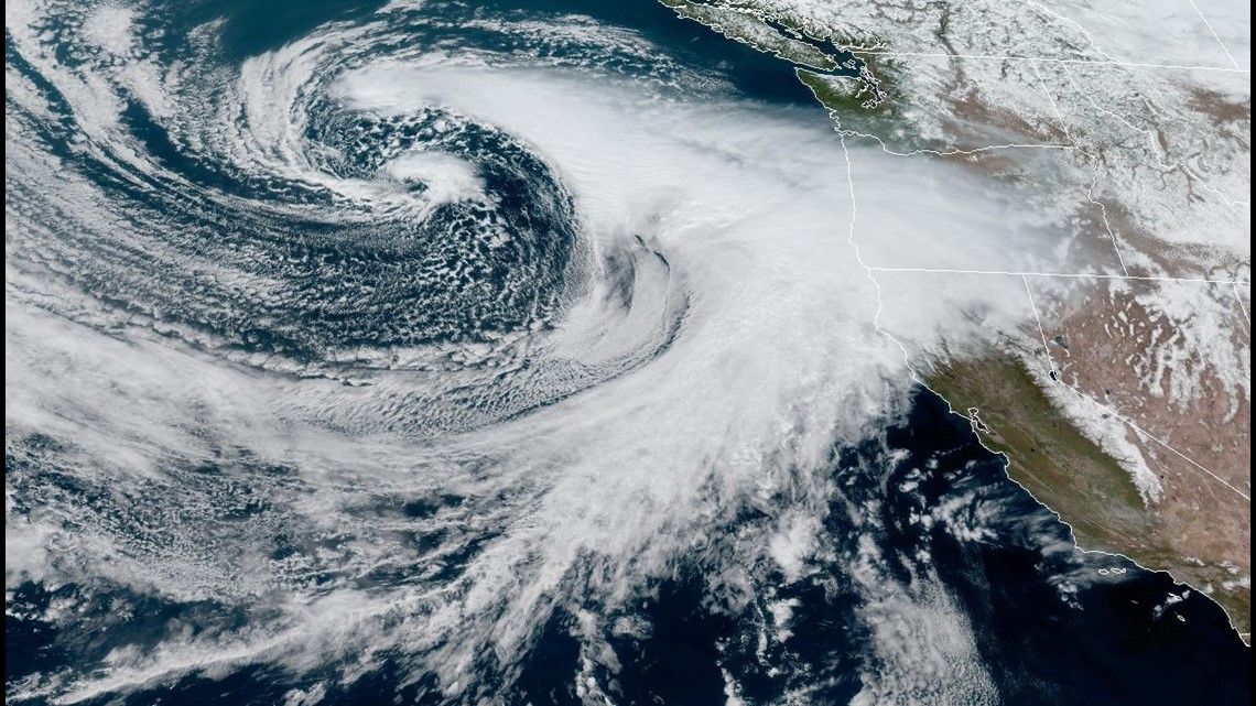
SACRAMENTO, Calif. — Although it's almost April, a cold system dropping down from Alaska will have it feeling more like January in Northern California.
Monday will act as a transition day before the system rolls in. Cloud cover will begin to increase in the afternoon, and high temperatures will be in the low 60s in the valley and upper 30s and lower 40s in the Sierra.
Heavy snow, soaking rain and cold air will accompany the system currently spinning a few hundred miles off the coast of Washington. The cyclone is expected to combine with another cyclone just to the south and will undergo rapid cyclogenesis, meaning it will intensify quickly.
Compared to last week's storm that became a bomb cyclone right off the central coast and slammed Santa Cruz with heavy winds, this system will become a bomb cyclone much further off California’s shores. A bomb cyclone occurs when a midlatitude (the latitudes between the tropics and polar regions) cyclone rapidly intensifies, experiencing a pressure fall of 24 millibars in 24 hours, according to the American Meteorological Society.


Rain and snow will spread into Northern California Tuesday morning and will continue through Tuesday afternoon. Rain will be heaviest as a cold front traverses the region, which is expected to occur early Tuesday afternoon.
Scattered shower activity is expected through Wednesday once the main band of precipitation associated with the front moves east. Thunderstorms are a possibility most of the day Wednesday, mainly south of Marysville.
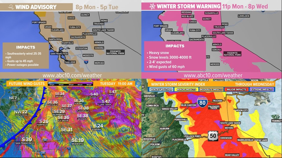
Snow will pickup in the morning hours Tuesday and will hold on through Wednesday. Very heavy snow rates are expected with this system. Snow ratios are expected to be high due to the cold air associated with the system and rates of 1-3" per hour are possible in the Sierra. Travel through the Sierra will be dangerous, if not impossible.
Snow levels will begin around 4,000 feet, but following the passage of the cold front, they will drop to around 2,000 feet.
A wind advisory has been issued for the Sacramento Valley due to expected gusts of 45 mph.
Speaking of cold temperatures, Sacramento is expected to only reach 51 degrees Tuesday. For reference, the average high for March 28 is 68 and the average high for early January is 55.
By Wednesday, 0.5-2" of rain is likely to have fallen in the valley along with 2-4 feet of snow above 4,000 feet.


WATCH ALSO: California Drought: Newsom lifts drought restrictions, Colorado River update, and salmon season


