An unusually dry stretch of weather has encompassed the Northwest to start the month of December courtesy of an expansive area of high pressure. But, a changing atmospheric pattern is forecast, bringing the return of more typical wet weather in the days to come.
December weather is synonymous with rainy conditions in places like Seattle, where average conditions usually bring around an inch of rainfall during the first four days of the month. However, in typical 2020 fashion, this year just hasn't been quite the same.
In 75 years of daily weather record keeping at Seattle-Tacoma Airport, there have been only five years where the first four days of December were dry, according to the National Weather Service. After another dry day this past Friday, 2020 will add to that statistic.
Along with the unusually dry stretch of weather, consistently mild afternoons were observed as well. Through the first five days of December, record-breaking temperatures were observed in western Washington on Saturday in Quillayute (61 F), Hoquiam (59 F) and at Seattle-Tacoma Airport (58 F).
During the same time frame, the atmospheric pattern has been set up in such a way that has resulted in wet weather taking aim across Pacific Canada and southeastern Alaska, which has resulted in devastating flooding and mudslides in some areas.
This same storm brought some rain to Washington late this past weekend, but the magnitude of the rain intensity was far less compared to what fell in Pacific Canada and southeastern Alaska.
Drier air is forecast to return to the Northwest on Monday, while rain remains in Canada. But the minimal air flow with the dry weather will bring back a stagnant air pattern, leading to lower are quality in parts of the interior Northwest.
Gusty winds will instead shift southward, whipping up an extreme fire threat across California to start out the week.
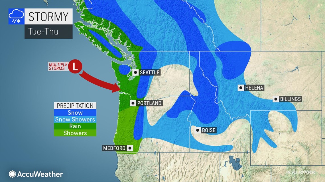
Another repeated dry stretch of weather similar to the start of the month is not expected this time across the Pacific Northwest, as more seasonably wet weather will return to the region by Tuesday. Places like Seattle and Portland, along the Interstate-5 corridor, as well as some interior locales like Spokane, Washington, can expect rainy conditions as the next round of wet weather moves ashore.


Through midweek, the most steady wet weather will largely be confined to Washington, Oregon, northern Idaho and western Montana, but there will likely be good news on the horizon for residents and vacationers alike seeking additional snowpack across the interior mountains of the West.
A return of well below-average temperatures and accumulating snow are expected to make a return across the interior West during the latter half of the week as the storm track sets its sights on the region. Thursday and Friday could feature a fresh round of snow across the northern and central Rockies, Utah's Wasatch Range, the Cascades and depending on the magnitude of the cold air, even some of the lower-lying valleys could have flakes fly.

