SACRAMENTO, Calif. — For now, the storm door has shut following a very soggy start to December. A stretch of dry weather will allow the state to dry out, which is not great news for a state desperate to break out of drought.
Although the Sierra has received 213% of normal snowpack, the state needs a much-above average winter to refill the reservoirs and recharge the aquifers in order to essentially break out of drought.
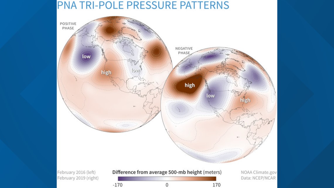
When looking at the larger atmospheric patterns that drive local weather patterns, the upcoming dry stretch makes sense. One of the major influences on California winter weather patterns is the Pacific North American (PNA) pattern. The PNA is dependent on the placement of has a positive and a negative phase. The positive phase consists of ridging over the west coast while the negative phase has low pressure over the west coast. The negative phase allows Pacific weather systems to push onshore rather than being blocked by high pressure.


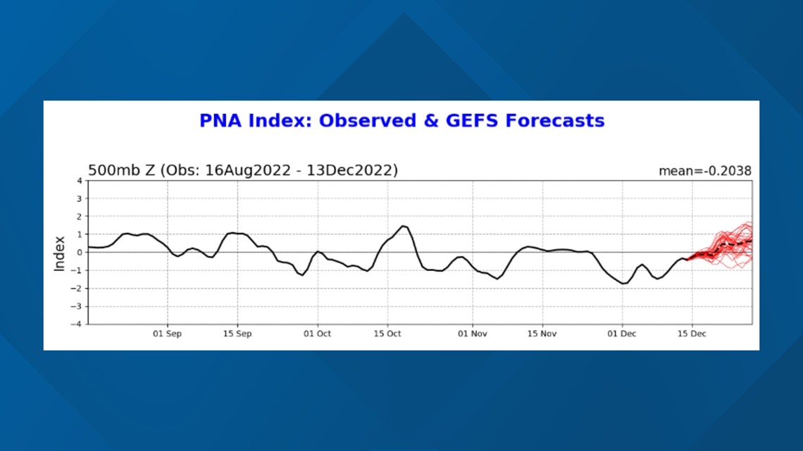
The PNA has been fairly strongly negative since the end of November, aligning with the wet conditions experienced to start December. However, the daily PNA index shows the index still negative but trending towards positive.


La Niña conditions are expected to persist due to the presence of below-average tropical waters in the Eastern Pacific. The latest estimates by NOAA show equal chances of La Niña continuing and neutral conditions in the January-March timeframe. By April, a 71% chance is given to an end to La Niña conditions and a return to neutral conditions.
California typically sees its wettest winters in El Niño years and is typically drier in La Niña years, although the signal isn't as strong.
The presence of a negative Pacific Decadal Oscillation since 2017 has also influenced the drought conditions of the last 3-4 years but has less influence over the day to day or week to week weather conditions.
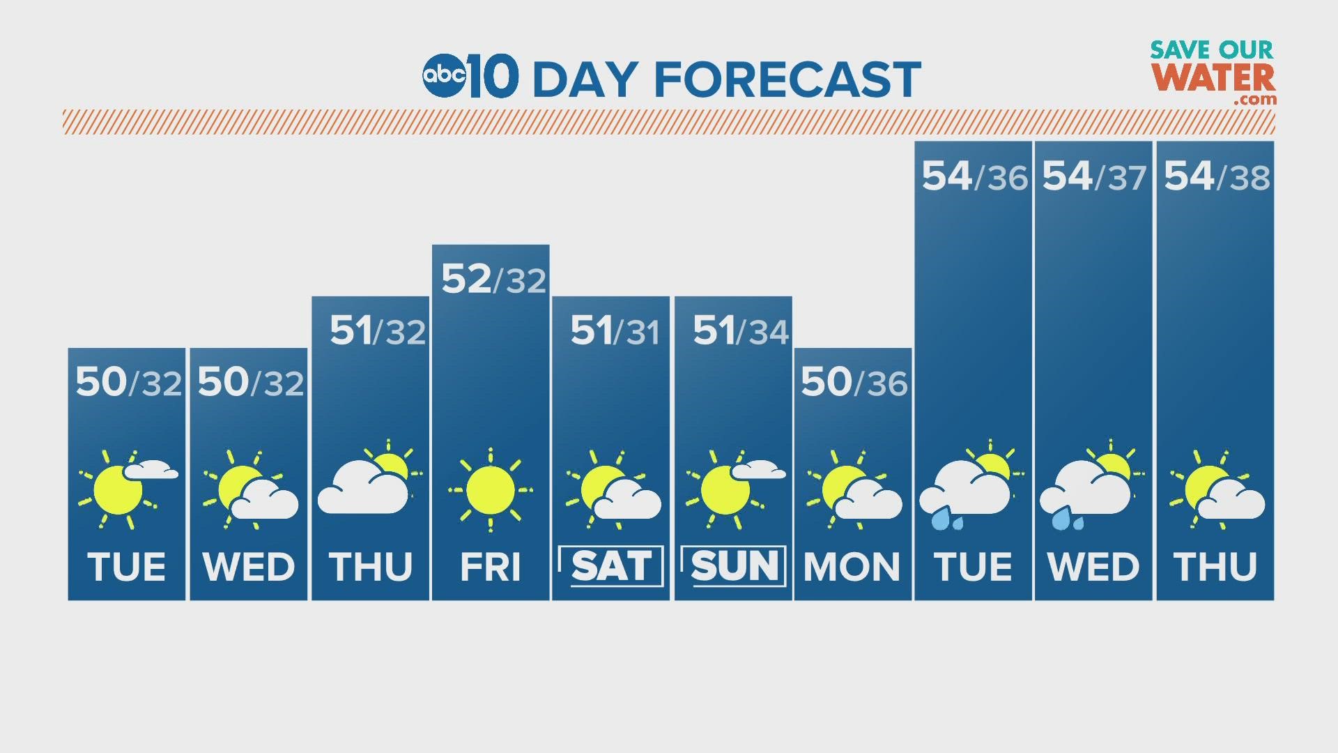
As of now, it looks like dry weather will dominate Northern California through the rest of the week and possibly through Christmas.
WATCH ALSO:


