SACRAMENTO, Calif. — After record-setting heat late last week and through the weekend, Northern California is seeing significant changes as we start a new work week.
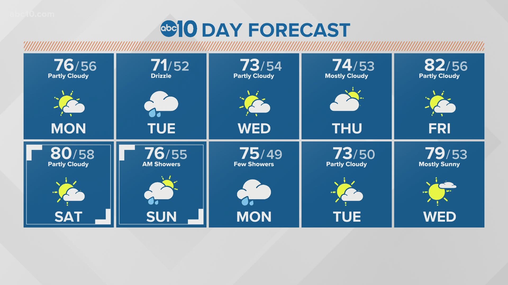
The winter-like storm moves in during the day Monday with strong wind, light rain, light snow, and cooler temperatures. The approaching weather system in the Pacific will bring rain to the San Francisco Bay, Sacramento and San Joaquin Valleys and snow to the Sierra.
Clouds will increase into the evening and the wind will pick up, with gusts close to 30 mph and constant wind in the 15-25 mph range. If you're allergic to Oak, pollen or other plants that are blooming now, be aware that windy days can trigger allergies issues.
This cool down comes after record-breaking heat for the valley.
RELATED:
The storm will start to produce some light showers by the late afternoon and continue on and off into Tuesday morning. Rain totals will be generally light, with less than 0.10" of rain expected in the Valley, and a little more than that - 0.25-0.50" - for either side of the foothills.
The Sierra will have a chance to see some light snow overnight Monday into Tuesday, with snow chances lingering Tuesday afternoon. Snow could drop to about 7,000 feet at times. Longer days and warmer temperatures tend to bring up the temperature of the actual road surface and reduces some issues with snow and ice, but it's not a guarantee. If drivers are losing traction, chain controls may be issues.
Be prepared for changing conditions if you need to travel into the mountains through Wednesday.
Lingering showers are possible into Wednesday evening, then dry and mild weather returns for the end of the week.
GET WEATHER ALERTS WITH THE ABC10 APP:
WEATHER IN YOUR EMAIL: Sign up for the Daily Blend Newsletter
CALIFORNIA WEATHER EXPLAINED: The last drought in California from 2012-16 was so catastrophic, some of the hardest-hit communities still haven't recovered. Can the Golden State get ready in time to make it through the next one before even more towns go under?


