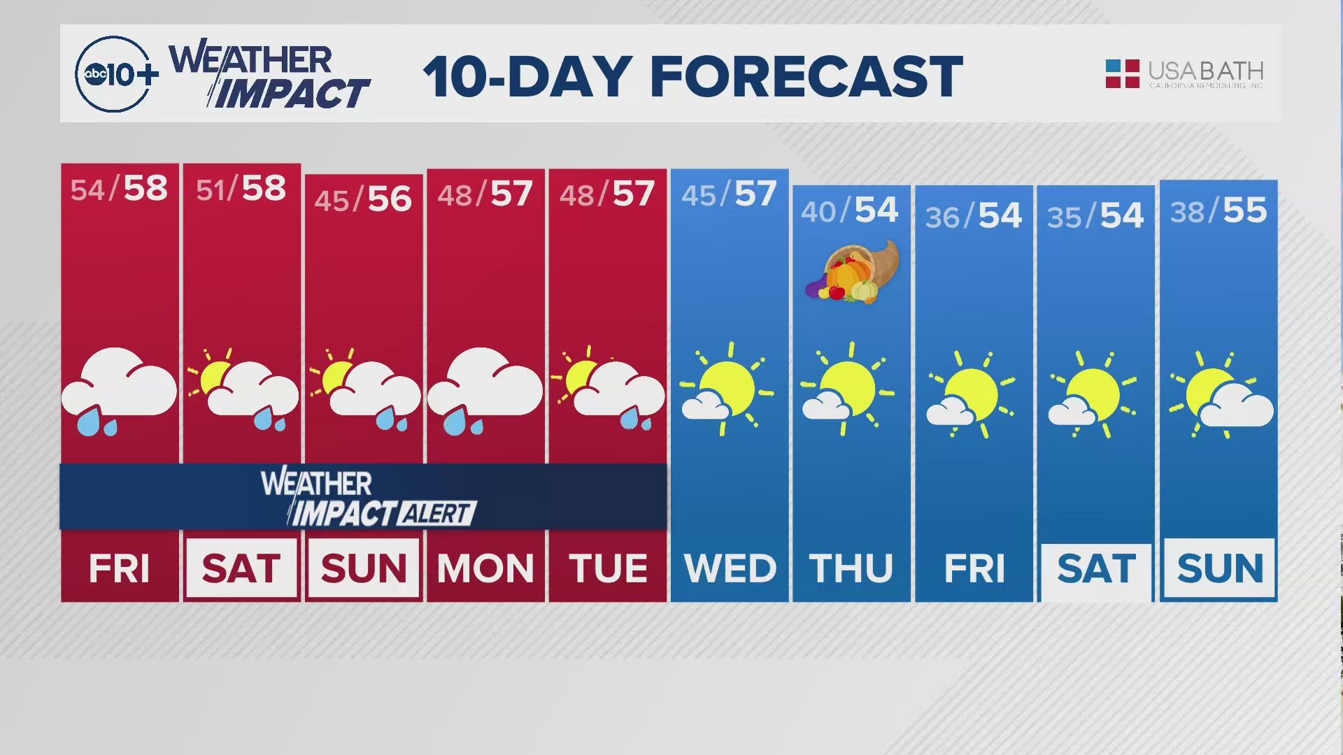
CALIFORNIA, USA — After several days of sunshine and temperatures in the 70s, Northern California is set to return to a wet winter pattern.
This new colder wet pattern arrives as welcome news for areas experiencing various levels of drought, and lower than average snowpack.
Thursday will see the temperatures start to drop to widespread 60s for Sacramento Valley locations. The weather will remain dry but the temperature trend will continue to cool into next week with highs moving into the 50s for several days with cold storms.
The first storm of the week arrives very late Friday night, but it will only last through the overnight hours for the valley. Valley rain will be generally light with 0.10 to 0.25 inches of rain for most spots and higher amounts of 0.50 inches or more for the foothills.
RELATED STORIES FROM ABC10:
Snow levels should lower to about 4,000 feet by early Saturday morning with 2 to 6 inches of snow for the mountain passes between Friday night and Saturday.
Chain controls are possible early Saturday morning for Sierra travel over the passes. Sunday will see some clearing skies but the cool air will remain passed then.
Later Monday next week, we will get a new series of storms that will be wetter and colder. Rain and snow chances remain at least until Thursday with snow levels dropping to 2,500 feet at times.
ABC10: Watch, Download, Read
There are no walk-ups at the McClellan vaccine clinic, and appointments must be made online first for those 65+ who want to get a vaccine.


