SACRAMENTO, Calif. — June is off to a cool start with much needed showers for the first weekend. Much of Northern California saw at least a trace of rain with some of the higher elevations getting over an inch of rain.
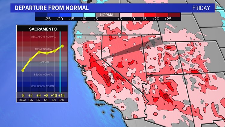
A big weather pattern shift will develop throughout the first full week of the month when 100s start to become a regular occurrence in the summer forecast.
Average highs for June run in the 80s to low 90s. Records are in the 100s and stretches of 100s are not uncommon either during the month.
A high pressure system will build throughout the West during the week. This will keep the storm track and cooler air pushed to the north through the Pacific Northwest.
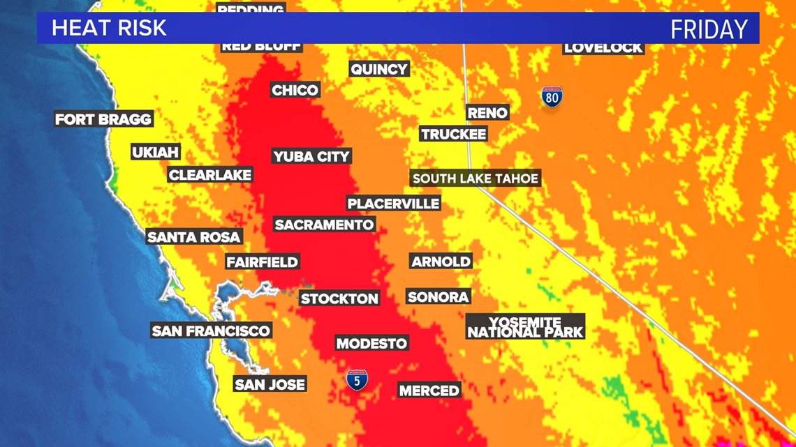
Peak heat is expected Friday in Northern California with High Heat Risk developing for much of the population. People most at risk are those sensitive to heat sensitive and without effective cooling and/or adequate hydration. The areas shaded in red below show the regions with the highest risk.

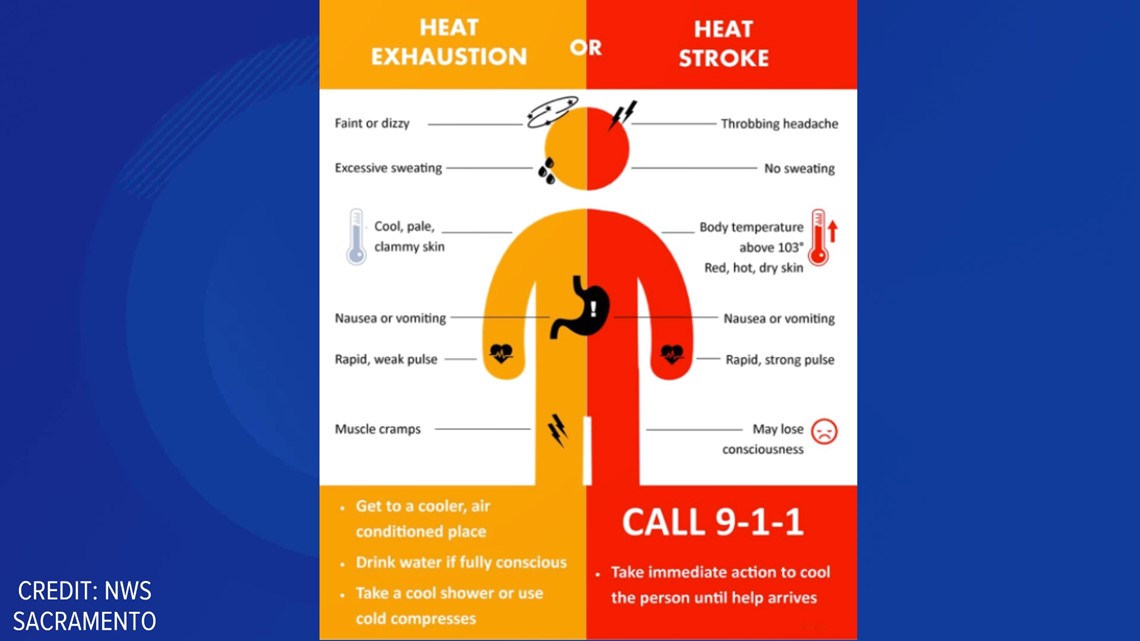
Heat Exhaustion and Heat Stroke are possible with this type of heat. Telling the difference can help ease symptoms and prevent further problems.

Temperatures start cooling by the end of the weekend into the following work week.
WATCH ALSO:


