SACRAMENTO, Calif. — It's been a wild and impactful two weeks of weather in California and it can be hard to keep up. After so many storms, where do we stand?
As the morning meteorologist at ABC10, even I get lost in all the numbers, so I have to write them down somewhere.
Weather stories in California need to be heard by people actually in California. Occasionally a national news outlet will do a California weather story and miss some element skewing the understanding of what's happening.
During times of big and high-impact weather, I will recap some of the highlights and nuances of the forecast to add some context to California weather for a national/international audience.
Good morning from rainy California, we are still in the middle of a major storm cycle that is kicking back in today. Here is the latest if you want the local perspective in this thread.
Yesterday (Thursday) was the first real break in the rain, snow and wind in about two weeks for some places. Sacramento had 14 days in a row — this is two days away from the record. They didn't count one day because it was thick fog, that was the "dry day."
Even though the rain stopped for a day, big things are still happening. The state is now at 104% for the April average snowpack with 3-6 feet more expected over this long weekend. Some resorts hit the season average a few days ago.
As good as the numbers look, many resorts have been challenged with closed roads, bad weather on weekends, wind holds for safety and power outages — it's been hard but heroic work has kept them mostly open.
The reservoirs keep coming up. Many small and medium reservoirs like Folsom (Sacramento area) and Millerton (Fresno area) and Cachuma (Santa Barbara) are spilling to make room for more rain so we don't flood. The big ones have room for now.
The ones to watch are Shasta and Oroville (maybe Trinity too). These are very big and were very low during the 2021 season. Oroville was record low and had to stop making power. Water was below intake and Shasta nearly recorded a record low.
Since then, they are getting closer to the average for the date -- 93% for Oroville and 74% for Shasta. They will not totally fill up this time of year because they are also used for flood protection along with water retention for spring/summer/fall.
This seems to be the main sticking point for the uninformed. They need space for incoming big storms so everything downstream doesn't flood (connected to the rivers). If you capture everything and then you get a big storm, you could compromise the dam and that could happen.
Back in 2017, Oroville was getting full so they starting spilling. They had a crack and damage, then the water was coming up so fast and a new storm came in so they had to run water over the damaged spillway to save the dam. Even then major problems happened.
The water went over the "emergency" spillway, which everyone said wouldn't happen. At the end of the day, math wins. If more is coming in than out, the water rises and bad things happen. It was a billion-dollar repair job and as close to a massive disaster as possible.
So, because of the major drought, there is room but again they are rising and will more with incoming storms. I don't know when or if they will spill but when that happens, the Feather and Sacramento River stays high for a long time and flood risk is managed.
For Central and Southern California, it's been just as wet and dicey. In fact the Salinas River that moves north to the Monterey Bay is so high Friday it should be the second highest crest on record.
So many roads are flooded on the Monterey Peninsula and could be cut off until the water comes down. This just happened to Santa Barbara as most roads were closed due to mudslides and the airport was closed. The Central coast had essentially two entire counties flash flooding at the same time as they got 5-15" in one day.
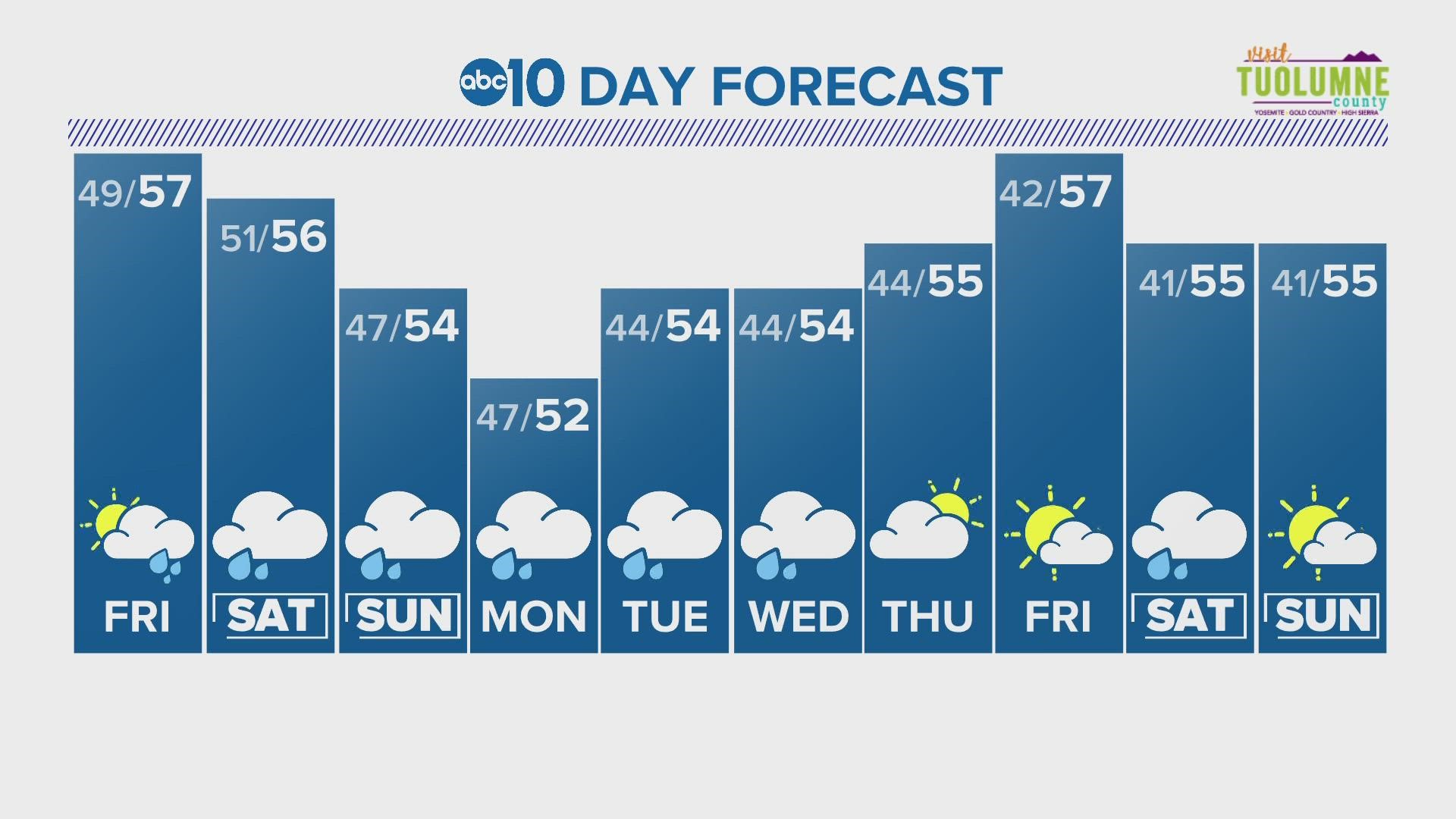
It's been really wet here with lots of damage and impacts, and this weekend we have more rain and snow in the forecast: 3-5" of rain, 5-7" in Sierra Foothills and 3-6' of Sierra snow over MLK weekend.
Finally, we have another round of wind Saturday that could take out more trees.
California is the land of extremes with the most variability in weather in any given year in the U.S.
When I got my first weather job out here in California nearly 20 years ago, all my meteorologist friends thought I was going into early retirement. What I have experienced and know (I grew up here) is that California weather is gnarly way more often than people think.
Granted I have had months where I didn't change the "sunny" icon in the extended forecast, but when it comes to big stormy winter wet patterns, we can get hammered and that's where we are right now. I see two days of sun at the end of next week.
Watch more on ABC10: Winter Storm Warning | Northern California bracing for more rain, wind and snow this weekend


