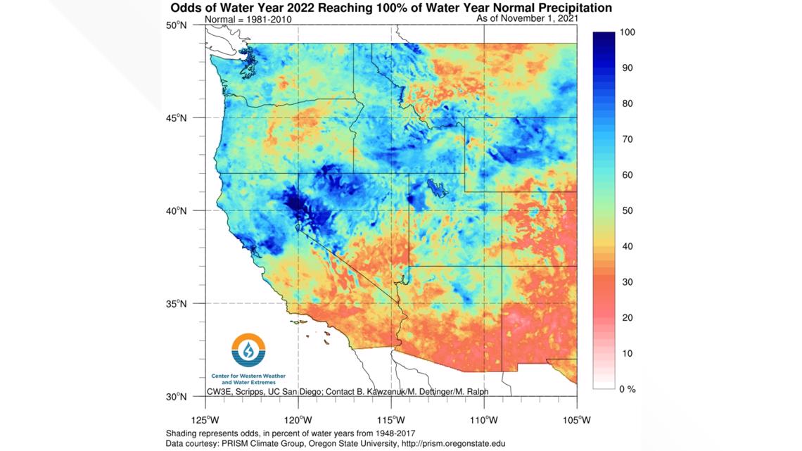
SACRAMENTO, Calif. — California as a whole continues to be in its third year of drought, but earlier in the water year, it had a strong chance to see a normal water year. After a strong atmospheric river arrived in October, the first month of the 2021-2022 water year. Forecast models from the Center for Western Weather and Water Extremes, showed the Sacramento region as having about an 80% chance of meeting an average water year.


The normal water year is defined as reaching the average precipitation of rain or snowfall in a given location, for Sacramento that would be just over 18 inches of rainfall. As of mid-July, Sacramento has received 16.54 inches for the entire water year starting October 1, 2021- September 30, 2022.
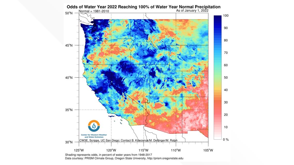
Another system in December delivered heavy rain and snow directly impacting Sacramento and the Central Sierra. Odds again increased to 85-100% chance of meeting the average.


PLAN YOUR WEEKEND:
► FORECAST DETAILS | Check out our hourly forecast and radar pages
► GET WEATHER ALERTS TO YOUR PHONE | Download the ABC10 mobile app
► WEATHER IN YOUR EMAIL | Sign up for the Daily Blend Newsletter
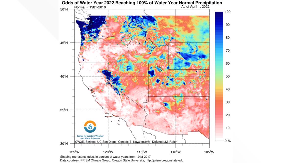
All of that changed in January 2022. A three month stretch of lackluster storms continued to lower our odds of reaching that 18 inch mark in Sacramento. April 1st is considered peak for water runoff, and without anymore storms pushing through, Sacramento remained at about a 1.5 inch deficit in reaching “normal.”


Research meteorologist Chad Hecht with the Center for Western Weather and Water Extremes said for California it's either feast or famine.
"There were a lot of months left in the water year, and January and February were really dry," Hecht said. "That is where we started to see that the odds of reaching a normal water year across the state start to dwindle."
Hecht said atmospheric rivers have been the key to California staying out of drought. The first two strong atmospheric rivers helped us out immensely, but the lack of them has made all the difference.
Research into predicting these drought years hopes to help with water management and water saving measures.
"A lot of the work that we're doing here is forecasting that high pressure, because it's really important to identify when it's going to break down and lead to impactful storms." Hetch said. "Or sometimes it shifts towards the northwest and allows an opens the door for storms to move underneath it in California or Southern California and even Northern California, which we saw a lot during one of your 2017, which was a really wet year for the state."
WATCH MORE: How 'King Tides' preview potentially devastating climate change impact on California.

