SACRAMENTO, Calif. — A new water year began Oct. 1, marking the start to a pivotal year ahead in terms of water security.
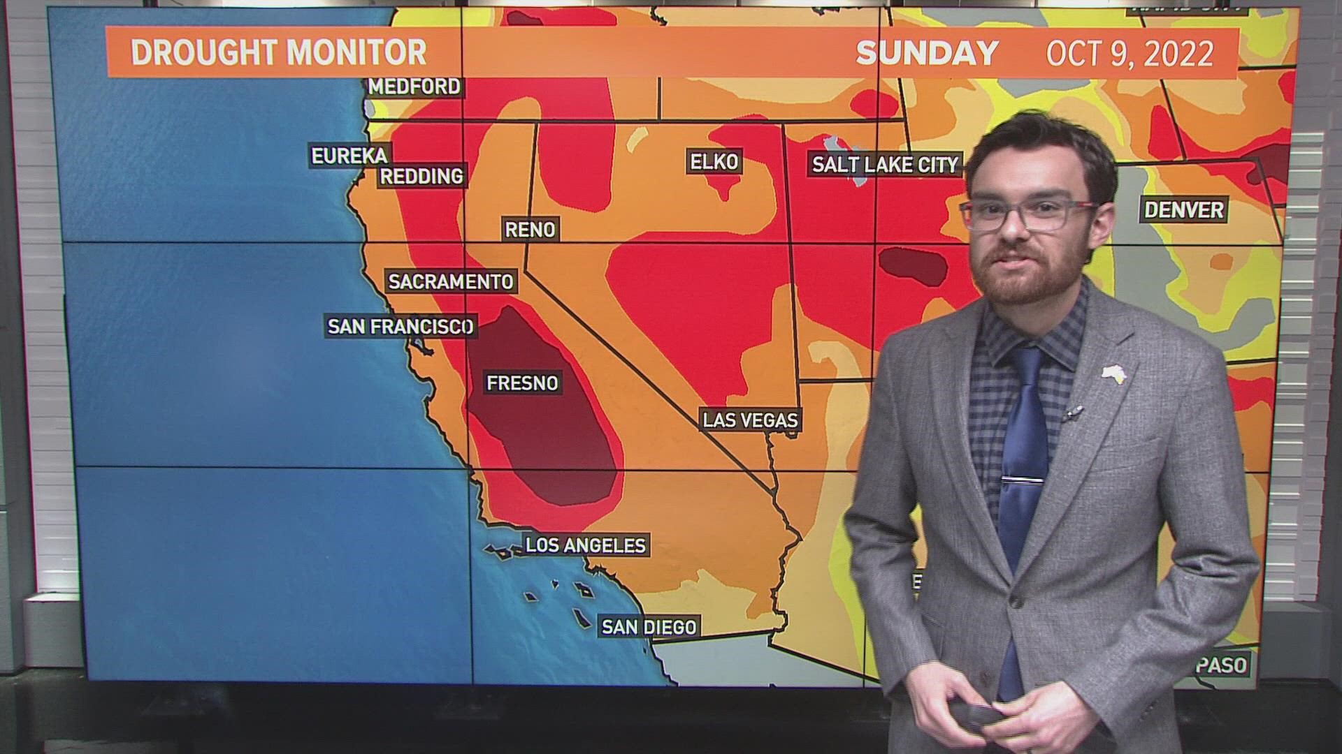
The summer-like pattern will continue for the extended forecast. Apart from a rare September soaking storm, it's been a very dry year. In fact, the years 2020-2022 have been the driest on record, according to UC Merced Professor of Climatology John Abatzoglou.
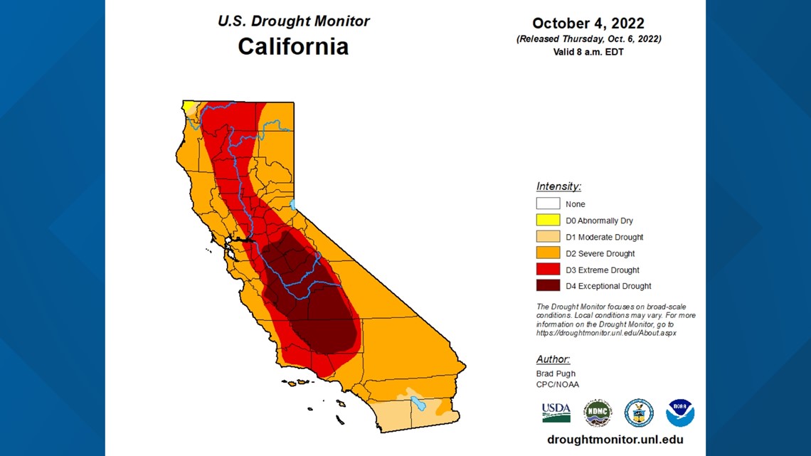
While drought conditions have improved since last October, the entire state still resides in some level of drought. Another mild, dry winter is a huge concern as the state tries to escape a fourth straight year of drought.

RELATED: Sacramento Weather Forecast
The winter ahead
The El Niño Southern Oscillation (ENSO) is the main driver of the atmospheric patterns controlling the waviness of the jet stream and is generally considered a respectable indicator of what a region can expect during the winter months.
The rare "triple-dip" La Niña is grabbing headlines, but there are other atmospheric patterns and motions, or oscillations, that could keep California dry this upcoming winter.
Four other lesser-known oscillations can impact California weather as well: the Arctic Oscillation, Madden-Julian Oscillation, Pacific/North American Pattern, and Pacific Decadal oscillation have all been linked to affecting California's winter weather.
Bob Henson, meteorologist, author, and journalist at Yale Climate Connections, described ENSO as the "big enchilada" of the oscillations, but acknowledged the forecasting value of the other four as well.
Here's the overview of each, including expected impacts for California this winter:
Arctic Oscillation (AO)
The main feature of the Arctic Oscillation is the waviness of the jet stream associated with the positioning of either low or high pressure in the Arctic.
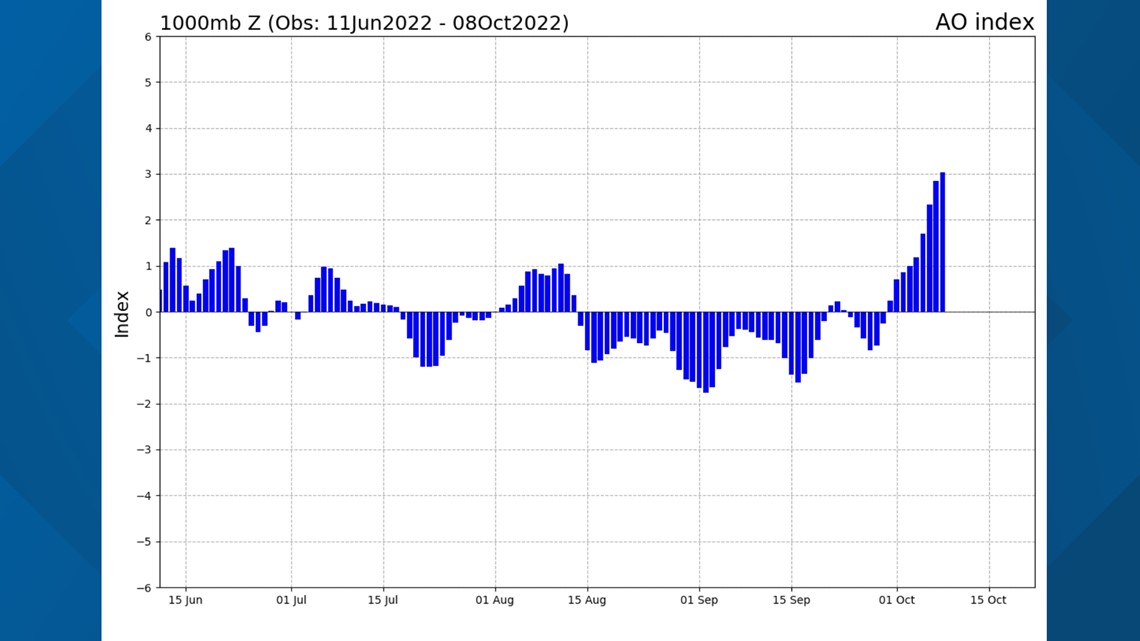
During positive phases, low pressure dominates the Arctic regions, and the jet stream is faster and less wavy, preventing storm systems from digging down into California consistently.
Data shows the oscillation is currently strongly positive, which is generally bad news for California.

Madden-Julian Oscillation (MJO)
Henson described the MJO as a "pulse of, of showers, thunderstorms, convection that wraps its way around the globe over a period of, say four to six weeks on average for six to eight weeks."
The MJO is expected to increase activity following a dormant period in the next few weeks.
"I would say MJO just modulates when you're going to get those periods of rain and a wet winter," Henson said. The effects of the MJO are amplified when it coincides with an existing area of low pressure, meaning more rain.
It's difficult to predict the influence of the MJO this winter in California due to its innate variability, however.
Research conducted by UC Davis professor Da Yang predicts a 54% increase in MJO-induced precipitation variability by the year 2100 under high-emission climate scenarios.
Pacific North American Pattern (PNA)
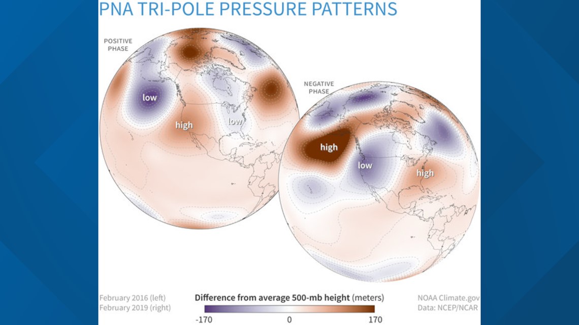
Henson described the PNA as a "descriptor" more than anything. The PNA is a more variable process compared to ENSO, meaning it changes more regularly than other oscillations.
The PNA is currently in its positive phase, which is marked by resilient high pressure over California sending storm systems to the north.
A negative phase typically results in a "much more of a wet pattern for California," according to Henson. It opens the door for storms to slide into the region, in a sense.

Pacific Decadal Oscillation (PDO)
The PDO is a 20-25 year oscillation consisting of a warm, or positive phase and a cold, or negative phase.
The 'cool' phase is characterized by a cool wedge of lower than normal sea-surface heights/ocean temperatures in the eastern equatorial Pacific and a warm horseshoe pattern of higher than normal sea-surface heights connecting the north, west and southern Pacific, according to NASA's Jet Propulsion Lab.
The oscillation is a measure of ocean temperature and can work in conjunction with La Niña to amplify drier than normal conditions, according to Henson.
The current state of the PDO is the cold, negative phase which has been linked to drought in California. "This has been not only a three year period with strong La Nina, but also a very strong negative PDO. So both of those have been hammering, you know, California and other places," said Henson.
What does it all mean?
Oscillation studies is a generally new frontier of atmospheric research, especially with respect to the impacts of climate change. The ability of forecasters to make sense of these oscillations is improving, as well as model capabilities.
Research is continuing to be conducted on these atmospheric oscillations and the potential power they hold in future seasonal forecasting skill.
While no promises can be made based off these oscillations and their current state, the odds are stacked against California receiving the rain and snow it needs to escape drought.
"You do have kind of a train wreck of dryness-producing influences for sure," Henson said, referring to the presence of La Niña, negative phases of the PDO and PNA, and positive phase of the AO.

