
CALIFORNIA, USA — After the collapse of the global phenomenon known as El Nino, its counterpart La Nina is developing and set to return within months.
These seemingly subtle changes in ocean surface temperatures in the Pacific can have far-reaching global impacts on weather and patterns. The El Nino of 2023-24 was the 4th strongest in the record-keeping era and had impacts worldwide.
The official name of this pattern is called the El Nino Southern Oscillation and it occurs when tradewinds at the equator change and the water at the surface of the ocean in the middle of the Pacific is much warmer than normal. The resulting patterns can become wetter or drier regionally but almost always warmer than normal for global temperatures.
We recorded the hottest global average temperatures multiple times in 2024 along with multiple record-breaking events for heat all over the planet.
Precipitation was mixed but often matched regional expectations of flooding or drought.
During the spring and summer of 2024, the El Nino region in the Pacific cooled and the trend forecast for more cooling has NOAA calling for a 74% chance of La Nina developing during the November 2024 to January 2025 time period.
What is La Nina?
La Nina is when the same El Nino region in the middle of the Pacific cools to below-average temperatures.

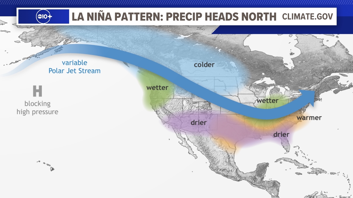
Long range forecasting is especially challenging with many factors changing the forecast daily. To produce a forecast with accuracy months in advanced is nearly impossible. However, patterns have been observed during La Nina events that give us a picture of what often happens, but not always. It is important to understand that winters have been recorded with nearly opposite results compared to expectations. These pattern maps are produced with several events added in to give an overall picture and not a certain forecast.

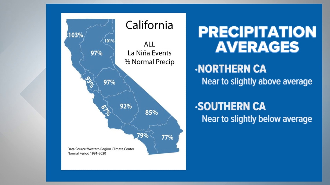
Results of past La Nina's precipitation have been compiled in California and a trend emerges if you factor in all La Nina events. Near-average to below-average rain is common in Southern California. For Northern California average to slightly above average rain is common during La Nina Years.

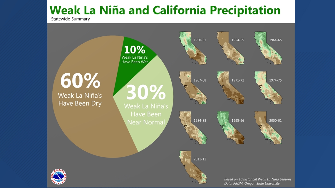
The official forecast calls for a weak to moderate La Nina in the months ahead and the trend is for dry conditions if you consider all of California. However, 10% of La Nina years were much wetter than normal including 1995-96 which saw widespread heavy storms and flooding events in Northern California. At the same time Southern California was extremely dry.
A recent study from Stanford claims one important fact about the highly variable strength of storms in California, discovering that atmospheric rivers are the dominant factor in determining heavy rain events especially rapid succession of these storms. Multiple strong atmospheric rivers can cause three to four times more damage than one storm on its own. El Nino and La Nina events can both host these types of patterns within a time period in winter.
In other words, an El Nino or La Nina pattern can give you a general idea of what to expect, but many examples exist that can buck the trend and result in excessive dry or wet conditions.
California is unique due to it's variability which is the highest in the United States. It's not uncommon to have an overall dry year, with one destructive and wet cycle in the middle.
Watch more on ABC10 | Where to find the scariest bridge in California | Bartell's Backroads


