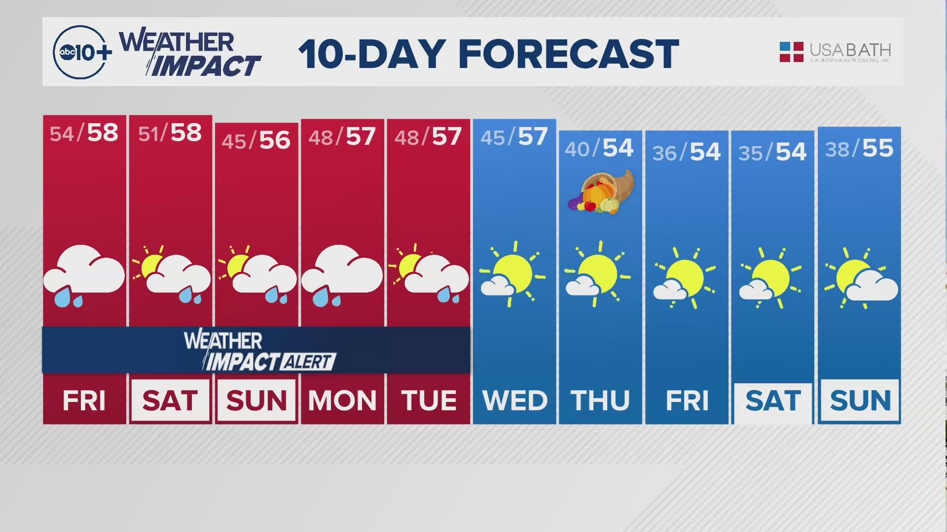
CALIFORNIA, USA — Every storm has unique qualities that people should pay attention to. Some storms are warm, some are really wet, and some are really windy, among other things.
This new series of storms will have something happening in the background that began last year.
Going back to the start of the rainy season for 2022-23, the state was in the middle of a pretty serious drought. Rain and snow were lackluster for a few years and California's reservoirs were very low. With the onset of a cold and wet pattern for an entire season our reservoirs rebounded. Since the snowpack was at least double compared to average it was much easier to manage water supplies through the long, hot summer and there were full allocations available.
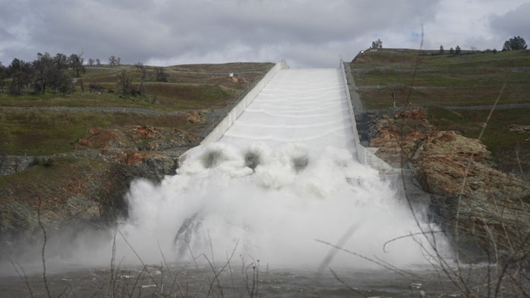
This year has been slower in some respects certainly for snow but the water is still in the reservoirs. As of Wednesday Lake Shasta, our biggest reservoir is nearly 80% full. Reservoirs all over California, federal, state, and private also are mostly well above average. This creates a situation where dam releases of water will be necessary to make room for incoming rain and melted snow. During the winter, the focus of reservoirs is to manage flooding and momentary releases may happen if there is a threat of having too much water in the reservoirs and the inability to release enough in time.
There is a long history of managing these levels with no real threats to the system until recently. In 2017 the concrete of the Oroville Spillway was damaged in the middle of intense atmospheric river storms. They momentarily stopped releases to asses the damage but were forced to continue releases and continued to damage the spillway because they needed to remove water for incoming storms. During this process, the never-used emergency spillway was breached and also created massive erosion, prompting evacuations. This was a close call and a reminder that above all else space for incoming storms must be preserved to not compromise the integrity of the dams themselves.
Coordinated releases have begun including Shasta and Oroville to make room for incoming water. As a result of these releases along with increased flows for sections of creeks and streams below dams, sections of big rivers like the Sacramento River will be much higher than normal. Some sections will reach the "monitor" stage indicating high water, but no threat of flooding. Some sections of other rivers like the Russian River and San Diego River will reach low-level flood status.

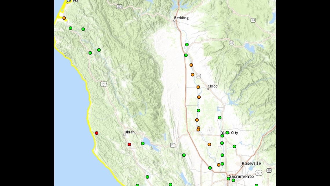
Orange dots are sections of the river that will be at the monitor stage. Red indicates various levels of flooding.
The next round of incoming rain will likely keep some dams spilling as well as rivers high and future crests of larger rivers in the state will need to be watched during this period of high inflow and outflow.
Watch more on ABC10 | California Storm Watch: Preparing for incoming atmospheric river and flooding | Jan. 31, 2024