SACRAMENTO, California —
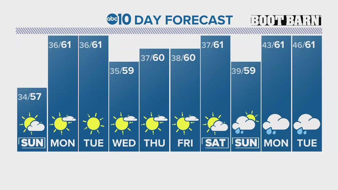
Northern California is set to warm up following a chilly weekend.
Many valley locations saw temperatures drop below freezing on Saturday and Sunday and high temperatures were only in the mid to upper 50s.
With high pressure in place this week, Northern Californians can expect above-average temperatures and dry weather.
Even with the Sierra picking up half a foot to a foot and a half of fresh snow last week, the snowpack is still much lower than average. The statewide percent of average is 37% and at this point last year that number was 162% of normal.
Valley high temperatures will be in the low 60s to right around 60 all week with little change in the day-to-day high temperature.
Mornings will still be on the chilly side with upper 30s and lower 40s expected daily but aren’t expected to reach the freezing mark.


Expect mostly sunny skies throughout the first half of the week before some cloud cover builds in later in the week
The models are hinting at a wetter pattern developing towards the end of the extended forecast. By early next week, low pressure is expected to develop off the California coast which could potentially bring rain and snow to the region.
The Climate Prediction Center echoes this sentiment, favoring above-average rainfall for California next week. It also favors much warmer than average temperatures for almost the entire US, including California.


With how far out this is, anything can happen but it is a good sign for a state struggling to receive meaningful precipitation so far this wet season.
WATCH ALSO:


